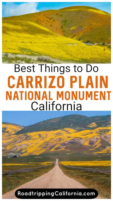
Considering a springtime visit to Carrizo Plain National Monument?
Carrizo Plain National Monument is a magnificent landscape reminiscent of yesteryear Central California: the remote plain is what’s left of the massive grasslands that covered this part of the Golden State, before agriculture took over.
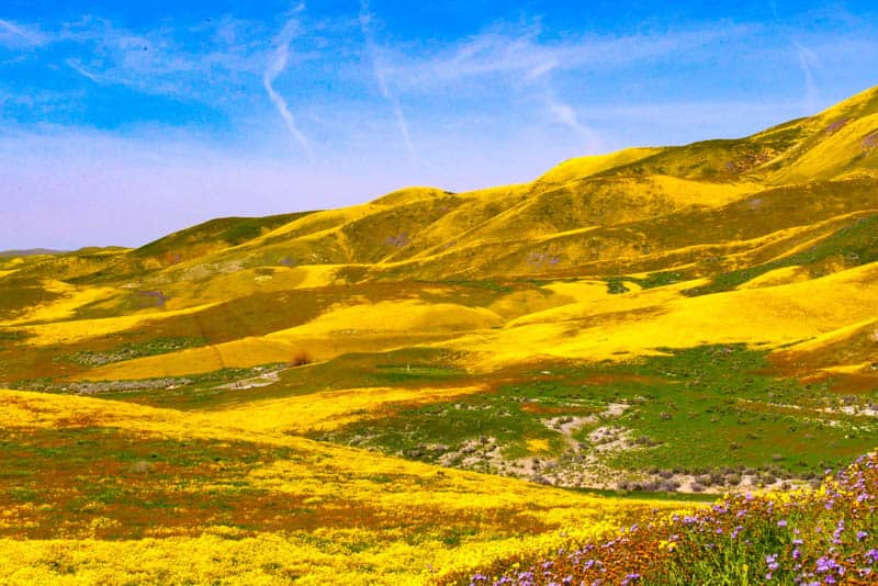
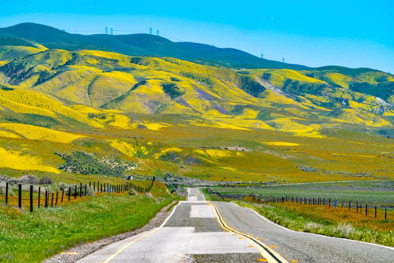
Today, Carrizo Plain National Monument is known for being one of the prime spring wildflower bloom spots in California. In a good bloom year, wildflower displays here are so breathtaking that they attract thousands of visitors from near and far.
Experiencing wildflower bloom at Carrizo Plain definitely deserves a spot on your California bucket list!
Some links on this page may be affiliate links. If you click an affiliate link and make a purchase, we may receive a small commission, at no extra cost to you. For more details, refer to our disclosure.
But Carrizo Plain National Monument is worth visiting for other reasons as well.
If you are an outdoors enthusiast, you will definitely want to plan a visit to Carrizo Plain National Monument, for the hiking, biking, and scenic driving opportunities.
History buffs will enjoy touring ancient petroglyph site and observing old farming relics.
Wildlife and birding enthusiasts can look for rare and endangered species.
And everyone that wants to savor serenity and silence will enjoy their time at Carrizo Plain.
In this article, you will discover all the fun things to do at Carrizo Plain National Monument, plus things to know before you go.
TABLE OF CONTENTS
Overview of Carrizo Plain National Monument
Visiting Carrizo Plain National Monument for Wildflower Bloom
Other Things to Do at Carrizo Plain National Monument
How to Get to Carrizo Plain National Monument in SLO County
Essential Information for Your Visit to Carrizo Plain National Monument
How Much Time Should You Allow for Carrizo Plain?
Tips for Visiting Carrizo Plain National Monument in Central California
Tips for Visiting Carrizo Plain for Wildflower Bloom
Overview of Carrizo Plain National Monument
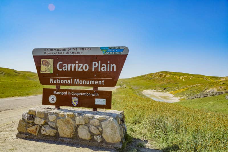
Carrizo Plain National Monument covers an area of close to 250,000 acres in the far eastern part of San Luis Obispo County in Central California.
Made a National Monument in 2001, Carrizo Plain was also designated a National Historic Landmark in 2012. It is the largest single native grassland remaining in all of California.
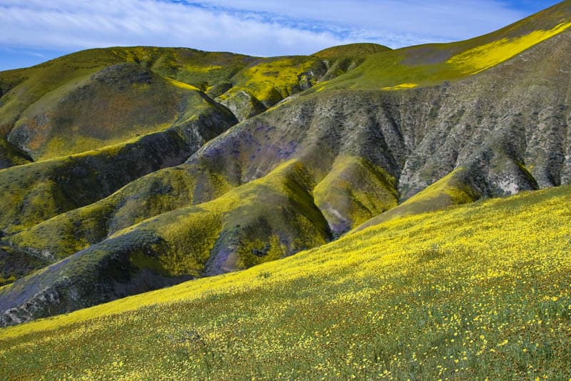
Carrizo Plain is sandwiched between two scenic mountain ranges: the Calientes to the southwest, and the Temblors to the northeast. The San Andreas Fault runs along the eastern edge of the plain and is clearly visible here.
The plain was once home to the Chumash and the Yokut, who presumably hunted here. They have left behind some beautiful rock art.
White settlers also lived on the plain, as evidenced by the ruins of old buildings and machinery.
Today it is home to the highest concentration of endangered species in California.
Carrizo Plain National Monument is managed by the Bureau of Land Management.
Visiting Carrizo Plain National Monument for Wildflower Bloom
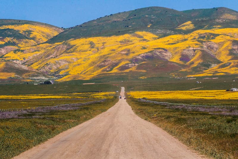
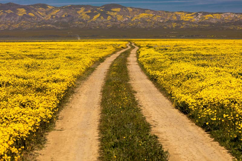
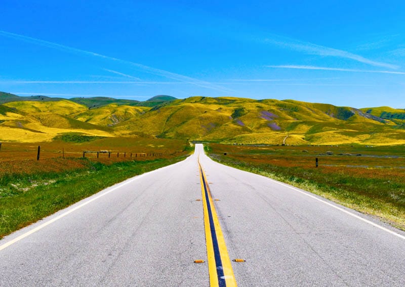
By far the most popular time for visiting Carrizo Plain National Monument is during spring wildflower bloom.
Bloom generally starts in mid March and peaks some time in late March or early April. Bloom generally continues until the third week in June before drying up.
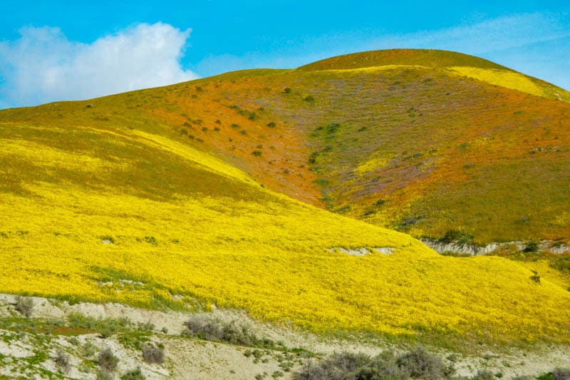
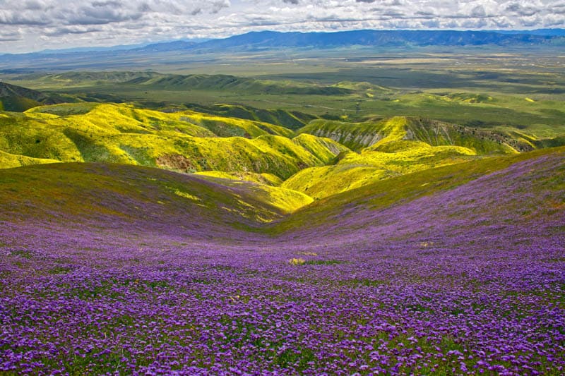
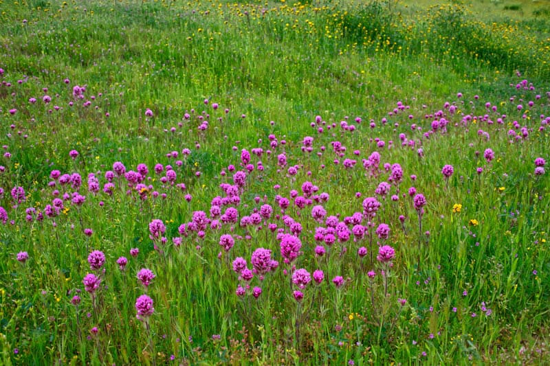
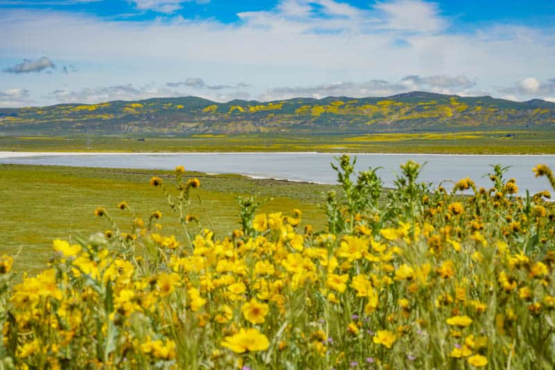
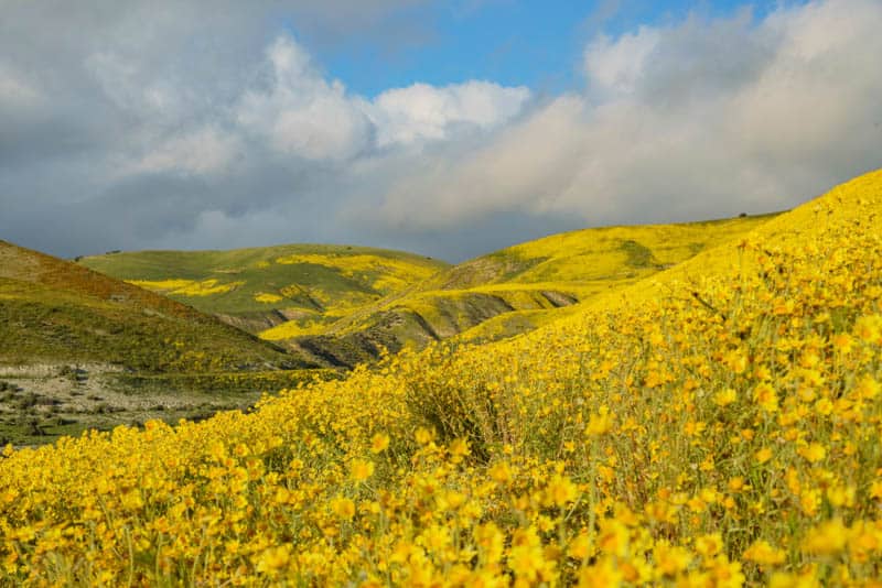
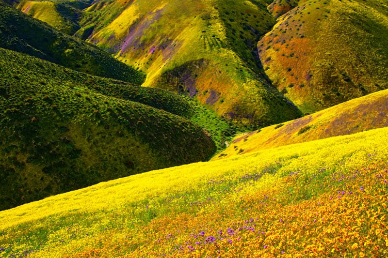
In good bloom years, the wildflower bloom at Carrizo Plain National Monument is nothing short of stupendous.
Vast meadows and entire hillsides are draped in color, making the area look like an Impressionist painting in yellow, orange, and purple.
Photographers come from all over the world to capture the vistas of vibrant color that stretch as far as the eye can see.
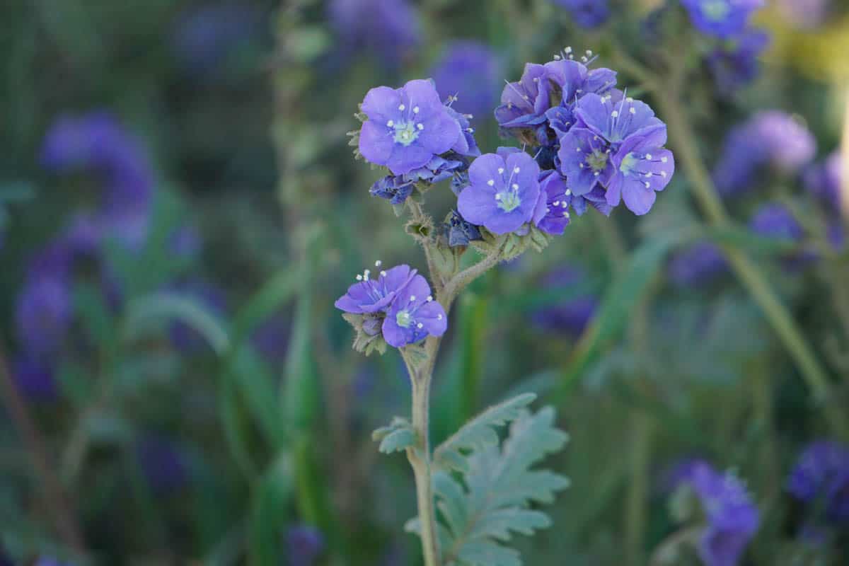
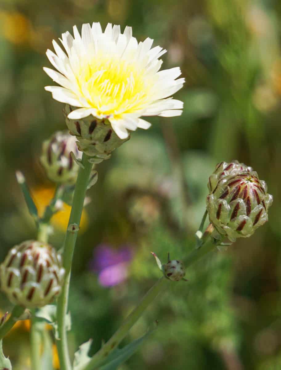
Hillside daisies, owl’s clover, goldfields, coreopsis, tidy tips, and phacelia are some of the wildflower species that bloom in profusion at Carrizo Plains National Monument.
But you can find many, many other species here, so if you enjoy identifying wildflowers you see, use Google Lens if you have an Android phone, or a free app such as iNaturalist.
Among the more prolific bloomers, you may find rare flowers, such as the endangered California jewelflower and Hoover’s woolly-star. The California jewelflower has beautiful maroon buds that open into white flowers.
The Temblor Range, grasslands in the plain, other hill slopes, and the shore of Soda Lake are all good places to see the display. If you are planning a trip to California in April in a superbloom year, consider adding Carrizo Plain to your itinerary!
Other Things to Do at Carrizo Plain National Monument
Stop by the Goodwin Education Center
The Goodwin Education Center is the Visitor Center at Carrizo Plain National Monument. It is located off Soda Lake Road, the main road that runs through Carrizo Plain National Monument: you will see signs for it as you approach.
At the center, you can browse interpretive displays about Carrizo Plain and adjoining Elkhorn Plain. The diorama, and the interactive displays, are extremely informative if you wish to learn more about this unique place, its geology, and its flora and fauna.
The center is open seasonally, from the beginning of December to the end of May. During that period, the center is generally open Thursday – Sunday, 9:00 a.m. to 4:00 p.m. Check their website for special closures and current hours of operation before you visit.
If you visit when the Goodwin Center is closed, you can still stop and pick up maps and brochures. They are left outside the door. Restrooms at the center are open all day and all through the year.
Visitor centers in the gateway communities of Santa Margarita and Taft also offer information on Carrizo Plain National Monument.
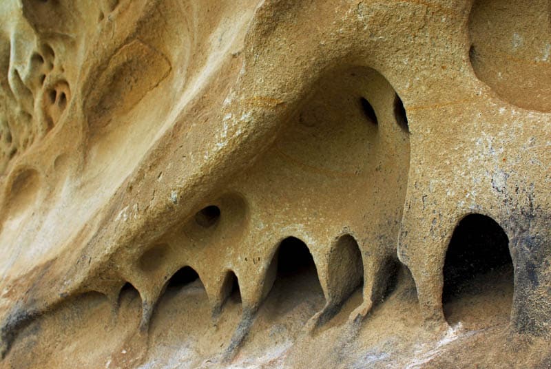
Take a Tour of Painted Rock
Just south of the Goodwin Education Center is Painted Rock, one of the top sights in Carrizo Plain National Monument.
The inside of the U-shaped sandstone rock was covered with beautifully detailed and colorful rock paintings by the Chumash and other Native peoples that lived in the coastal regions of California long ago.
Today you can take a guided or self-guided tour of Painted Rock. Guided tours are offered between March and mid-July, and a tour lasts about 90 minutes.
Self-guided tours can be done from mid-July until the end of February. A 1.4-mile round trip easy to moderate hike gets you up close to Painted Rock and its multi-colored pictographs.
To protect the site from vandalism, access to Painted Rock is restricted, and a permit is required for a visit. You can get a gate code for a self-guided tour, or register for a guided tour, at the Recreation.gov website.
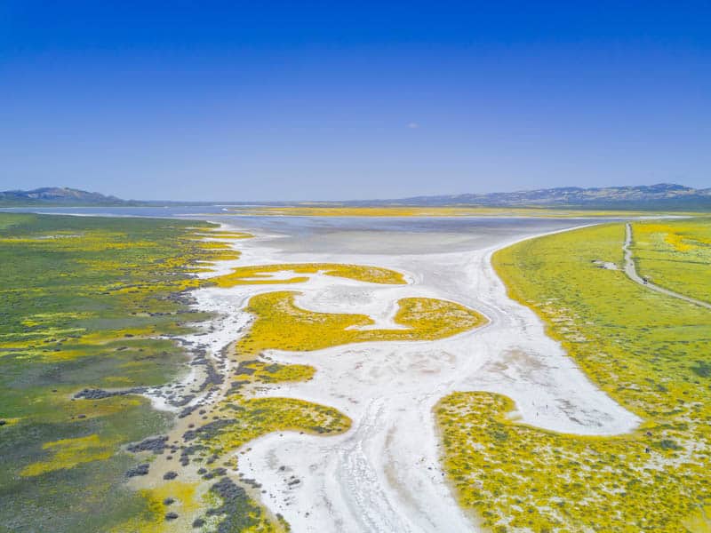
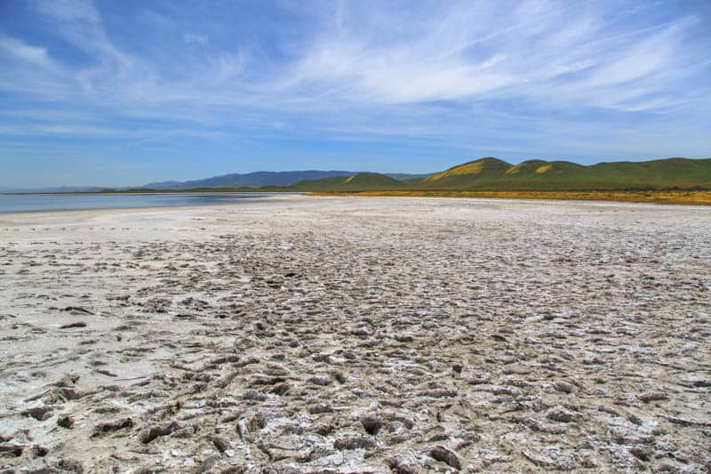
Walk the Boardwalk at Soda Lake
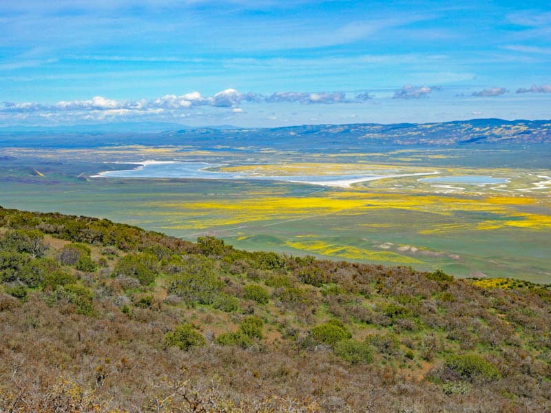
Covering about 3,000 acres, the ephemeral alkali Soda Lake is one of the most prominent natural features in Carrizo Plain National Monument. When it is dry, the surface glistens white with accumulated salts.
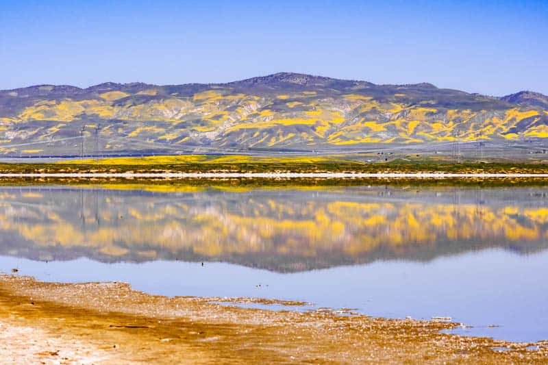
Water levels in the lake basins rise and fall based on rainfall: when we visited in April in a wet year, there was quite a bit of water in the lake.
In some particularly wet years, the water doesn’t dry up completely, and you may see patches of wet even in the summer.
Walk the boardwalk trail that runs by the shore to view and photograph the lake and admire the flora and fauna. During wildflower bloom, when you walk the boardwalk, you will be surrounded by a sea of wildflowers!
The boardwalk can be accessed off Soda Lake Road. There is parking at the Soda Lake Trailhead. From the parking area, the lake shore is just a 5-minute walk on a wide gravel trail.
Take in the View from Soda Lake Overlook
Across the road from the Soda Lake boardwalk, you can walk a short trail to the top of Overlook Hill for a panoramic view of Soda Lake and Carrizo Plain, and the masses of wildflower displays in season.
The trail is short but a little steep. From the top, you can see Soda Lake Road snaking across the plain. And looking down from the overlook, you get a better sense for how vast Carrizo Plain really is.
The Soda Lake Overlook is one of the best photo spots in Carrizo Plain National Monument, so don’t miss it!
See the San Andreas Fault
The famous San Andreas Fault, which separates the Pacific Plate from the North American Plate, runs through the eastern edge of Carrizo Plain National Monument, along the bottom of the Temblor Range.
It is one of the most prominent natural features in the park, along with Soda Lake.
The fault has given rise to the Panorama Hills and Elkhorn Hills, making for a beautiful landscape in this part of the park, and has altered the course of creeks and streams such as Wallace Creek.
When it rains, little pools, called sag ponds, form along the fault, creating great photo ops.
Hike the Wallace Creek Trail in Carrizo Plains National Monument to actually walk on the San Andreas Fault! The round trip is just 1.3 miles, and the trail is flat, with a steep short climb to the top of the ridge.
You will find informational pamphlets in the dirt parking area at the trailhead.
Drive the Scenic Loop
If you enjoy scenic drives, you can combine area roads for an 80-mile scenic loop that is impressive any time of the year and especially breathtaking during wildflower season, when hillsides are painted in vibrant colors.
Seven Mile Road, Soda Lake Road, Elkhorn Grade Road, Elkhorn Road, and Simmler Road combine to form the loop. Be aware that some of these roads are unpaved and may be impassable after rains.
Explore Other Dirt Roads
There are several dirt roads that run through Carrizo Plain National Monument, and if you arrive in an appropriate vehicle and you are an experienced backroader, you can explore some of them to see more of the monument.
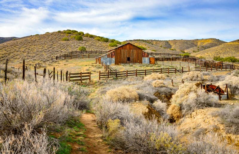
Panorama Road, Simmler Road, Pipeline Road to Quail Spring Road, Padrone Canyon Road, and the road to Travers Ranch are all worth exploring.
Padrone Canyon Road offers beautiful scenery and the opportunity to see wildlife. The Traver Ranch area has old farm equipment to see.
Dirt road driving in Carrizo Plain National Monument is only possible if you have a high-clearance 4WD, and conditions have been dry for a while.
Even trucks and Jeeps can get stuck in wet clay, so heed signage and err on the side of caution.
Tow services are hard to come by here if you get stuck, and very expensive.
Offroad driving is not permitted within Carrizo Plain National Monument. There are designated OHV driving routes in the nearby Temblor Recreation Area.
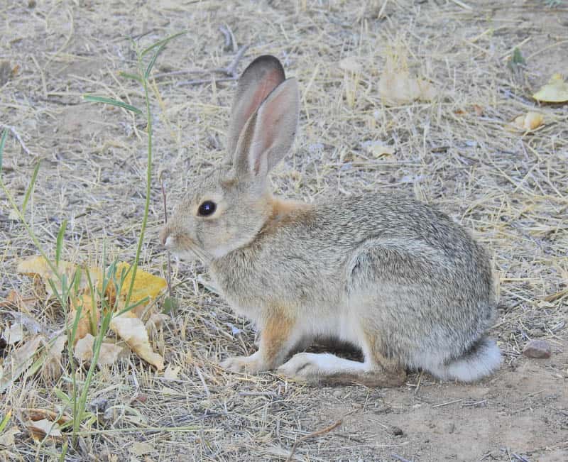
Look for Wildlife
Carrizo Plain has been called “the Serengeti of California.” Here you will find the greatest populations of endangered and threatened wildlife in the Golden State.
It is home to the pronghorn antelope, the second fastest animal on land in the world, and the fastest in North America.
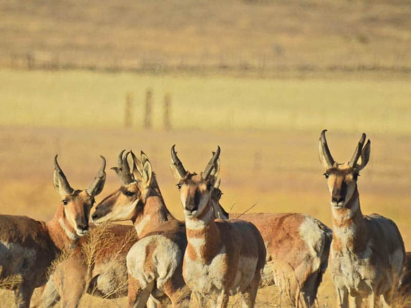
If you are lucky, you may see a whole herd of pronghorn in Carrizo Plain when you visit: they often move around in groups. They are skittish, and may not wait around to be photographed, unless you see them in the distance and can capture them with a zoom lens.
Carrizo Plain National Monument is also home to the endangered San Joaquin kit fox, San Joaquin antelope squirrels, giant kangaroo rats, blunt-nosed leopard lizards, cottontails, hogs, bobcats, and a variety of snakes, among other creatures.
You are more likely to see wildlife if you visit early or late in the day. Bring your binoculars and zoom lens, and watch or photograph animals from a safe distance!
Go Birdwatching
The largest protected habitat on the Pacific Flyway, Carrizo Plain National Monument is a superb place for birding in the winter. But you are likely to see birds in the monument no matter when you visit, and even during the day.
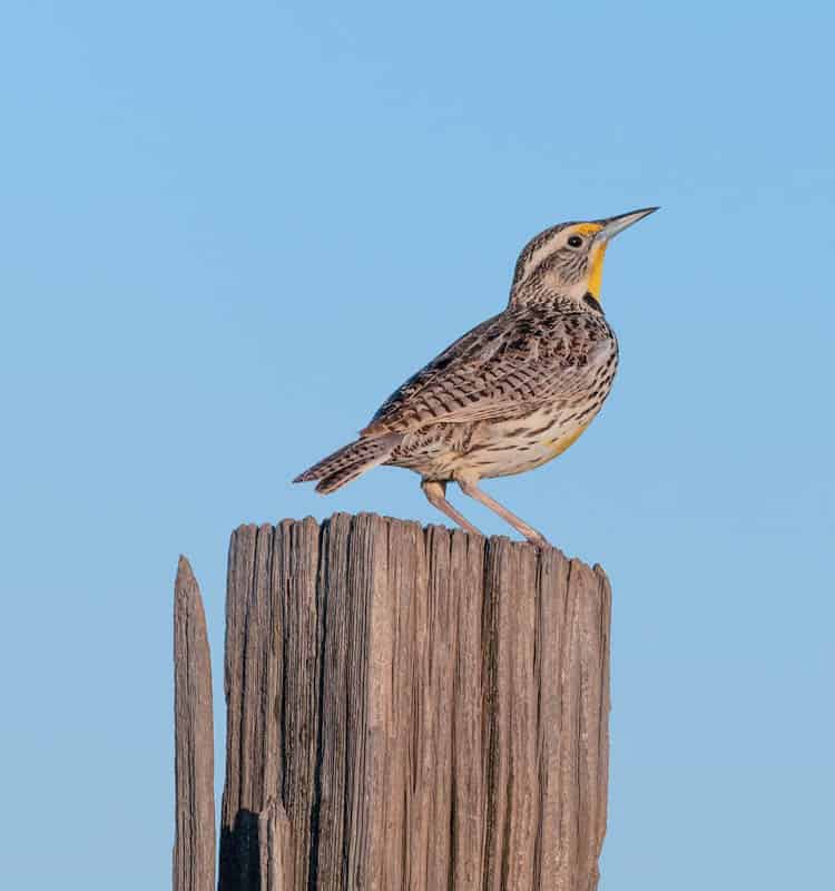
Carrizo Plain is home to the endangered mountain plover, and is a foraging ground for the magnificent California condor.
Soda Lake attracts several dozen species of migratory birds in season, from sandhill cranes to long-billed curlews.
Hawks, pelicans, swifts, owls, and Peregrine falcons have been spotted here.
Bring your scope or binoculars and look for birds perched on old fence posts left over from farming days in Carrizo Plain, and from the boardwalk trail at Soda Lake.
Morro Coast Audobon Society Sponsors a Christmas Bird Count at Carrizo Plain National Monument if you are an avid birder and plan to visit around Christmas!
Admire the Flora
While the wildflowers are definitely the showstoppers at Carrizo Plain when they are in bloom, the monument is also home to several other noteworthy plant communities.
You are more likely to notice them if you visit outside of wildflower bloom time!
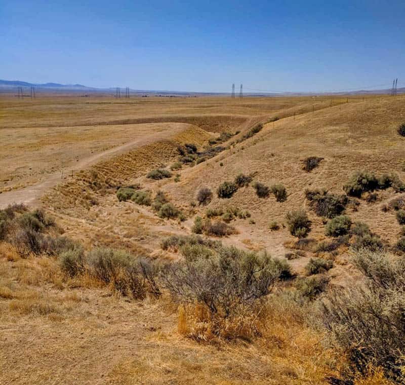
The grasslands at Carrizo Plain are all that’s left of the massive grasslands that once covered that entire Central Valley.
You will also see California juniper woodland areas, iodine bush, desert tea, manzanitas, and salt bush scrub.
You won’t see too many trees here, because it is so arid.
Hike (or Bike) in Carrizo Plain National Monument
Hikers will find many trails to explore in Carrizo Plain National Monument. Arrive in a high-clearance 4WD vehicle to access trailheads for some of the more adventurous trails that are not off Soda Lake.
We’ve mentioned some of the easier trails above: the Soda Lake Boardwalk Trail, the short uphill trek to Soda Lake Overlook, the hike to Painted Rock, and the Wallace Creek Interpretive Trail at the San Andreas Fault.
If you are looking for a moderate but longer hike, try the Caliente Mountain Ridge Trail, which is out and back, about 16 miles round trip. This hike rolls along the ridge to Caliente Mountain, and offers spectacular views of Soda Lake and Carrizo Plain.
You can go biking on the dirt roads in the park as well, as long as you do not attempt to ride when the roads are not completely dry.
Enjoy Photography at Carrizo Plain
Carrizo Plain’s wildflower bloom is eagerly awaited by landscape photographers for the masses of color. During bloom, you can find many spots in the monument to capture the beauty of the flowers.
Carrizo Plain’s wildlife and birds also offer exciting, if tenuous, photo ops.
For other interesting subjects for your lens, visit the Travers Ranch area and other places where dilapidated old barns and huts and a variety of old farming implements and machinery are scattered about.
There are interesting rock formations in the park as well.
Stargaze
Carrizo Plain is far enough away from civilization that it has dark skies, perfect for stargazing. Soda Lake, with its white salt flats, is a great stargazing location: flat and open.
Overlook Hill by Soda Lake has an elevated position for stargazing, or, if you are apprehensive about wildlife being around in the dark like we are, just park in the Soda Lake Trailhead parking area and sit inside or on the bonnet of your car to observe the night skies!
A cloudless, moonless night is perfect for seeing the most stars, and the recommendation is that you wait in the dark for at least 30 minutes for the eyes to adjust: at the end of that time, your patience will be amply rewarded!
How to Get to Carrizo Plain National Monument in SLO County
Carrizo Plain National Monument is located at 17495 Soda Lake Rd, Santa Margarita, CA 93453. Visitors arrive at Carrizo Plain National Monument by road, and you need your own wheels to be able to explore the monument.
From the north, you can access Soda Lake Road in Carrizo Plain National Monument from California State Route 58. From the south, you can access Soda Lake Road in Carrizo Plain National Monument from California State Route 33 or 166. See map.
From Los Angeles, Carrizo Plain National Monument is 120 miles, and it will take you about 2 hours to arrive at the turnoff for Soda Lake Road. If you enjoy the outdoors, Carrizo Plain National Monument makes for one of the coolest day trips from LA you can do!
From San Francisco, it is 253 miles to the north end of Soda Lake Road, a drive of about 4 hours.
If you do not wish to camp overnight, you could make a weekend of it, or a short mid-week getaway, and combine a visit to Carrizo Plain National Monument with a Central Coast town like Paso Robles or San Luis Obispo. This is how we visited. Carrizo Plain is about one hour from the Central Coast.
Essential Information for Your Visit to Carrizo Plain National Monument
Park Hours
Carrizo Plain National Monument is open every day, 24 hours a day.
Park Entrance Fee
There is no fee to visit Carrizo Plain National Monument. A small fee may be charged for registering for guided or self-guided tours.
Road Conditions
Soda Lake Road is the main road that runs through Carrizo Plain National Monument. It is only partially paved (along the north end). The unpaved part is pretty rough. Other roads in Carrizo Plain National Monument are dirt and/or gravel.
Dirt roads in the monument can become impassable during or after rain. Some roads, such as Panorama Road and Simmler Road, may not dry out for many weeks after a period of rain. The park may close roads for different reasons, so call ahead if you plan on driving the dirt roads.
Towing services are hard to come by, and may be expensive, so obey all road closure signs, and exercise caution when venturing out onto dirt roads after rain in the winter or spring.
Pets
Pets are allowed in Carrizo Plain National Monument but must be controlled. Pets must be leashed, or caged, at all developed sites in the monument, such as the visitor center, overlooks, trail heads, and campgrounds. Pets are not allowed in the Painted Rock area.
Restrooms
There are restrooms at the visitor center, and pit toilets at the Soda Lake Overlook. The two campgrounds have restrooms as well.
Food and Drink
No food or drink is available at Carrizo Plain National Monument. Please stock up on food, water, and essential supplies before you enter the monument.
You can buy food and drink and other supplies in Santa Margarita, located northwest of Carrizo Plain National Monument, or Taft, located east of the monument.
Fuel
Please fill up your gas tank prior to your visit to the monument, and keep an eye on your gas gauge during your visit.
Gas is available in the gateway communities of Santa Margarita and Taft. Both communities are about an hour away from the visitor center in the monument.
Cell Reception
Do not count on cell reception in Carrizo Plain National Monument.
Cell reception can depend on your carrier and may be spotty depending on your location within the monument. To be safe, download maps and other informational material prior to your visit and print hard copies as back-up.
Camping
If you want to spend a night or a few nights soaking in the beauty and silence of Carrizo Plain, there are two primitive, first-come, first-served campgrounds from which you can choose.
Both campgrounds are signposted and accessed from Soda Lake Road and are free at the time of writing. Dispersed car camping is also permitted in certain parts of the monument.
KCL Campground offers twelve campsites, two of which are elevated ADA compliant. There are picnic tables, fire pits, horse corrals, and ADA compliant vault toilet.
There is no electricity or drinking water, and no trash service. You will find some of the few trees in the monument here.
Selby Campground has thirteen campsites, with picnic tables, fire pits, horse corrals, and a wheelchair-accessible vault toilet. There is no electricity or drinking water, and no trash service.
Both campgrounds can accommodate small RVs and trailers, up to 25 feet in length. Roads leading to the campgrounds are dirt or gravel and may be impassable when wet or after a period of rain.
If you don’t own an RV but would like to tour Carrizo Plain National Monument in one, check out Outdoorsy to find the perfect vehicle for your trip!
How Much Time Should You Allow for Carrizo Plain?
If you enjoy the outdoors, there is a lot to see and do at Carrizo Plain National Monument. Depending on the things you want to do, allow for half a day to a full day at the monument.
In about four hours, you can walk the boardwalk at Soda Lake and take in the view from the Overlook, perhaps drive the scenic loop around the park, and visit one or two other places of interest, such as Painted Rock or Wallace Creek at the San Andreas Fault.
A full day will allow you to add in one or two hikes or some time spent observing birds and/or wildlife, or some photography around the old farming buildings or other scenic spots in the park.
Of course, if you are time-constrained and just want to see the wildflowers in season, you can spend just an hour or two along Soda Lake Road, taking in all the beauty from the road or the short Soda Lake boardwalk.
Tips for Visiting Carrizo Plain National Monument in Central California
Best Time to Visit Carrizo Plain National Monument
Wildflower bloom time in the spring is undoubtedly the most popular time to visit Carrizo Plain National Monument. Springtime in Carrizo Plain is beautiful.
You will likely see water in Soda Lake, entire hillsides covered in flowers, and pleasant daytime temperatures. There may be some rainy days in the spring.
Winter and late fall are also pleasant from a weather perspective, with daytime temperatures in the 60s or low 70s. Expect it to be cold early and late in the day.
Winter also is the wet season, and there may even be a dusting of snow here and there. But you will have bright sunny days as well. Winter is the best time to see migratory birds in the park.
Summer daytime temperatures can exceed 100 degrees, so we recommend visiting Carrizo Plain National Monument between late fall and spring for the best weather. Expect the plain to be brown and barren in the hot, dry summer.
If you visit in the summer, plan on sightseeing and auto-touring during the day and restrict hikes or extended time outside your vehicle for early or late in the day.
Find out and follow safety guidelines and rules
The Carrizo Plain National Monument is wilderness, with no facilities or services. It is managed by the Bureau of Land Management (BLM).
Visit the BLM website for information on safety, rules and guidelines for enjoying the Carrizo Plain National Monument, and proper day use and overnight use.
Bring the appropriate vehicle
Soda Lake Road is partly paved and partly graded dirt and considered generally passable to regular vehicles in dry conditions. When we visited, the unpaved section of Soda Lake Road was a teeth-rattling experience in a regular sedan, even though we drove really, really slow.
Dirt roads in Carrizo Plain National Monument are best traversed in a 4WD and high-clearance vehicle. Arrive in a vehicle appropriate for the driving routes you plan to cover on your trip!
If you plan to rent a vehicle for your trip, check out Discover Cars. They scour multiple providers to get the best price, and they have a wide variety of vehicles in most locations.
Bring Appropriate Mapping and communication Devices
If you plan to drive the dirt roads in the monument, or go hiking or dirt biking, these resources may prove useful, not only on your visit to Carrizo Plain National Monument, but on other wilderness trips as well!
- The Garmin Fenix 6 is a premium model GPS watch, with all the functionality you could ask for in terms of mapping, GPS, music, and monitoring. It’s great for any wilderness excursion. Buy it on REI | Buy it on Amazon
- Or check out the Garmin Instinct, a more affordable option, on REI or Amazon. It features GPS, heart rate monitoring, and a 3-axis compass. The construction is solid and it has a good battery life.
- The affordable InReach Mini functions as a great backup resource for navigation. With a satellite subscription, it enables you to send and receive texts when there is no cell phone reception. It weighs only 3.5oz, and has tracking and SOS capabilities as well. Buy it on REI | Buy it on Amazon
What to Wear
Dress appropriately for the weather, and bring rain gear in winter and early spring. We always bring light but warm waterproof jackets with hoods on all outdoor adventures.
Light, loose, full-sleeved top and long pants are best for hiking or sightseeing outdoors in the sun. We generally wear clothing with SPF protection if we are going to be in the sun for several hours. Check REI for women’s SPF shirts here and men’s SPF shirts here.
Sturdy, closed-toed footwear is a must. Sneakers or sturdy walking shoes with good grip are fine for short nature trails. Lightweight hiking shoes or boots are best for longer trails. We wear the La Sportiva brand cuffed hiking boots: they are not heavy, they are waterproof, and they are super comfy. Check women’s here and men’s here.
Sun Protection
Use a wide-brimmed hat with SPF protection, sunscreen (we love this sunscreen), lip balm with SPF (love this 3-pack!), and sunglasses.
Bring binoculars and your camera
If you enjoy birding or wildlife viewing, you may want to bring your binoculars. Our go-to binoculars are the Celestron Trailseeker compact binoculars: they are not too heavy, and they perform well in low light, when you can typically expect to see birds and animals.
If you plan to visit to photograph the wildflowers, you will want to bring your photography gear. We don’t usually carry our large camera and lens on hikes, but we did to Carrizo Plain.
Most times, we use our little Panasonic Lumix DC-ZS70, which fits into a pocket. It has a 30X zoom and Leica lens, and produce good shots of birds and animals.
Bring Essential Supplies
Bring these essentials: a first-aid kit, disinfecting wipes or hand sanitizer, headlamp or flashlight, and a pocket knife.
Bring your trekking poles if you anticipate needing them: they can be useful during elevation changes. Also carry, and use, bug spray as needed. Invest in a light and easy-to-carry daypack to stow food and other supplies.
Tips to Enjoy Wildflower Bloom at carrizo Plain National Monument
Check for bloom updates online so that you can time your visit for close to peak or peak bloom. Check the California wildflower hotline and view Instagram stories or current photos.
If you arrive via California Highway 58, you will see areas of bloom along that road as well!
If you plan to restrict yourself to Soda Lake Road, you can get by in a regular sedan as long as it is dry. You will see lots of wildflowers even without venturing onto the unpaved portion of Soda Lake Road.
Planning to pose among the wildflowers? Use paths already made by prior visitors, and avoid trampling on flowers.
Arrive early or late in the day if you visit during peak bloom in “superbloom” years, to avoid crowds.
Early or late in the day are also the best times for photographing the wildflowers and the colorful panoramas.
*****
Planning to explore more of California? Check out some of our other articles!
- Visiting Cabrillo National Monument in San Diego
- Things to Do at Point Reyes National Seashore
- Inside the 9 Incredible National Parks in California
- How to Visit Devils Postpile National Monument in Mammoth Lakes
- Point Lobos State Reserve: The Complete Guide
- How (+ Where) to See the Mono Lake Tufas
- The Ultimate Guide to the Alabama Hills
Did you find this article informative? Pin it for later reference!
Hi! Thank you for your helpful blog! May I ask if it’s recommended to use an RV than a sedan? Thanks in advance for your answer.
Hi Sherwin, the roads in the monument are very bumpy and uneven, and we would not recommend driving an RV here unless you will be on the paved road only. Roads also get muddy and slick or impassable after rains. We suggest a high-clearance SUV.
When the roads are dry, with no recent rain, you may be able to drive a small RV to one of two campgrounds in the monument, although a part of the route in each case is on gravel roads and you have to be careful.
We suggest calling the monument prior to your visit to ask the staff about road conditions and the advisability of driving an RV at the time you plan to visit.
What is the current condition of bloom in Carrizo plain? Is April-2023 beginning a safe time to expect peak? I would greatly appreciate some suggestion.
Thank you.
Hi! Bloom generally starts late March and peaks in early to mid April. A good bloom is expected this year! The best way to time your visit is to check Instagram for current photos.
I checked Instagram, and there are patches of yellow bloom on the slopes of the mountains but none in the flat areas. I would say late March/early April.
Thank you for writing an excellent article. Informative and helpful.
Thank you for reading. It was a good bloom year!