Looking for the best Death Valley hikes? Death Valley National Park is home to a variety of geological wonders, and hiking is one of the best ways to get up close to its epic landscapes.
Death Valley hikes range in length and skill level, so whether you are looking for a scenic trail to a viewpoint or an easy walk to a historic site, or you want to literally climb a mountain or go down into the depths of a volcanic crater, you will find a trail in Death Valley National Park to suit.
From being able to run your fingers along the smooth marble walls of a canyon to seeing and hearing a waterfall at the edge of a desert, the best Death Valley hikes offer a variety of wonderful sensory experiences that make them well worth the effort.
Some links on this page may be affiliate links. If you click an affiliate link and make a purchase, we may receive a small commission, at no extra cost to you. For more details, refer to our disclosure.
You’ll even find super short walks from parking lots to viewing areas: the short walk to the viewing area at Zabriskie Point, and the short walk to view the double wagon and mine remnants at Harmony Borax Works are both not to be missed!
If you are planning a hiking trip to Death Valley National Park, read on to learn about the best Death Valley hikes, plus some tips for hiking in the desert park!
Zabriskie Point Hike
Difficulty: Easy
Length: About 0.4 mile, out and back
Elevation gain: About 50 feet
Time: 0.5 – 1.0 hour (longer if you want to take photos)
Trailhead: Along CA Highway 190 at Zabriskie Point, see map.
Without question one of the most scenic viewpoints in Death Valley National Park, Zabriskie Point is easily accessed via a short paved trail from the parking lot.
Once you arrive at the top, walk around and take in the views from all around the viewing area.
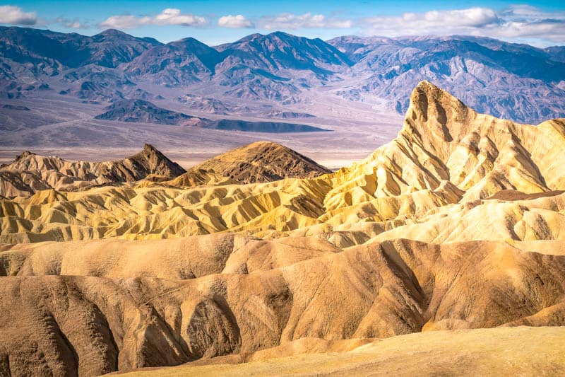
Look for subtle colors in the badlands, admire Manly Beacon and Red Cathedral, and snap photos of the giant elephant toes.
While any time of day is wonderful for this short and very popular Death Valley hike, go at sunrise for an otherworldly experience: you can watch as the rising sun paints the Panamint Mountains and the badlands golden.
Arrive early is you also have photography on your itinerary, because Zabriskie Point is an extremely popular sunrise photo spot.
Sunset is another beautiful time to do the Zabriskie Point Trail, especially if you visit on a day when the skies become colorful just after the sun sets.
Mesquite Flat Sand Dunes Hike
Difficulty: Easy to moderate
Length: About 2 miles, out and back
Elevation gain: About 185 feet
Time: 1.5-2 hours
Trailhead: Along CA Highway 190 at Stovepipe Wells Village, see map.
This huge sandy playground is one of the most fun hikes in Death Valley National Park, for kids and adults alike.
This is one of the places in the park where you see a little vegetation, and the sand is loose and soft when dry.
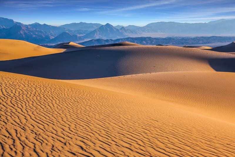
If you walk all the way to the top of the highest sand dune and back, you will have covered about two miles.
There is no formal trail, so you can strike out as you wish.
The good part about this hike is that you can explore to the extent you are able: there isn’t a must-reach payoff.
The “trail” is more difficult than it looks, because the sand is loose and your feet sink into it as you walk.
If you visit early in the day after a windy night, you will be able to make the first cool set of footprints on the pristine sand!
During the day you have to walk out quite a bit for a stretch of footprint-free sand.
Or walk here at sunrise or sunset to enjoy the play of shadow and light on the dunes as you hike.
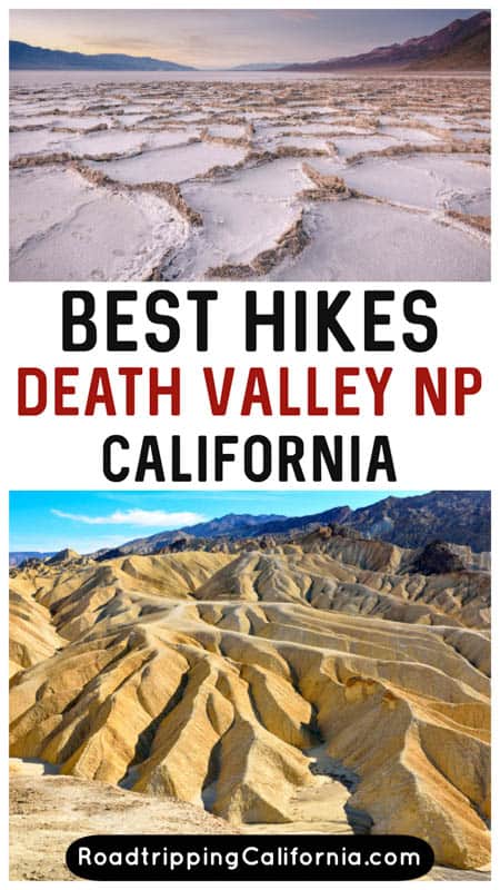
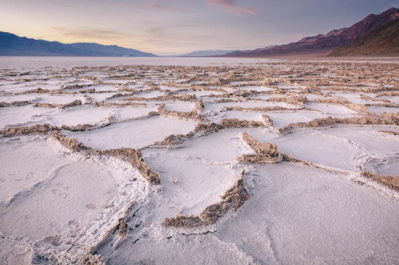
Badwater Salt Flat Hike
Difficulty: Easy to difficult, depending on length
Length: About 1 mile out to the edge of the salt flat and back; 5 miles each way from end to end
Elevation gain: None
Time: Varies depending on length you choose, allow at least 30-45 minutes
Trailhead: Along Badwater Road, see map.
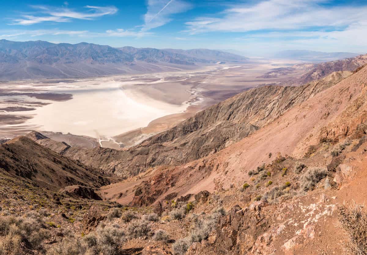
Badwater Basin is the lowest point in North America!
This huge salt flat is over 200 square miles in area and stretches as far as the eye can see. It is one of the coolest landscapes in Death Valley National Park.
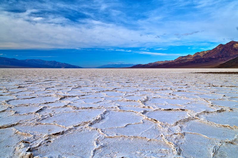
A ramp leads down from the parking area onto a boardwalk, and from there you can step out onto the flat and walk along the flattened “trail” to the far edge, or as far as you want to go.
As you walk, you will see obvious flattened paths where you can branch off to explore, but try not to walk on pristine areas where you can see the shapes of the beautiful salt polygons. The delicate salt crystals are easily crushed.
Salt Creek Interpretive Trail
Difficulty: Easy
Length: About 0.5 mile, loop
Elevation gain: None
Time: About 30 minutes
Trailhead: Along Salt Creek Road off CA Highway 190, see map.
The Salt Creek Interpretive Trail is an accessible wooden boardwalk and a delightful trail for all visitors to the park, including young kids that will love looking for pupfish in the creek.
The Death Valley pupfish, Cyprinodon salinus, are a small species of fish endemic only to two spots in Death Valley. They are classed as endangered.
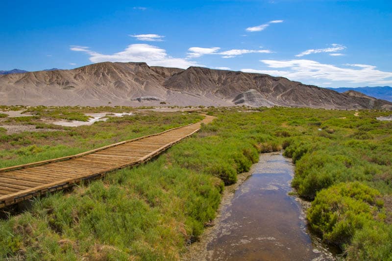
The easy stroll is best done between November and May, when there is water in the creek. The Salt Creek pupfish spawn in the spring and it’s the time when you are most likely to see them. Interpretive plaques along the route offer information.
This trail is also where you are most likely to see birds in Death Valley National Park, so bring your binoculars. It’s nice to see a bit of green in the desert park!
Natural Bridge Trail
Difficulty: Easy
Length: About 1 mile, out and back
Elevation gain: About 85 feet
Time: About 45 minutes
Trailhead: Along Natural Bridge Road off Badwater Road, see map.
This short hike through a canyon takes you to a natural bridge created by the erosive action of water on the canyon walls over time. The impressive bridge extends across the breadth of the canyon.
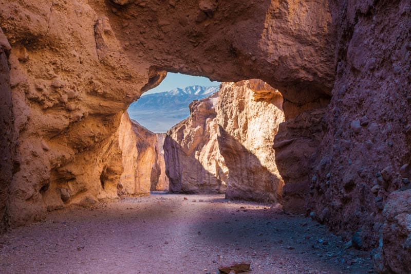
The trail to Natural Bridge climbs from the parking lot to the mouth of the canyon and then follows the canyon wash. It narrows before widening again at the bridge. The trail is flat but rocky, and uneven in places, so watch your step.
You can walk back after you view the bridge, or you can continue to explore the canyon beyond the bridge. There is a dryfall to see a little beyond the bridge, and side canyons to explore if you have the time!
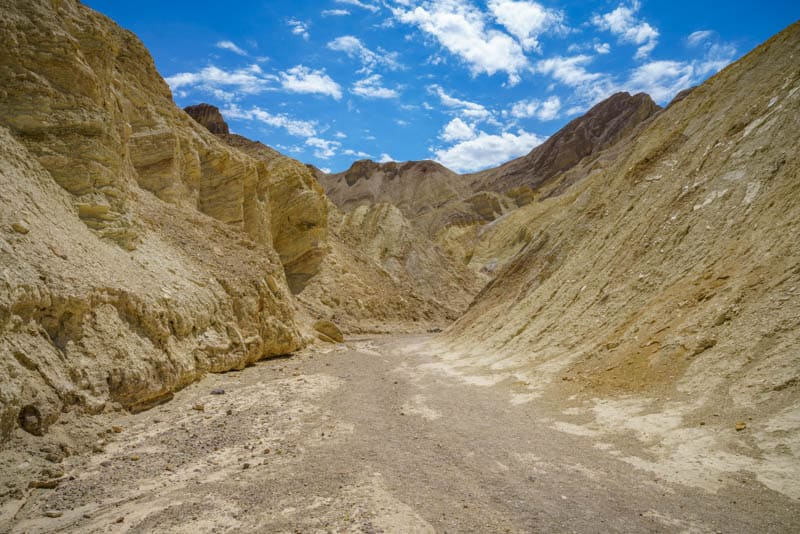
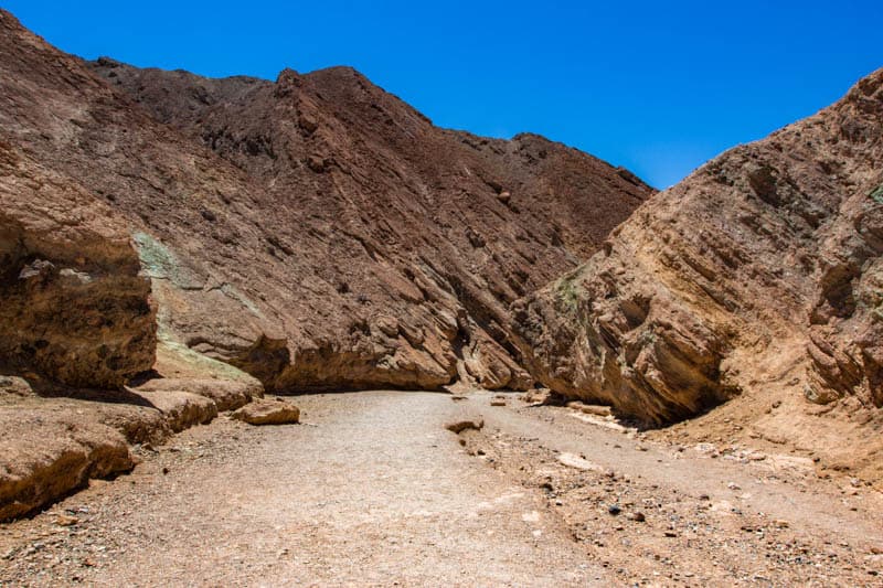
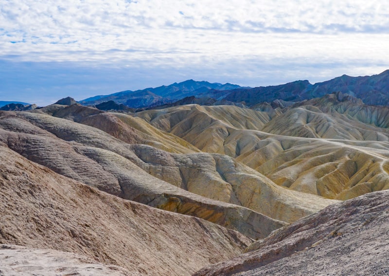
Golden Canyon – Gower Gulch Trail
Difficulty: Moderate
Length: About 4.3 miles, loop
Elevation gain: About 675 feet
Time: About 2 hours
Trailhead: Along Golden Canyon Road off Badwater Road, see map.
Arguably the most beautiful trail in Death Valley National Park, the Golden Canyon Trail can be hiked on its own as an out-and-back or combined with the Gower Gulch Trail for a loop.
You can also add in the Badlands Loop (see below) for a long but super scenic hike.
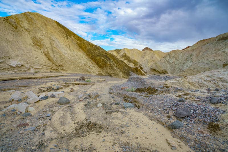
You will start by hiking up Golden Canyon towards the rock formation known as the Red Cathedral (you can see this striking red formation from the viewing area at Zabriskie Point).
Pass by Manly Beacon (another famous rock formation viewable from Zabriskie Point) and hike the short spur to the base of Red Cathedral.
The trail through the canyon is uphill and rocky, and involves a little bit of scrambling and maneuvering past boulder overhangs.
At the end of Golden Canyon, or after you hike to Red Cathedral, you can walk back to the parking lot, or continue on to descend into Gower Gulch.
There isn’t a firm trail into Gower Gulch, so you can find your own path down and out of the wash!
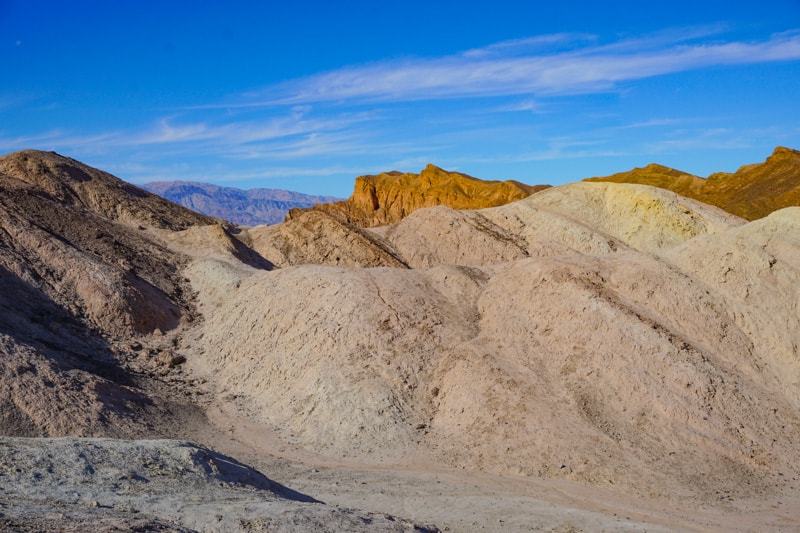
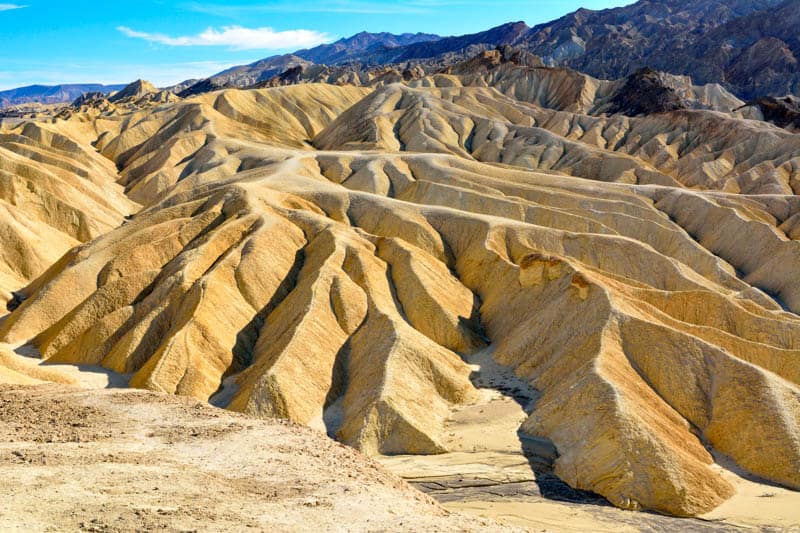
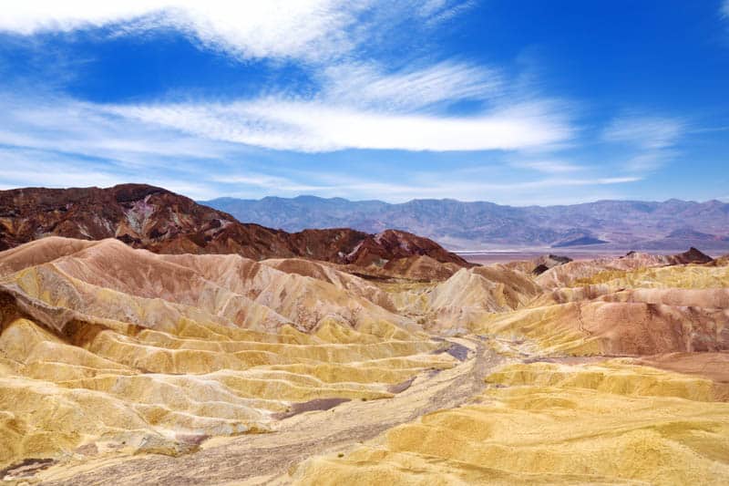
Badlands Loop Trail
Difficulty: Moderate
Length: About 2.7 miles, loop
Elevation gain: About 535 feet
Time: About 2 hours
Trailhead: Near Zabriskie Point Parking Lot, off CA Highway 190, see map. You can also access the Badlands from the Golden Canyon – Gower Gulch Trail described above.
If you stand at the viewing area at Zabriskie Point and look longingly at the stunning ridges of the badlands, feeling the urge to explore them, then this trail is for you!
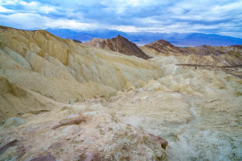
The trail winds through the badlands, letting you gawk at the beautiful colors and textures from up close. The shades of yellow, tan, gold, and burnt orange are a photographer’s dream.
The start of the loop comes up in about 0.5 mile from the trailhead, and there are signs at major intersections, so watch for them to stay on the loop.
You can do this hike on its own or as part of the Golden Canyon – Badlands – Gower Gulch Loop Trail, about 7.8 miles in total.
Darwin Falls Hike
Difficulty: Moderate
Length: About 2 miles, out and back
Elevation gain: About 450 feet
Time: About 2 hours
Trailhead: Darwin Falls Road (Old Toll Road), off CA Highway 190, see map.
This trail is away on the western edge of Death Valley National Park near Panamint Springs Resort, but if you are traveling to the park from the west, or spending a few days in the park, it is very cool to come upon this lush oasis and flowing waterfall in the most arid place in the country!
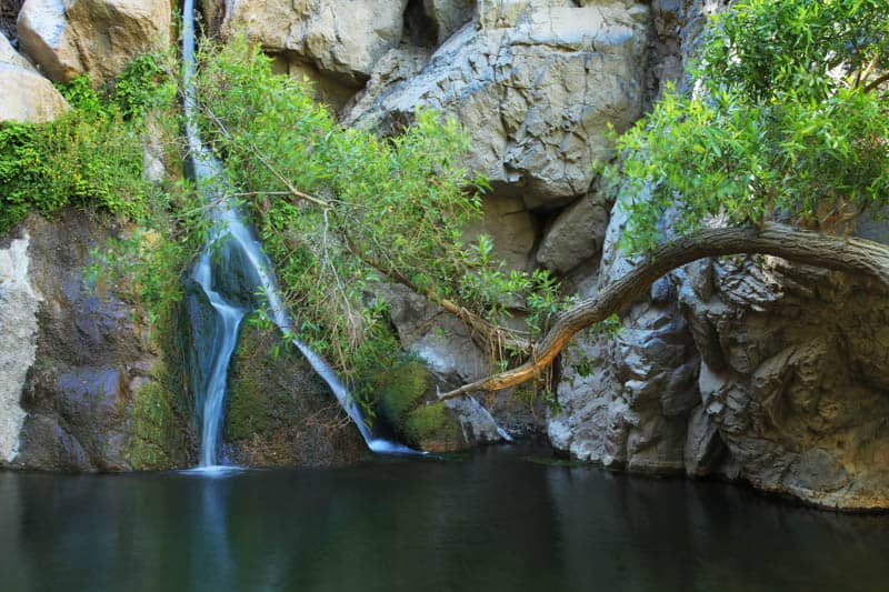
The trail is unmarked but not too difficult to follow as it winds its way along the desert wash into the canyon, which features dramatic high walls. It is rocky in places, so watch your step.
Further along, the trail runs alongside the creek, and there are a couple of stream crossings to navigate before you reach the little clearing with the waterfall.
Watch out for vegetation overgrowth and slippery rocks. You may see birds and lots of colorful dragonflies here!
Note: Swimming at the waterfall is not permitted.
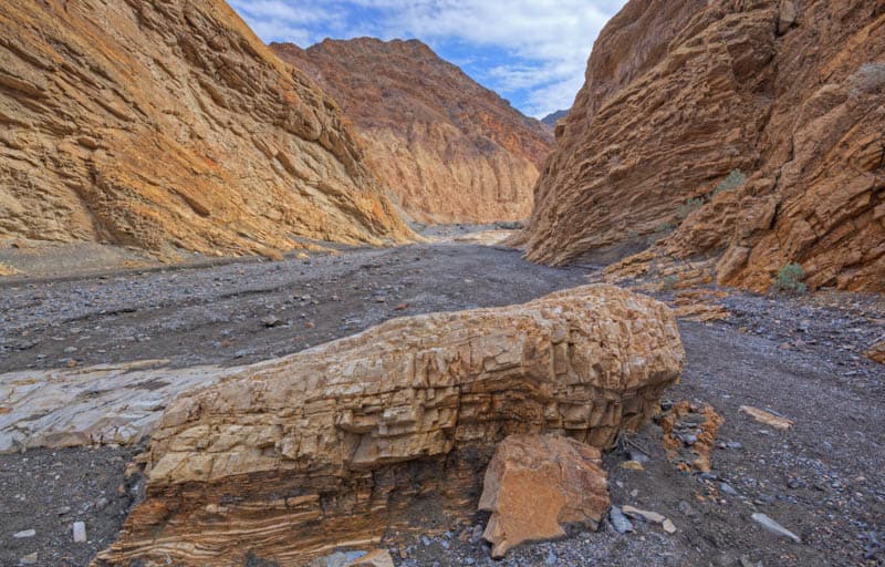
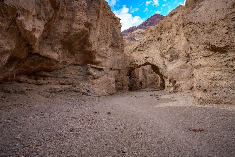
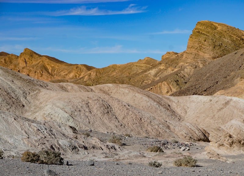
Mosaic Canyon Hike
Difficulty: Moderate
Length: About 4 miles, out and back
Elevation gain: About 1,200 feet
Time: About 3 hours
Trailhead: Mosaic Canyon Road, off CA Highway 190, see map.
The Mosaic Canyon hike is one of the most rewarding hikes in Death Valley National Park, with the opportunity to see some very cool geological formations: smooth marble walls and mosaic created by nature!
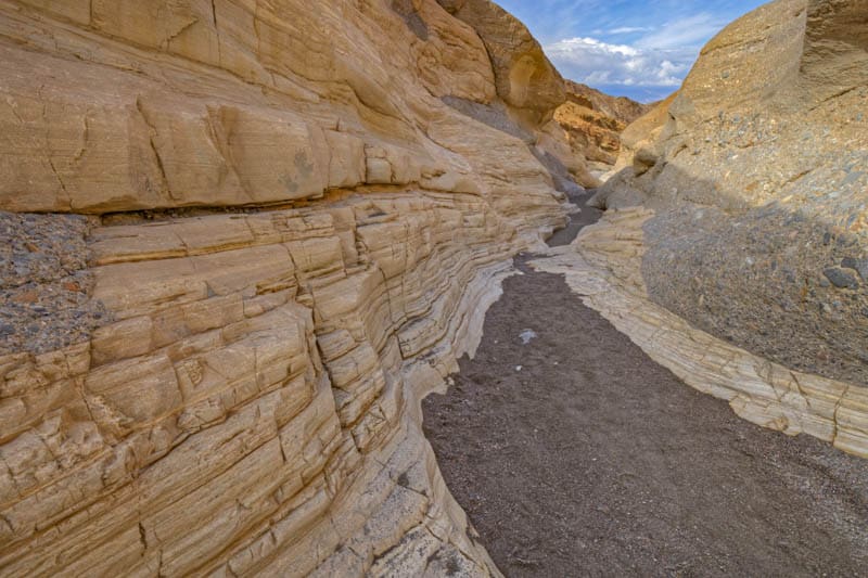
This hike starts out as a very easy and flat walk until the first set of narrows, after which some rock scrambling and climbing are required to traverse the remaining sets of narrows to an amphitheater with a dryfall at the end.
If you aren’t comfortable with scrambling, it is still worthwhile to hike the easy part of Mosaic Canyon Trail, because the beautiful smooth honed marble walls and gorgeous natural mosaic come up almost as soon as you enter the canyon!
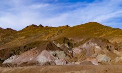
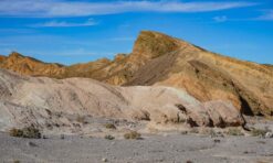
Artist’s Palette Hike
Difficulty: Easy to moderate
Length: Variable, depending on how far you want to go
Elevation gain: Variable
Time: Variable, allow at least 30-45 minutes
Trailhead: Artist’s Palette Viewpoint on Artist’s Drive, off Badwater Road, see map.
Artist’s Drive and Artist’s Palette are among the top sights in Death Valley National Park. Once you park at the Artist’s Palette Viewpoint, you can descend into the wash and then head into the hills to explore the colorful deposits up close.
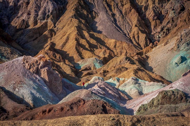
If you want colorful close-up shots of the mineral deposits to light up your Instagram feed, this is your opportunity! From lavender to blue to green to yellow, pink, red, and rust, you will not want for a color here.
There is no designated trail, so you can craft your own adventure by wandering where you will in the little passageways or climbing up the many canyon washes.
To return to the main wash where you started, walk downhill, and then make your way to the parking lot.
Desolation Canyon Hike
Difficulty: Moderate to strenuous
Length: About 3.6 miles, out and back
Elevation gain: About 600 feet
Time: About 3 hours
Trailhead: Desolation Canyon Road, off Badwater Road, see map.
The Desolation Canyon hike showcases colorful mineral deposits and other geological formations, somewhat akin to the neighboring Artist’s Drive.
It is an adventurous hike through designated wilderness, and involves climbing and rock scrambling.
Start by hiking east towards the Black Mountains and into the high-walled canyon, where you will begin to see some colors.
Follow the main canyon to stay on the route, or take the time to explore a couple of smaller side canyons along the way.
About a mile in, you have to climb or scramble up a dryfall and down the other side.
The rest of the route is along the wash, with colors on the canyon walls that range from red and orange to yellow, purple, green, and blue.
Towards the end of the route, you’ll climb up the ridge for panoramas over Death Valley, before returning the way you came.
Ubehebe Crater Rim Hike
Difficulty: Moderate
Length: About 1.5 miles, loop
Elevation gain: About 500 feet
Time: About 1 to 1.5 hours
Trailhead: Ubehebe Crater Road, off Scotty’s Castle Road, see map.
Ubehebe Crater is one of the most awesome sights in Death Valley National Park. It is 0.5 mile wide and 600 feet deep.
You can hike the entire rim loop, or go 0.5 mile to Little Hebe Crater and then turn back.
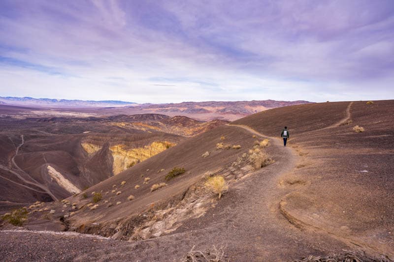
The recommendation is to do this loop counter-clockwise, so you get the climbing done early in the hike.
It is very cool walking along the rim and looking into the yawning crater: you feel like you are on Mars! Stay on the trail, well away from the edge.
It is also possible to go down into the crater, although the climb back up is very steep, with loose gravel making it difficult to get traction.
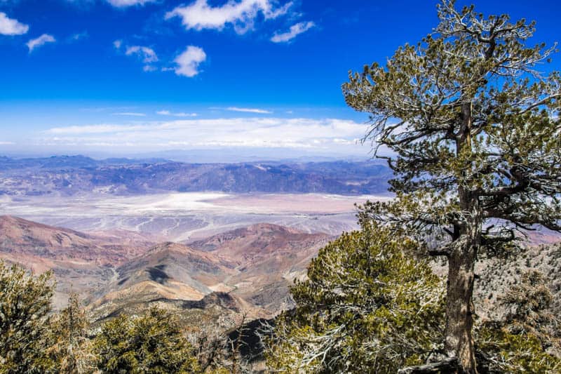
Telescope Peak Hike
Difficulty: Strenuous
Length: About 14 miles, out and back
Elevation gain: About 3,000 feet
Time: About 7-9 hours
Trailhead: Mahogany Flat Campground, off Upper Wildrose / Emigrant Canyon Road, see map.
At 11,049 feet above sea level, Telescope Peak is the tallest point in Death Valley National Park, so this is the ultimate Death Valley hike for panoramic views and bragging rights.
The trail starts by climbing up the eastern slope of the Panamint Mountains, and the first mile of the trail is lined with trees.
After this point, the vegetation clears up, and you get fabulous views over the valley as you continue climbing.
At about 2.5 miles, the trail opens into a meadow, where climbers electing to backpack the route generally camp for the night.
The next 1.5 miles are relatively flat, and offer stunning views, before a series of switchbacks takes you over the remaining 3 miles to the summit.
From the top, you can look down into Badwater Basin, the lowest point in the park!
You can also look west and see if you can spot Mount Whitney, the highest point in the lower 48 states.
Dante’s Ridge Hike
Difficulty: Strenuous
Length: About 9 miles, out and back
Elevation gain: About 2,100 feet
Time: About 4-6 hours
Trailhead: Dante’s View parking lot, north side, see map.
One of the more challenging hikes in Death Valley National Park, the Dante’s Ridge hike takes you to Mount Perry and back, although you can go as far as you like.
There is no official trail, but you’ll walk along the ridge from the parking lot at Dante’s View.
There are spectacular unobstructed views all along the trail, so plan on hiking on a clear day to capitalize on the views. Admire the beautiful red rock, colorful lichen, and wildflowers in season.
The trail goes up and down, so be prepared for frequent elevation gain and loss. It is mainly dirt and sand, with some rocky outcroppings. There is some scrambling towards the end, and in places footing can be treacherous.
It can be windy at times, so bring a windcheater and wear layers.
Tips for Hiking in Death Valley National Park
Follow Park Safety Guidelines and Advice
The Death Valley National Park website has a page on safety. Read and follow the guidelines for a safe visit to the park. You are responsible for your safety!
Also check in with park rangers if you have questions and to assess the suitability of specific hiking trails or other activities for you and your traveling companions. The Visitor Center is located at Furnace Creek.
Get a National Parks Pass!
Do you have a National Parks Pass? If you plan to visit 3 or more national parks (or other federally managed recreation areas) over the course of the year, purchasing the America the Beautiful National Parks Pass may save you money!
The pass is valid for 12 months from the time of purchase and is accepted at over 2,000 sites in the country. You can buy the annual pass online at REI.
Practice Leave No Trace Principles
Much of Death Valley National Park is designated wilderness, with minimal services and amenities. You may not find restrooms at some of the trailheads for the hikes described in our article and none along the trails.
Visit responsibly and practice leave no trace principles, to keep the park in great shape for future visitors.
Bring the appropriate vehicle
Most of the roads leading to hiking trails in Death Valley National Park, and the parking lots at the trailheads, are dirt and/or gravel.
The park suggests a high clearance vehicle for the road leading to Darwin Falls, and definitely recommends a high clearance vehicle with 4WD for the final stretch of road leading to the trailhead for Telescope Peak.
Although the dirt roads leading to the other trails described here are considered generally passable for sedans, they can be very rough and bumpy. Bring a high clearance 4WD for the easiest drives on Death Valley dirt roads, drive slow, and know how to change a flat.
If your car breaks down, help can be a long time arriving, and a tow or other services can be super expensive. If you arrive in a sedan, consult with park rangers if you are unsure about the suitability of your vehicle for a specific road.
Looking to rent a car for your Death Valley trip? Discover Cars offers you the ability to compare availability and prices across many major car-hire companies. Pick the car that best meets your needs!
Book your car with Discover Cars now!
Best Time of Year to Hike in Death Valley National Park
Visit in the cooler months of the year, from November to March, if you want to do day hikes of reasonable length or difficulty at lower elevations in the park. Desert heat can be lethal.
The hottest temperature on death has been recorded at Death Valley, and summer daytime temperatures in the park get well over 100 degrees on a routine basis. Definitely not the time for lower elevation hikes in the park.
Higher elevation hikes, such as the Telescope Peak hike, are best done in the summer. In winter and spring, the mountains get a lot of snow and trails can be icy or covered with snow!
Check the weather forecast
Canyons can get flooded during rain storms. Flash floods may occur in washes.
Always check the forecast before you head out on a hike, no matter what the time of year, and be alert for weather changes and running water: you may need to head to higher ground with little notice.
Best Time of Day to Hike in Death Valley National Park
If you visit in the spring or fall, it will be much more comfortable to start your hike earlier in the day.
Shorter trails can also be done in the late afternoon.
Not only is the sun less intense early or late, you will also have better light for photos, and a higher chance of shade in canyons.
During shorter winter months, return to your vehicle by 4 p.m., to avoid being caught out after dark. Hike when it is bright and warm outside.
Carry plenty of water
Even if you aren’t hiking, you need to drink adequate amounts of water when visiting a desert park like Death Valley. You may need even more water if you hike.
Bring lots of drinking water in a cooler in your vehicle, and carry a filled hydration pack or filled water bottles with you on your hikes.
Carry food and snacks
Pack your cooler with plenty of food and carry non-perishable snacks on your hikes, along with a meal, if you plan to do a longer trail.
Inside Death Valley National Park, food and other supplies can be bought at Furnace Creek, Stovepipe Wells Village, and Panamint Springs.
Invest in a light and easy-to-carry daypack to stow food and other supplies.
Download maps before you arrive
There is no cell reception in most parts of the park. Download any maps or directions you need to your phone before you arrive.
Keep a printed Death Valley hiking trail map as backup: National Geographic has an illustrated trail guide for Death Valley National Park.
If you hike a lot, get a GPS smartwatch, if you do not have one already: it will come in handy not just at Death Valley National Park but in other parks and wilderness areas as well.
Check out this premium Garmin Fenix 6 (you can buy it on Amazon or you can buy it on REI), or the more affordable Garmin Instinct (on REI or Amazon).
Also consider the InReach Mini as a backup resource for navigation. With a satellite subscription, it enables you to send and receive texts when there is no cell phone reception.
It weighs only 3.5oz, and has tracking and SOS capabilities as well. Super helpful if you have a breakdown or are lost without cell reception!
Buy it on REI | Buy it on Amazon
Dress in Layers
Always dress in layers, to account for temperature differences during the course of the day, and at different elevations in the park. Wear loose, light colored clothing for sun protection.
We generally wear clothing with SPF protection if we are going to be in the sun for several hours, definitely on day hikes in the desert. Check REI for women’s SPF shirts here and men’s SPF shirts here.
Wear Appropriate Footwear
Sturdy, closed-toed footwear is a must. Lightweight hiking shoes or boots with excellent traction are best.
We wear the La Sportiva brand cuffed hiking boots: they are relatively light, waterproof, and very comfy. Check women’s boots here and men’s here.
Use Sun Protection
Use a wide-brimmed hat with SPF protection, neck protector, sunscreen, SPF lip balm, and sunglasses. Most trails in the park are exposed.
Carry Essential Supplies
Pack these essentials in your daypack for hiking Death Valley National Park: a first-aid kit, bug repellent, disinfecting wipes or hand sanitizer, headlamp or flashlight, and a pocket knife.
Bring your trekking poles if you anticipate needing them, your camera, and binoculars to view birds or wildlife. On longer, more complex hikes, carry the 10 hiking essentials.
Did you find this article informative? Pin it for later reference!