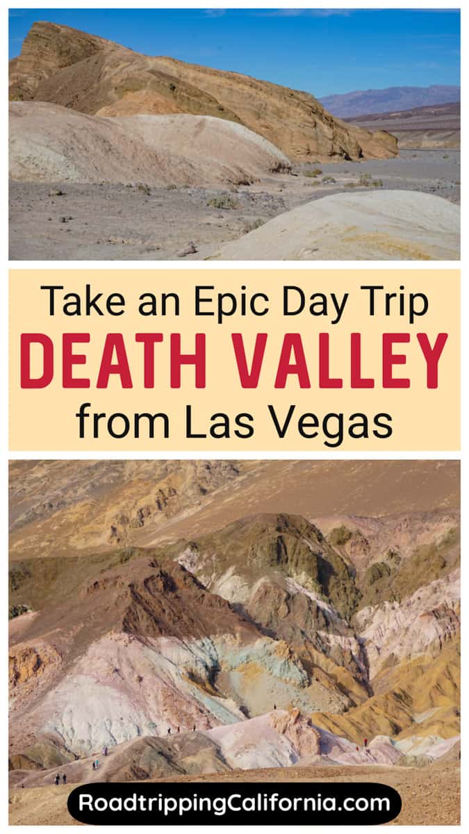
Death Valley National Park is the closest national park to Las Vegas, and a Vegas to Death Valley day trip is one of the most popular adventures for outdoor enthusiasts visiting Sin City.
It’s one of the easiest national parks to visit from Vegas.
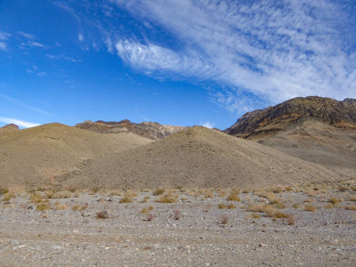
With its otherworldly landscapes, many natural wonders, and very cool scenic overlooks, Death Valley National Park is a must-visit, especially if you plan to visit Vegas in the cooler months of the year.
Some links on this page may be affiliate links. If you click an affiliate link and make a purchase, we may receive a small commission, at no extra cost to you. For more details, refer to our disclosure.
Death Valley features many diverse landscapes, from the sand dunes you’d expect to unexpectedly colorful rock faces, dramatic eroded canyons and badlands, and even mountain ranges, their peaks capped with snow in the colder months.
So if you love the outdoors, you’ll definitely want to add a day trip from Las Vegas to Death Valley to your itinerary for the city.
We’ve visited more than once for the day from Vegas, although we’ve done longer visits to Death Valley as well.
IN THIS ARTICLE…
Vegas to Death Valley Day Trip
Getting to Death Valley National Park from Vegas
What to Do in Death Valley on a Day Trip from Vegas
Map of One Day Death Valley Itinerary Route
Tips for Visiting Death Valley on a Day Trip from Las Vegas
With More Time in Death Valley
Death Valley National Park Day Trip from Vegas
Death Valley National Park is huge: at almost 3.4 million acres, it’s the largest national park in the contiguous United States.
But fortunately for time-strapped visitors, many of its major sights are located not far apart from one another, making it possible to see and do a lot in one busy day.
And better still, most of the best sights in Death Valley National Park are nestled together in the southeast part of the park, the area closest to Vegas!
The park is also known for being the hottest, driest, and lowest national park. Planning is key to an enjoyable visit to Death Valley.
On a day trip from Vegas, you can take in the highlights of Death Valley National Park, from the badlands of Zabriskie Point and the vast white salt flats of Badwater Basin to the golden sands of Mesquite Flat Sand Dunes and the panoramas from Dante’s View.
Sound exciting?
In this article, we’ll tell you how to get to Death Valley National Park from Vegas, what to do during your one day in Death Valley, and things to know before you go: be sure to read our helpful tips to get the most out of your visit.
Getting to Death Valley National Park from Vegas
Death Valley National Park is located in the northern Mojave Desert and straddles the states of California and Nevada.
If you are flying in, Las Vegas is a very convenient base for launching a visit to Death Valley: it’s the nearest international airport and closest big city.
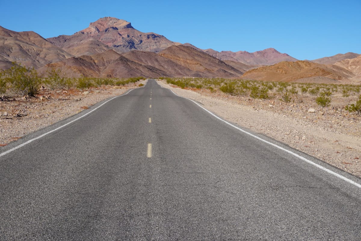
Drive
Renting a car in Vegas and driving yourself is the most flexible transport option for your Vegas to Death Valley road trip.
There is more than one route for getting to Death Valley National Park from Las Vegas.
Via Pahrump to Death Valley Junction: This is the shortest route to get into the park, at 111 miles. In normal traffic, it should take about 2 hours of drive time.
It’s also a scenic route: we stopped at a couple of places to snap photos.
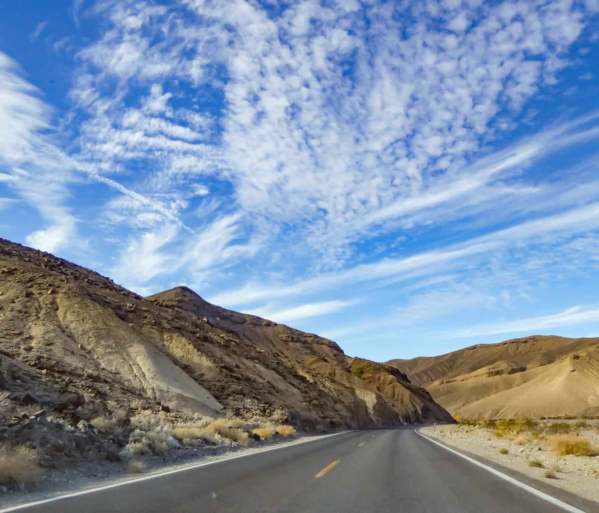
This is the route you should take if you want to be at Dante’s View for sunrise photography.
And if you do choose this route, take the short unpaved Twenty Mule Canyon detour en route from Dante’s View to Zabriskie Point: it’s a beautiful, albeit bumpy drive.
At the end of your sightseeing stint in the park, you can either retrace the route to return to Vegas, or loop to the ghost town of Rhyolite and Beatty before heading back to Las Vegas via Interstate 95 South.
See map for this route as a loop.
Via Amargosa: If you prefer to drive the Interstate, you can head north on I-95 from Vegas to Amargosa, where you can take NV-373 S to Death Valley Junction.
While this route is a little longer, at 129 miles, it may take a few minutes less of driving time.
See map for this route as a loop.
Via Beatty: If you choose this route, you’ll take Interstate 95 North past Amargosa to Beatty, where you will take NV-374 S into Death Valley National Park.
You can stop to tour Rhyolite before heading to Stovepipe Wells Junction, which is the northern end of the drive we suggest within the park.
This route is the longest, clocking in at 160 miles up to Stovepipe Wells, and a drive time of about 2 hours and 35 minutes.
This is the route you should choose if you want to visit Mesquite Flat Sand Dunes early in the day. You’ll land up at Zabriskie Point or Dante’s View around sunset, from where you can continue on to Death Valley Junction and Amargosa (or Pahrump) on your way back to Vegas.
See map for this loop route.
Looking to rent a car for your Vegas to Death Valley National Park trip? Discover Cars offers you the ability to compare availability and prices across many major car-hire companies, both brand and budget. Pick the car that best meets your needs!
Book your car with Discover Cars now!
Take a Guided Tour
Prefer to visit Death Valley National Park from Vegas on a guided tour? If you’d rather not drive, there are several tours that cover the major sights in the park.
This highly-rated small group day tour of Death Valley from Vegas includes hotel pick-up and drop-off if you are based in downtown Vegas.
You’ll travel to the park by air-conditioned coach or minibus. The tour takes from 11 to 12 hours. Entrance fees, lunch, and bottled water are included.
On this tour, you’ll stop at Rhyolite before heading into the park to take in major sights like Mesquite Flat Sand Dunes, Badwater Basin, Zabriskie Point, and Dante’s View.
This well-reviewed full-day tour of Death Valley from Vegas includes hotel pick-up and drop-off in downtown Vegas, lunch, snacks, bottled water, and entrance to the park.
You’ll visit on board a luxury SUV or mini coach and stop at Rhyolite before touring the best sights in the national park, including Artist’s Palette and Zabriskie Point.
This highly-rated small-group tour has you staying back in the park after sunset, to watch the millions of stars in the dark skies at night!
The tour price includes park admission and bottled water, but not lunch. Hotel pick-up and drop-off are included if you are based in downtown Las Vegas.
The 11-hour tour includes most of the major must-see spots in Death Valley National Park.
Book this full-day sunset and stars guided tour of Death Valley from Vegas now!
One Day Death Valley Itinerary for Your Day Trip from Vegas
To describe the itinerary, we’ve chosen the route that starts in the ghost town of Rhyolite, just outside the park, from where you move on to the Mesquite Flat Sand Dunes, near Stovepipe Wells.
If you choose to enter via either route that starts at Death Valley Junction, you’ll do this itinerary exactly in reverse.
We’ve marked some stops and hikes optional. If you visit in spring or late fall, when you have more hours of daylight, you may be able to fit some of the optional spots into your day.
Good to know: This itinerary would also work perfectly if you are planning one day in Death Valley National Park as part of an LA to Vegas road trip. Enter from the west, and pick up the itinerary at Mesquite Flat Sand Dunes, omitting Rhyolite!
Stop 1: Rhyolite Ghost Town
One of the many boom-and-bust towns that you can find in places around California, Rhyolite came into being when gold was discovered in the area in 1904.
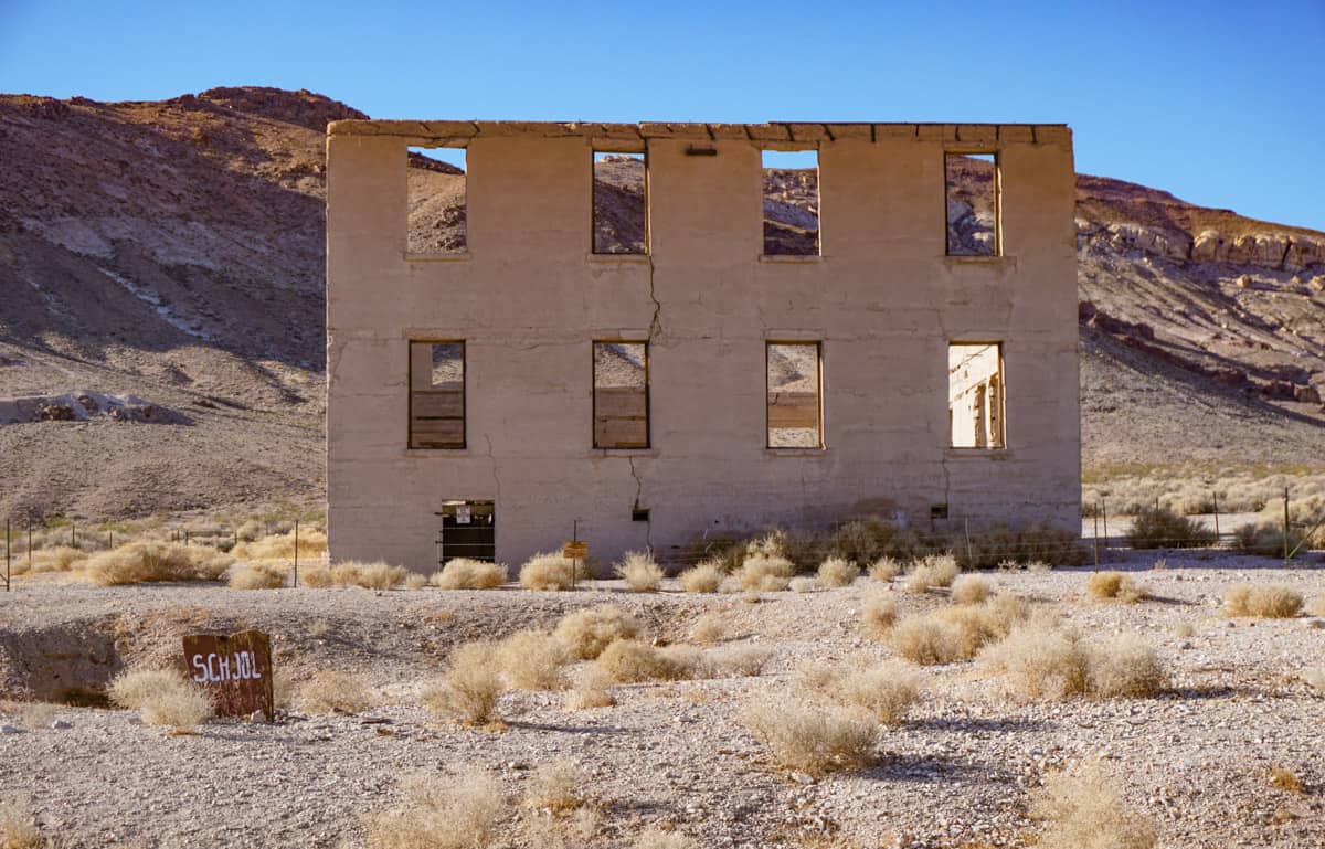
In typical boom fashion, lots of buildings came up in a short time, including hotels, stores, a school, machine shops and foundries, and a hospital.
The town boasted a stock exchange and a Board of Trade, and, of course, a red light district.
Unfortunately, the financial crisis of 1907 started the town’s downward slide, with production slowing and mines closing. Many residents fled.
In 1916, the lights were turned off, and Rhyolite officially became a ghost town.
A few years, later, however, Rhyolite began to be used as a filming location, and in 1926, the striking Tom Kelly house, built out of thousands of bottles, was restored. It’s a must-see when you visit Rhyolite.
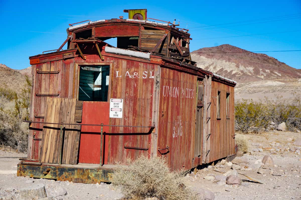
You can wander the small site and snap photos of the building remnants. The train depot and train car are popular photo subjects.
Also, do not miss The Last Supper sculpture by Belgian artist Albert Szukalski. Created in 1984, it’s unique!
The sculpture garden, called the Goldwell Open Air Museum, is located at the south entrance to the town, and here you can see many installations other than The Last Supper.

Rhyolite is open between the hours of sunrise and sunset and is free to tour.
Stop 2: Mesquite Flat Sand Dunes
After you leave Rhyolite, enter the park and drive along CA-190 W to the Mesquite Flat Sand Dunes at Stovepipe Wells.
Early in the date (or late) is a wonderful time to visit the sand dunes: the contrasting areas of light and shadow stand out in photos you take at these times.
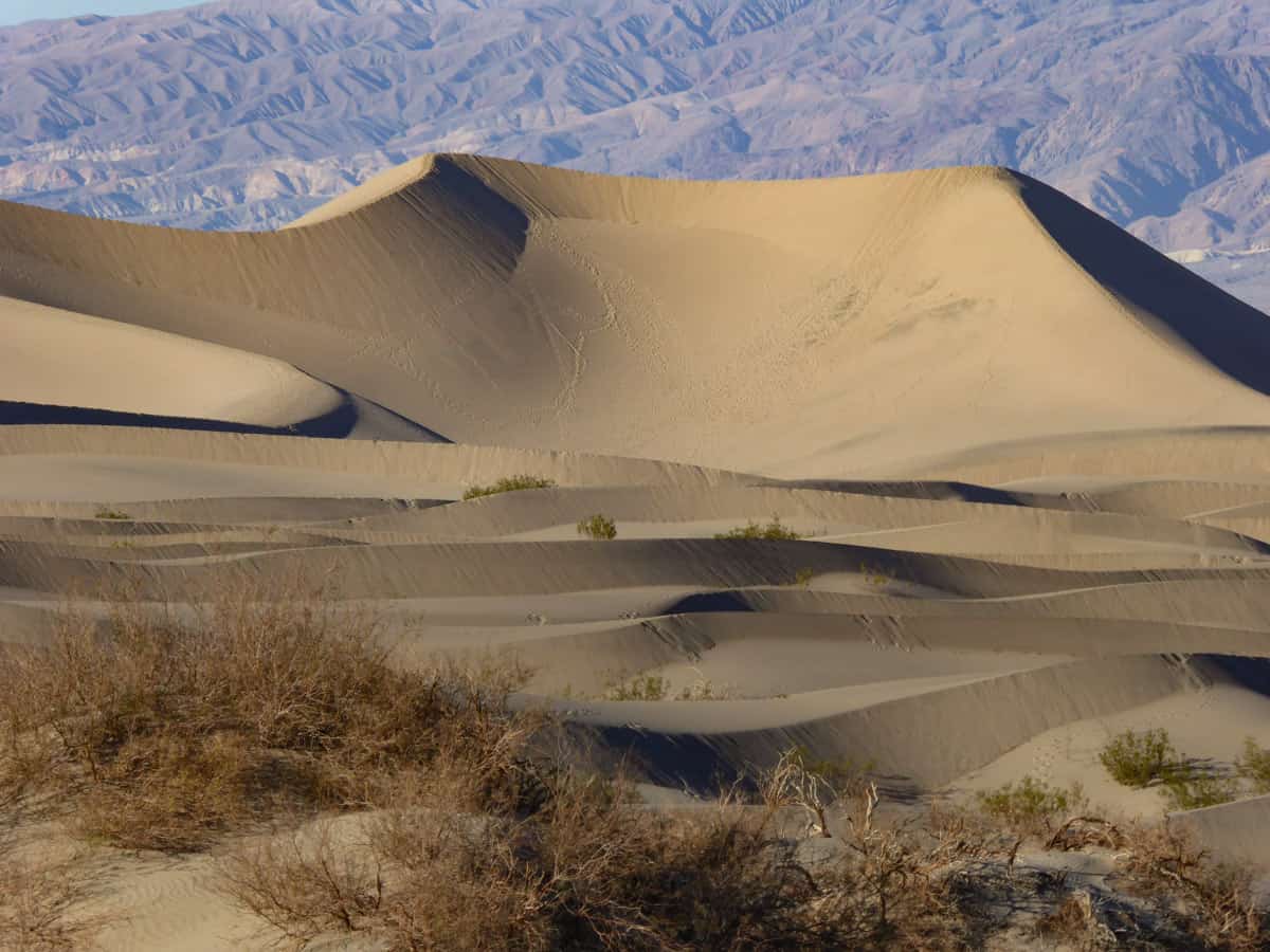
There are several dune fields in Death Valley, but Mesquite Flat Sand Dunes are easy to access and perfect for a day trip to the park.
You can park off the road and enjoy viewing them right from the side of the road, or you can park in the lot and walk out onto the sand for a bit.
You can walk out as far as you like, but manage your time: walking in the loose sand isn’t easy and you have many other stops in the park!
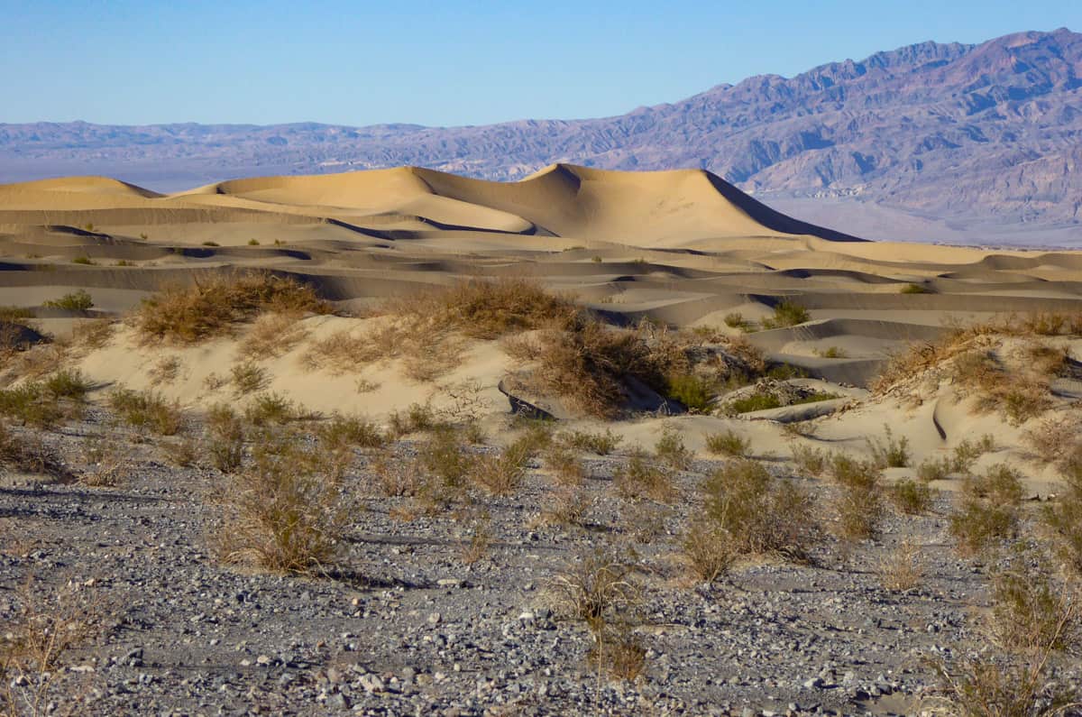
If it was windy the night before and previous footsteps were erased, you may even be able to get a photo with just your single set footsteps in the sand!
You may see some of the mesquite trees that give these dunes their name: this is one of the few places in Death Valley where you see vegetation. In the spring, the small trees put out yellow flowers.
Stop 3: Harmony Borax Works (Optional)
History buffs and photo enthusiasts will want to make a brief stop at Harmony Borax Works, located near the Furnace Creek Visitor Center.
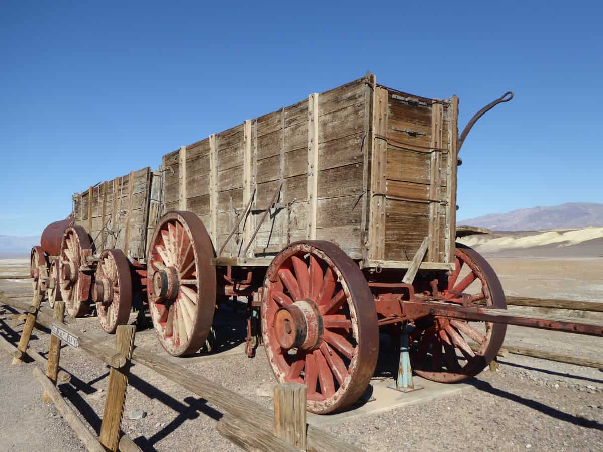
These borax works were instrumental in the development of Death Valley, even though production here was discontinued in just five years, when the owner suffered a financial collapse.
The site includes a double wagon that you can view up close, and the remnants of the production facility. From the site, you also get good views across the valley.
Stop 4: Furnace Creek Visitor Center
Stop at the Furnace Creek Visitor Center, to view the exhibits and watch the park film: it’s 20 minutes long.
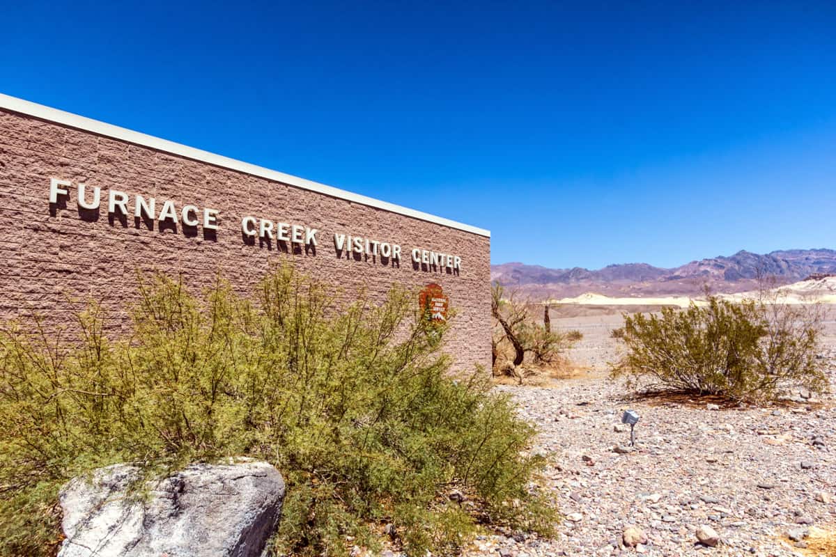
Pay the park entrance fee here in person, or pick up a National Parks Pass. You can also buy snacks and bottled water here, and use the restroom.
The coolest thing to do at the Furnace Creek Visitor Center is to pose for a photo by the thermometer and lovely mosaic just outside the entrance. Especially if you visit in the summer, when high temperatures over 120 degrees Fahrenheit are common!
Stop 5: Devils Golf Course (Optional)
Once you leave the visitor center, you’ll move off CA-190, the main road that runs through the park, onto Badwater Basin Road.
A little ways along Badwater Basin Road, you will come upon the Devils Golf Course.
It’s a vast area of crystallized salt and dirt sharpened by wind and rain into jagged spires and mounds: hence the name.
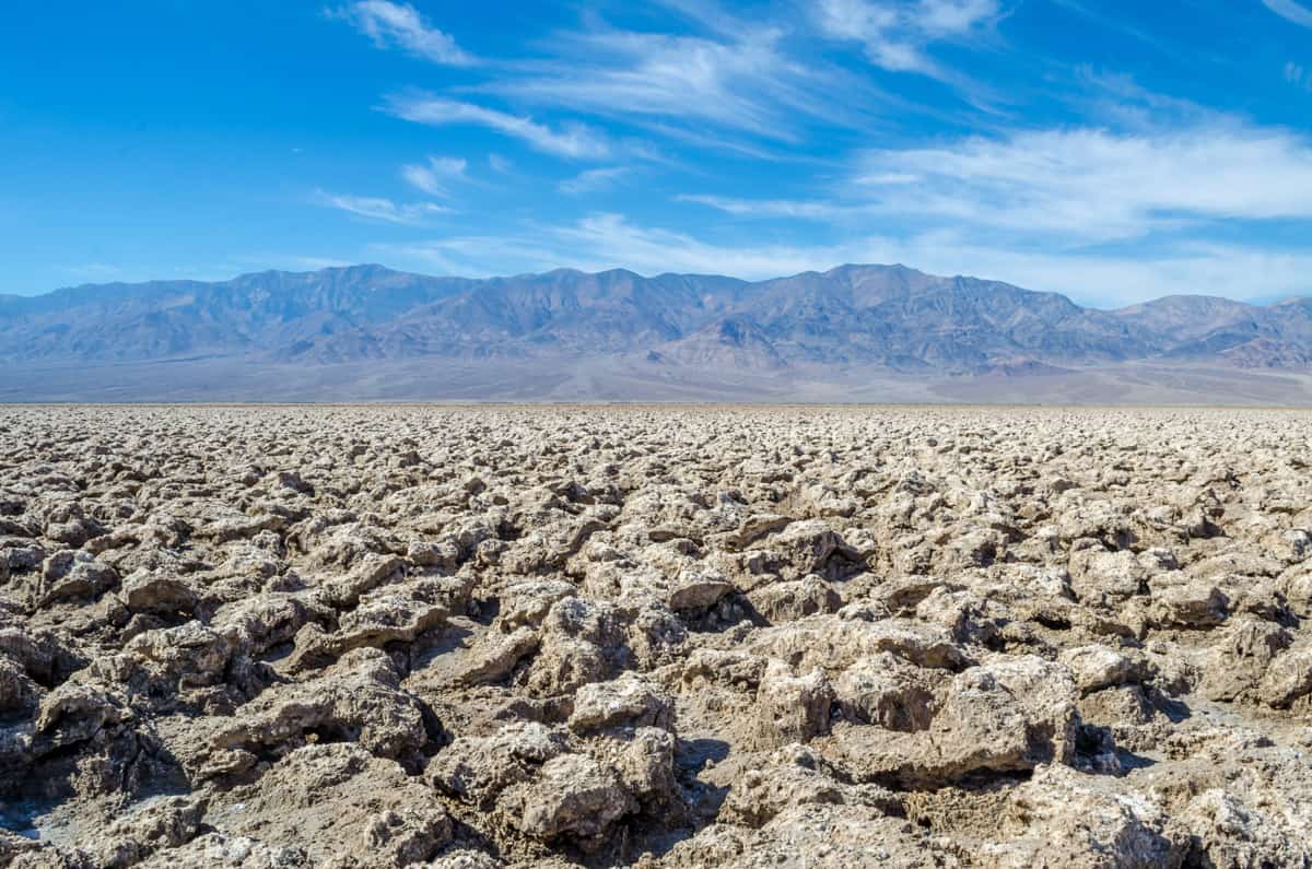
There’s a short and somewhat bumpy ride along an unpaved road to a parking lot if you want to view the spires up close. If you bend down and listen closely, you may hear little pinging sounds as the salt crystals expand and contract.
Be very careful if you choose to step out onto the jagged salt crystals: they are very sharp and may cause injury.
We mentioned it here because it’s right on the way to the salt flat, but frankly, Devils Golf Course was a little underwhelming for us, and on a day trip, you may want to skip it in favor of more time at one of the other stops.
Stop 6: Badwater Basin Salt Flat
One of the jaw-dropping sights at Death Valley National Park, the vast expanse of salt flats at Badwater Basin will take your breath away.
The salt flats of Badwater Basin cover about 200 square miles and contain the lowest point in North America. And, in a study of contrasts, from here you can also see Telescope Peak, over 11,000 feet above sea level!
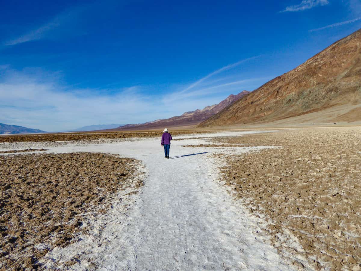
You can take in the size and majesty of the salt flats right from the parking lot, but if you visit in the cooler months, it’s definitely worthwhile stretching your legs by walking out into the enormous expanse of white.
Further away from the parking lot, if conditions are right, you can see the gorgeous polygon shapes formed by the salt. They make for cool photos, especially if you are lucky and visit just after a storm has rolled through.
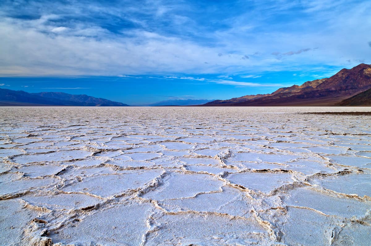
You may see a little pool of water by the boardwalk viewing area, where you can get reflection photos on still days.
Before or after your walk, you can pose for a photo by the sign that says “282 feet below sea level.” Also look for the “sea level” sign on the rock face of the Black Mountains on the east.
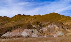
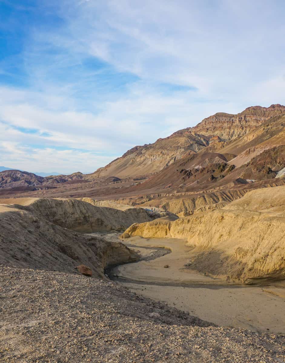
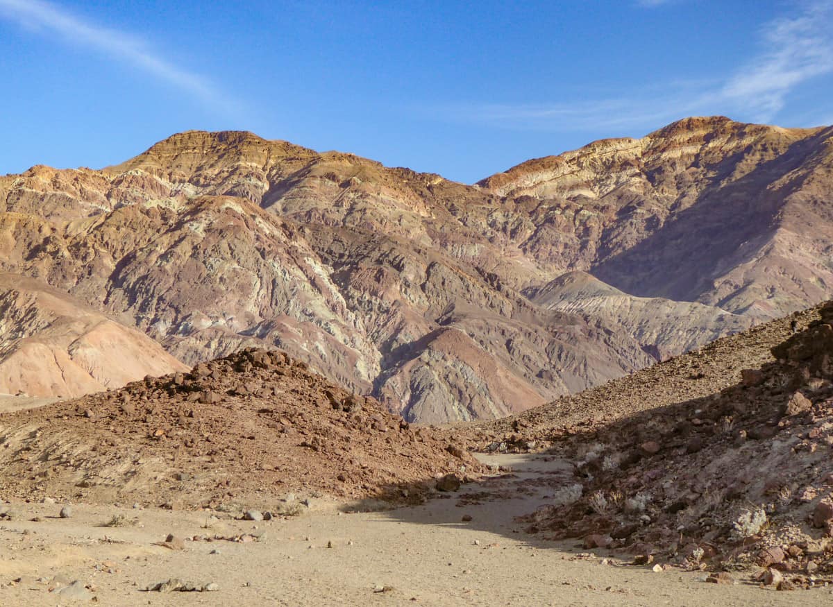
Stop 7: Artist’s Drive and Artist’s Palette
On your way back to CA-190, take Artist’s Drive, a one-way loop detour off Badwater Basin Road that is home to the colorful Artist’s Palette.
The multi-hued colors on the hills at Artist’s Palette in Death Valley are the result of volcanic deposits. You’ll see a range of colors, from rust and orange to lavender, blue, green, and yellow.
Park at the official parking lot (it’s signed), and walk down into the washes to see the colors up close.
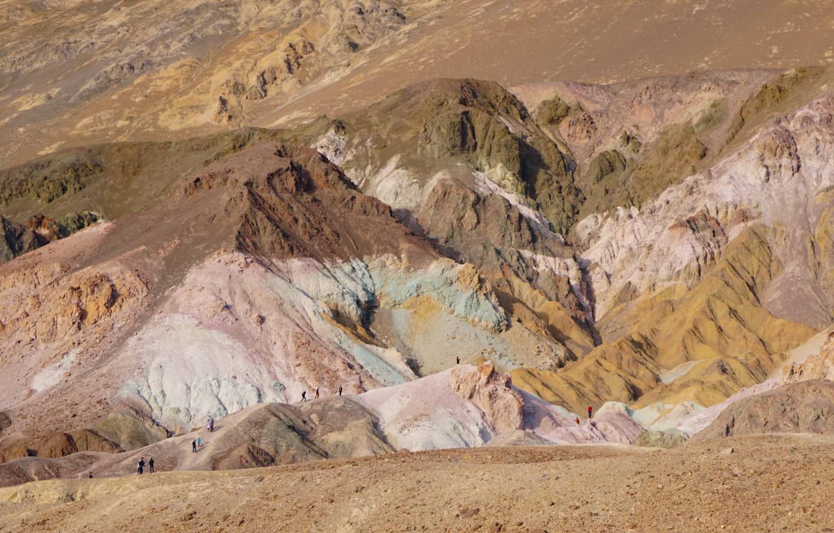
While the viewpoint is without a doubt the highlight of the drive, Artist’s Drive is scenic throughout, providing views of the valley on one side, and views of gorgeous rock faces on the other.
A few minutes before you arrive at the parking lot, you’ll likely see folks parked by the side of the road as they explore a ravine with a great view of the Artist’s Palette.
It’s worthwhile stopping here: not only do you get a fine view of the Artist’s Palette, the ravine itself, and the other rock formations here, are striking.
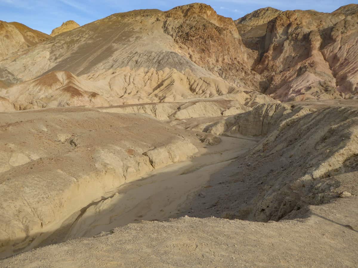
Artist’s Drive is fully paved and is 9 miles long.
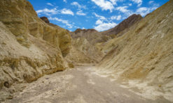
Stop 8: Golden Canyon (Hike, Optional)
If you have the time for just one hike on your very full Death Valley day trip itinerary, make it the Golden Canyon. You can walk into the canyon up to the base of the Red Cathedral and back out for the short, but very scenic, version.
Look for the trailhead off Badwater Road, a couple miles south of the junction with CA-190. There is a decent-sized parking lot.
From the parking lot, you’ll walk into the canyon, with its tall golden walls. The subtle colors and textures in the rocks are spectacular.
The route is gradually uphill, and there is some rock scrambling at the very end to get up into the Red Cathedral. The views from the top of the path at the end are worth the scramble, if you are able to do it.
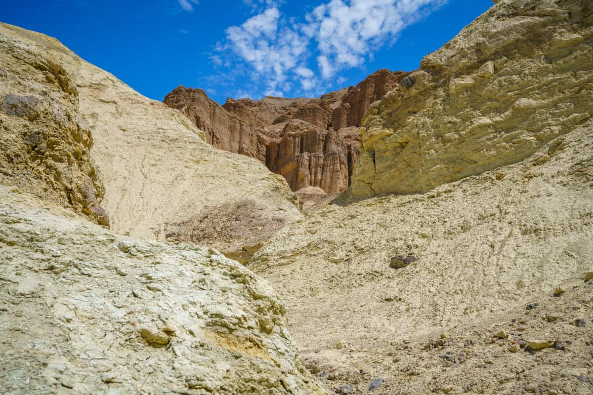
But even if you do not do the scramble at the end, the hike is still very worthwhile, and you can even explore one or two of the little side canyons along the trail.
The out-and-back trail is just under 3 miles.
Good to know: We do not recommend (and the park does not recommend) hiking at lower elevations in Death Valley during the warmer months of the year, or any time it’s above 80 degrees.
If you plan to do this hike in late spring or early fall, you will want to leave very early from Vegas, and enter the park at Death Valley Junction so you can do this hike while it’s still relatively early in the day.
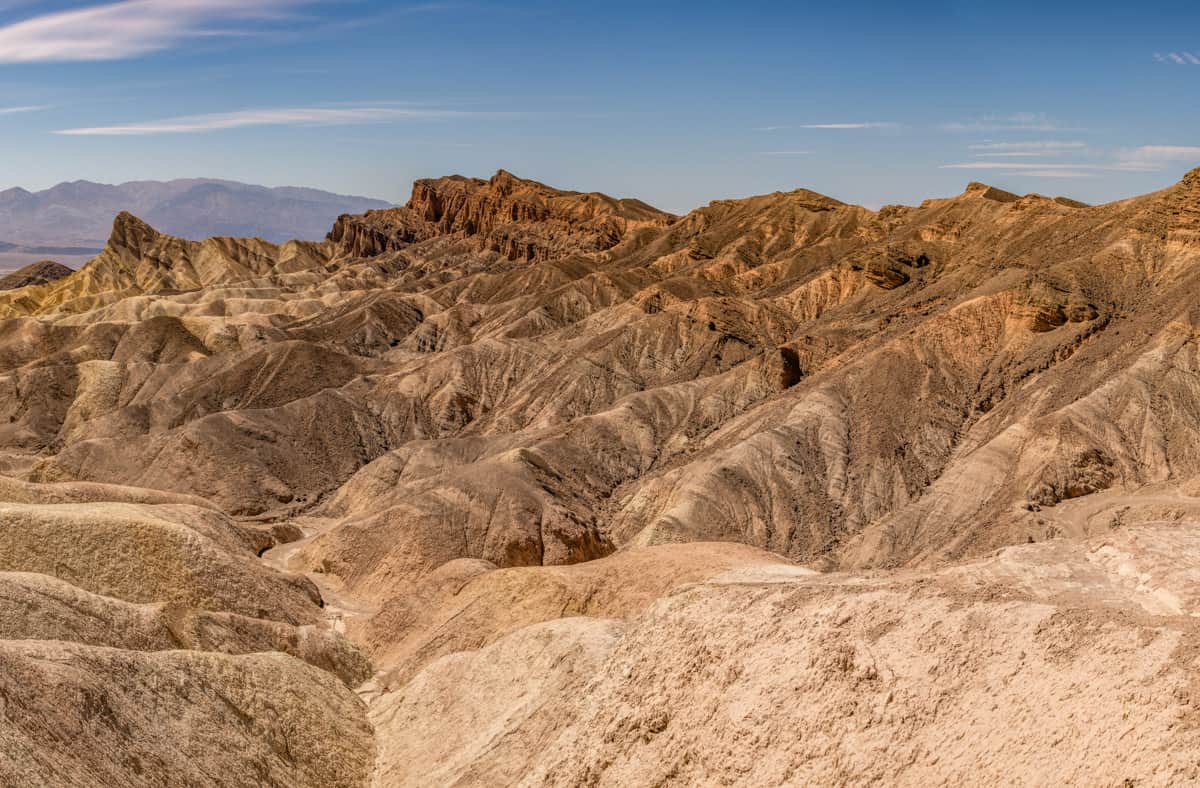
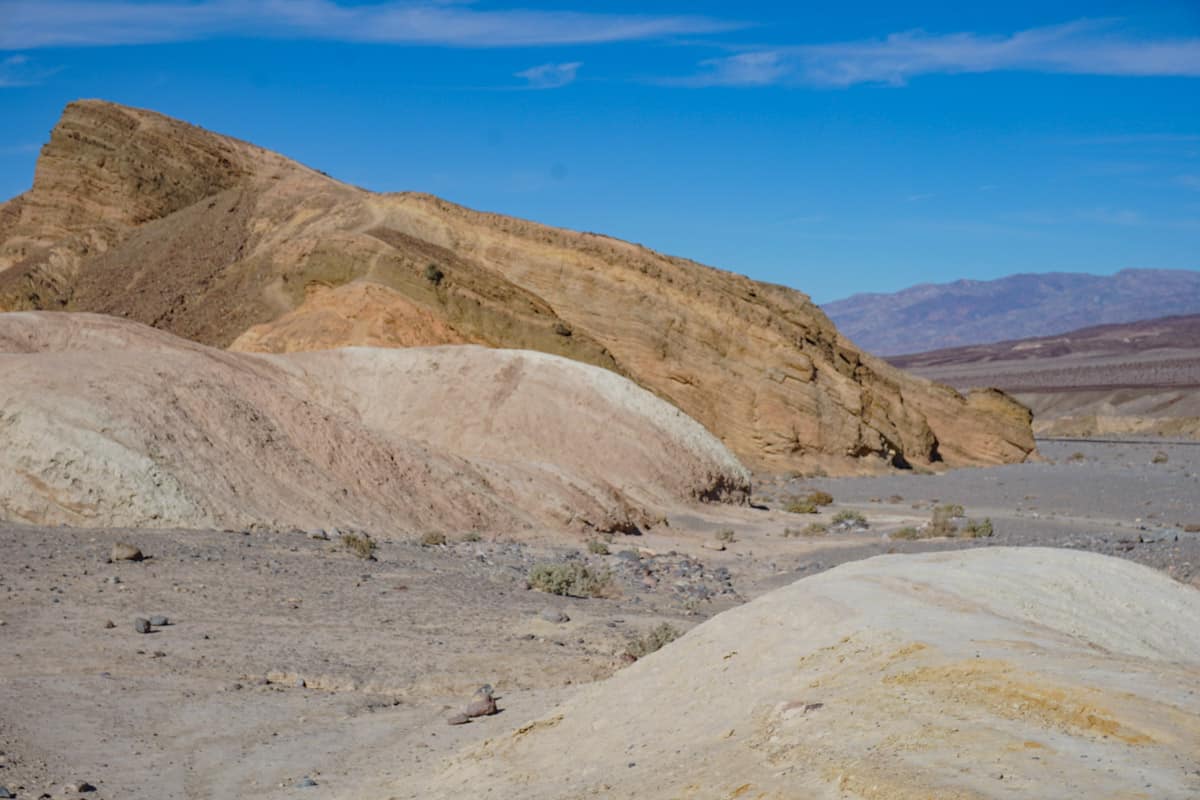
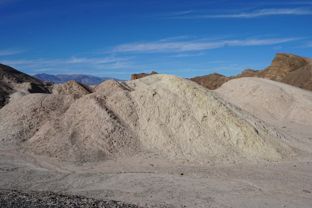
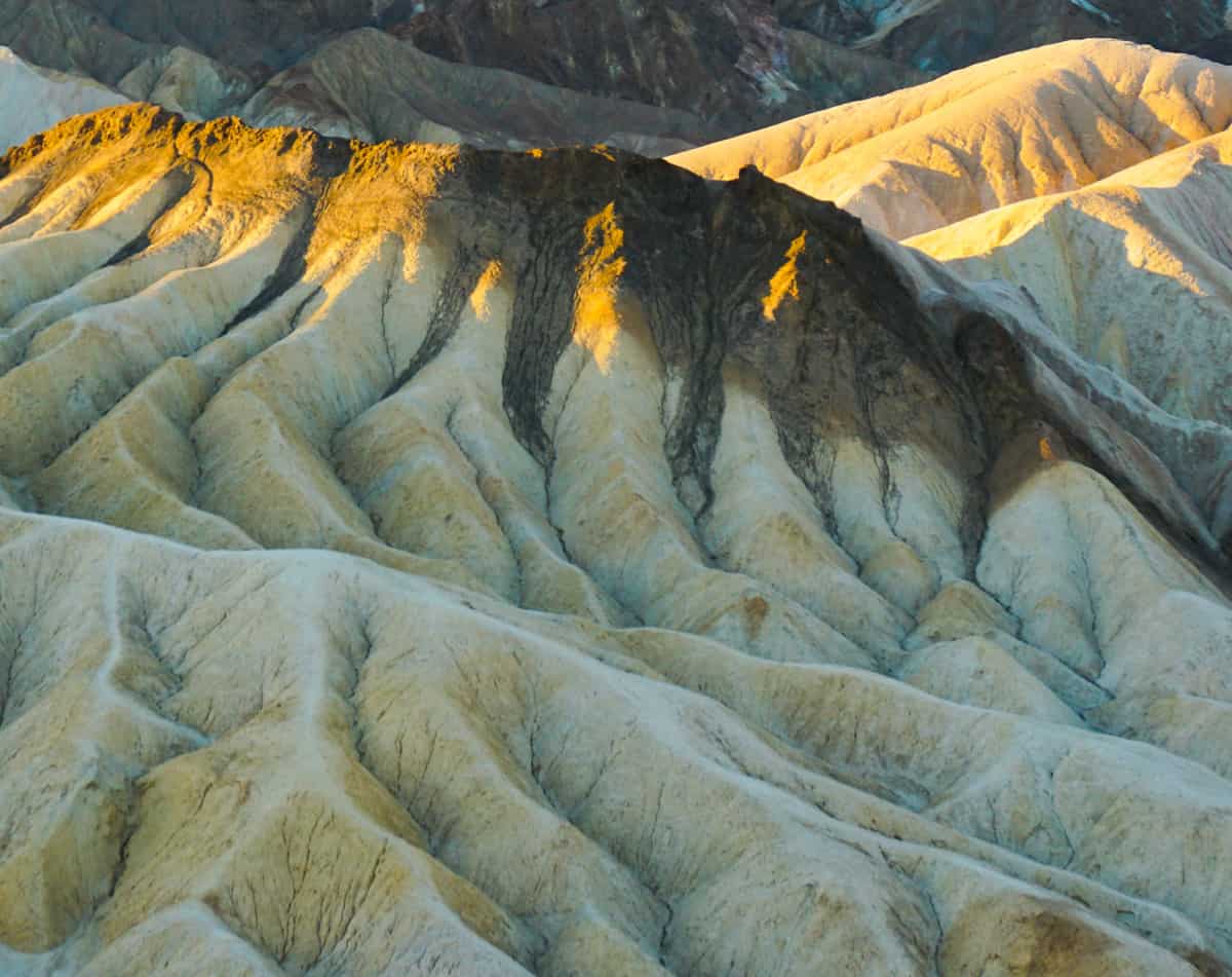
Stop 9: Zabriskie Point
Undoubtedly one of the top spots in Death Valley National Park, Zabriskie Point offers breathtaking views of the badlands of the valley.
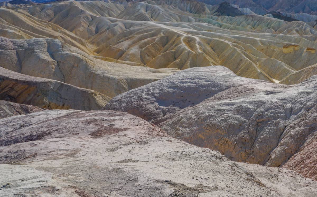
Serious photographers swarm the viewing area at sunrise and sunset, when a colorful sky can add serious drama to an already dramatic scene. But the views are gorgeous no matter when you visit.
The eroded ridges of yellow and brown you see here have been shaped by water. And in the background are the Panamint Mountains, sometimes with their tops covered in snow.
A couple of rock formations you’ll want to note are Manly Beacon and Red Cathedral.
Manly Beacon juts out prominently above the ridges, and is named for one of the forty-niners that visited here. Red Cathedral is red, just like its name, and towers up from the ridges.
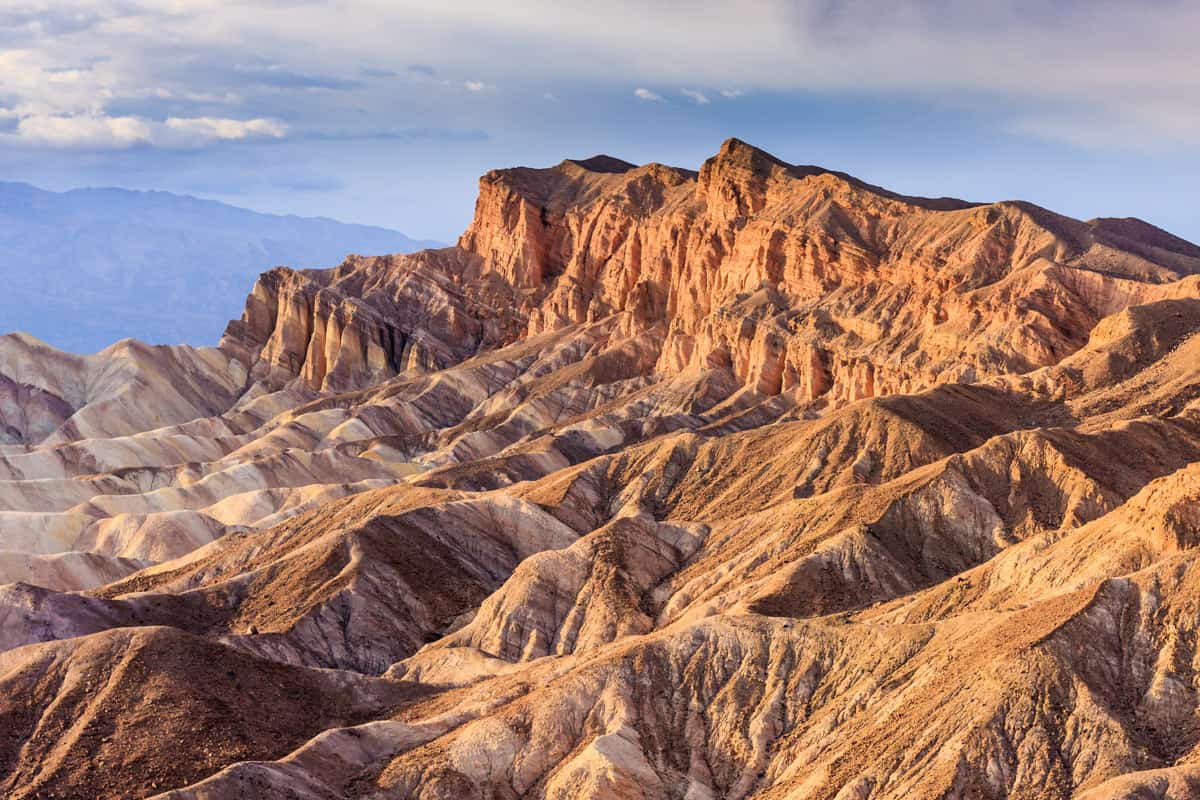
Also look for the Elephant’s Feet, ridges that are topped with a bit of dark brown or black and look exactly like giant feet.
The walk from the parking lot to the viewing area is short and paved, but fairly steep. Be sure to walk around and take in the views from different parts of the viewing area.
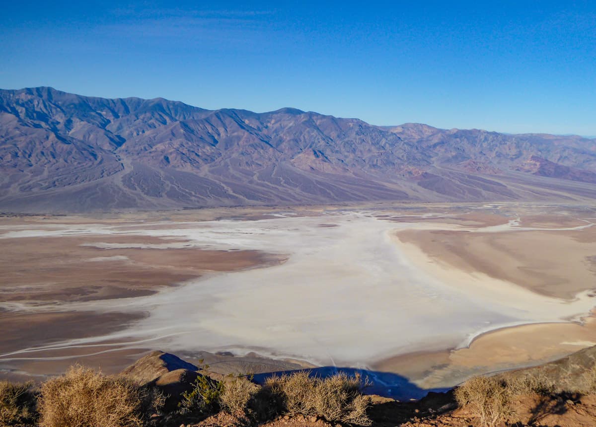
Stop 10: Dante’s View
The highest point in Death Valley National Park that you can reach in a vehicle, Dante’s View offers expansive panoramas and is an excellent sunrise or sunset photo spot.
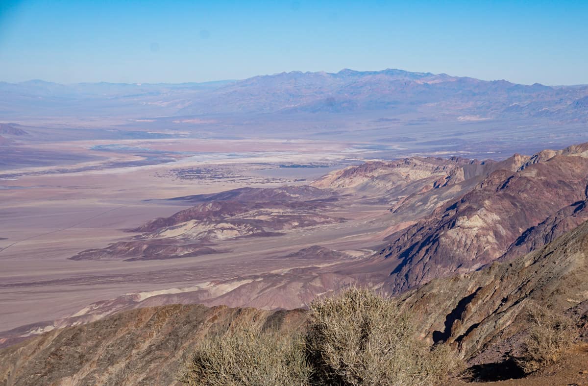
If you are a Star Wars fan, Dante’e View featured as the view of Mos Eisley in Star Wars Episode IV: A New Hope.
From the viewing area, you can look down into the vast white salt flats of Badwater Basin, and the Panamint Mountains behind them.
There is a ridge at the top that you can walk, for more views. Although the trail extends for several miles, you can walk out a little bit as time allows and then return to the main viewing area.
If you are comfortable driving down the winding road after dark, Dante’s View is also a splendid place for a spot of stargazing. On a cloudless, moonless night, you will see tons of stars, and maybe the Milky Way.
The drive to Dante’s View from CA-190, the main road, is about 13 miles one way. The drive gets windy as you climb to the top, with multiple switchbacks.
Vegas to Death Valley Day Trip Itinerary Map + Route
Here’s a map of your one day Death Valley itinerary route within the park:
Tips for Your Las Vegas to Death Valley Day Trip
Start early and be prepared for a long driving day
Even though the sites in the park we’ve described in our itinerary are clustered somewhat close together, you are still looking at about 400 miles of driving, give or take a few based on the specific route you choose.
We suggest starting as early as you can from Vegas, especially in the preferred late fall to early spring visiting season, when daylight hours are at their shortest.
Arriving at sunrise at your first sightseeing stop is ideal.
If you visit during warmer months with longer daylight hours, starting early will allow you to enjoy at least some sights in the park before it gets oppressively hot.
Pack a cooler with lunch, snacks, and water
On a day trip from Vegas to Death Valley National Park, it’s unlikely you’ll have the time to have lunch in a restaurant, unless you visit in the summer, when it’s a good idea to take an indoor break at the hottest part of the day.
Pack a cooler with sandwiches or other items that are easy to eat in your car at lunch. Bring lots of snacks that you can eat through the day.
And make sure you pack plenty of drinking water. Even if you’re in the car most of the day, you will still want to stay hydrated.
If you do decide to break up your day with a sit-down lunch, the Ranch at Death Valley at Furnace Creek has onsite eateries open for lunch.
Fill up the tank before you enter the park
There are gas stations at Stovepipe Wells and Furnace Creek inside Death Valley National Park, but gas prices tend to be much higher than outside the park.
Plus, you don’t want to cut it close, because you won’t have cell service in the park to seek help if you run out of gas.
Fill up at a gas station in a town near the park entrance you plan to use: Pahrump, or Beatty.
Rent a regular car
If you are wondering what kind of vehicle to rent for your Las Vegas to Death Valley day trip, a regular passenger sedan will work fine if you follow the itinerary we’ve outlined.
Most of the roads along the route we’ve described are paved, and the couple of unpaved stretches (the road to the Devils Golf Course parking lot, or the Twenty Mule Team Canyon) are generally considered passable for passenger sedans.
Just drive slow on the dirt roads!
If visiting the Racetrack Playa at Death Valley National Park is on your bucket list, it requires careful planning, whether you’re going to visit on a day trip or otherwise.
Even with a high-clearance 4X4, tyre blowouts or other issues with your vehicle may very well occur, and getting help is both difficult and expensive. We recommend leaving it off your day trip itinerary.
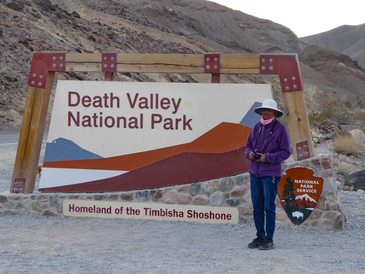
Pose for a photo at the entrance sign
No matter which entrance you use to enter Death Valley National Park, keep your eyes open for the colorful entrance sign.
The signs are colorful and make for great photo spots!
Don’t count on cell reception in the park
Download (and print) any maps or brochures you may need, because cell reception is very poor to non-existent in Death Valley National Park.
Most of the sights we’ve described in our itinerary are well signposted.
Pay the park entrance fee
At the time of writing, the entrance fee for Death Valley National Park is $30.00 per automobile and $25.00 per motorcycle, valid for 7 days.
There are unmanned kiosks at the various park entrances where you can pay the entrance fee with a credit card. Display the receipt on your dashboard.
You can also pay online at recreation.gov in advance: print a hard copy of the entrance pass to display on your dashboard.
If you have an America the Beautiful National Parks Pass, remember to bring it to Vegas and display it in your vehicle when you are in the park.
If you do not have a National Parks Pass, buy one online at REI. If you plan to visit 2 or 3 parks during the year, the pass may save you money. It’s valid for 12 months from purchase, at over 2,000 federally-managed recreation sites all over the USA.
With more time in Death Valley National Park…
A day trip to Death Valley National Park from Vegas is better than not visiting the park at all. But it’s even better to overnight in the park so you have at least two days to explore.
On a one day visit you’ll spend a lot of your day in the car, driving from spot to spot. Two or more days allow you to explore at leisure and see more sights in the park, do a few Death Valley hikes, and enjoy stargazing, sunrises, and sunsets at different spots.
We have a detailed article on all the exciting things to do in Death Valley National Park, but some great additions include the Golden Canyon and Gower Gulch loop hike, Ubehebe Crater in the north of the park, and the Mosaic Canyon hike near Stovepipe Wells.
If you plan to overnight in the park, we also have an article on where to stay in Death Valley.
More California Desert Travel Inspiration
Other than the majestic landscapes of Death Valley, you can marvel at the massive boulders and diverse flora in Joshua Tree National Park and Mojave National Preserve on an epic desert road trip. Find out how to plan a California desert road trip!
There are many things to do in Joshua Tree National Park other than admiring the scenery. Try some Joshua Tree hikes, do some rock scrambling, and enjoy stargazing.
Joshua Tree features several easy nature trails perfect for families, like the hike to Barker Dam or the Hidden Valley Trail. You can also opt for a more challenging hike, like the Ryan Mountain Trail to the highest point in the park.
If you plan to overnight in the park, we have a guide on where to stay in Joshua Tree.
Just a little northwest of Death Valley National Park, you’ll find the beautiful Alabama Hills, a part of California’s high desert located off Highway 395, one of California’s most scenic drives.
Did you find this article informative? Pin it for later reference!