Looking for the best Point Lobos hiking trails? If you are planning your first visit to the beautiful California state park, read on to discover the top six Point Lobos hiking trails to put on your itinerary!
Point Lobos State Natural Reserve, located near Carmel-by-the-Sea on the Central California Coast, is gorgeous.
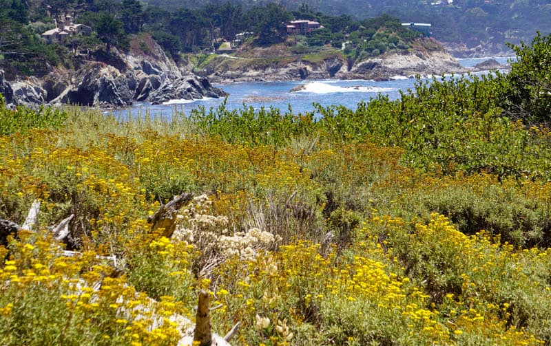
All the hiking trails in the reserve are beautiful, and if you have the luxury of time, you’d want to hike all of them. They are some of the most scenic trails in Big Sur.
But the oceanfront trails are what keep us returning to Point Lobos. We never tire of walking beside the water, enjoying the views, no matter what the weather.
If you are visiting Point Lobos on a day trip from San Francisco or the SF Bay Area, these trails make the perfect activity for the day.
Some links on this page may be affiliate links. If you click an affiliate link and make a purchase, we may receive a small commission, at no extra cost to you. For more details, refer to our disclosure.
We’ve walked the iconic Point Lobos oceanfront trails in the sun, in the fog, and in the mellow light of golden hour, just before sunset.
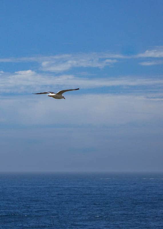
And the views are beautiful every time, with coastal flora and birds and animals to observe.
Best Point Lobos Hiking Trails
Bird Island Trail
South Shore Trail
Sea Lion Point Trail
Cypress Grove Trail
North Shore Trail
Granite Point Trail
Tips for Hiking Point Lobos
Best Point Lobos Hiking Trails
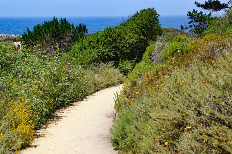
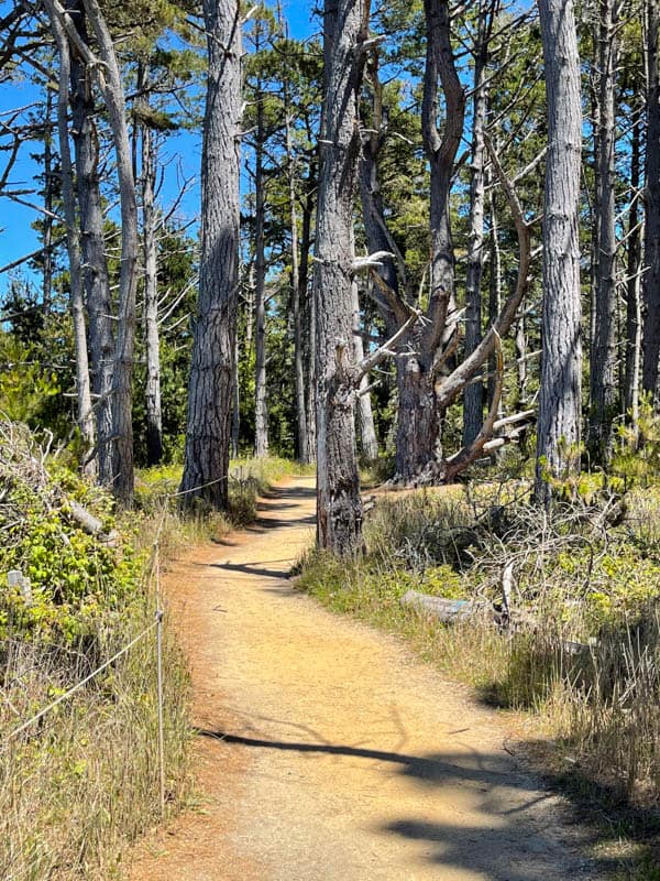
The trails at Point Lobos State Reserve are scenic nature trails rather than actual hikes. They are designed primarily to help you enjoy the magnificent views and to observe the park’s flora and fauna.
Although there are steps in some places, and trails can be uneven in certain parts, most of the trails are suitable for pretty much most visitors to the park. Some trails are partly or fully accessible.
Don’t forget your smartphone or camera, because you will want to take lots and lots of photos! Also read our complete guide to visiting Point Lobos State Natural Reserve, for the best experience at this beautiful state park.
Here are our picks for the best trails at Point Lobos State Park:
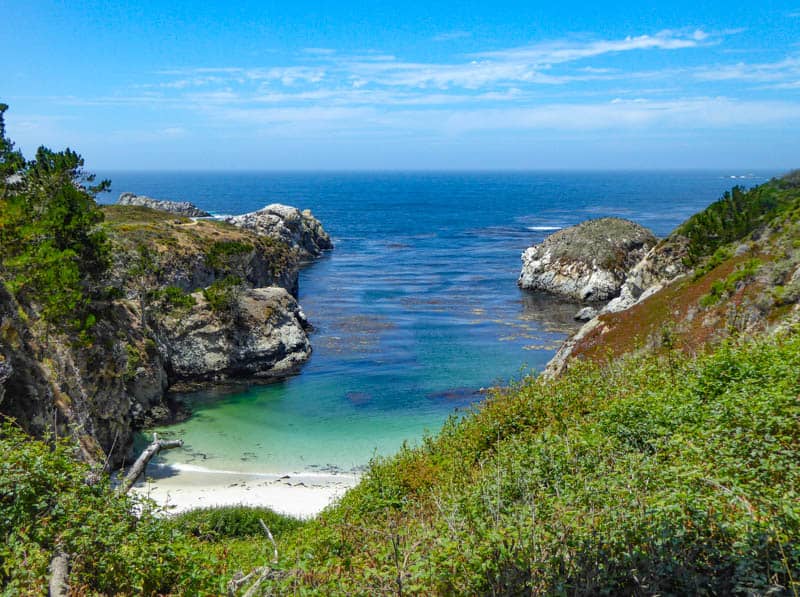
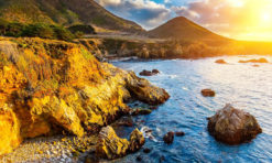
1. Bird Island Trail
In our opinion, Bird Island Trail is the top trail in Point Lobos State Reserve. Short and scenic, this trail takes you past some of the best attractions in the park.
Bird Island Trail Facts
Distance: 0.8 mile round trip loop
Elevation Gain: ~50 feet
Difficulty: Easy, suitable for most skill levels, trail is accessible other than for steps down to beach
Trailhead: Bird Island Trail Parking Lot, Google Maps. From the parking lot area, either take the steps, or the accessible ramp uphill to the start of the trail.
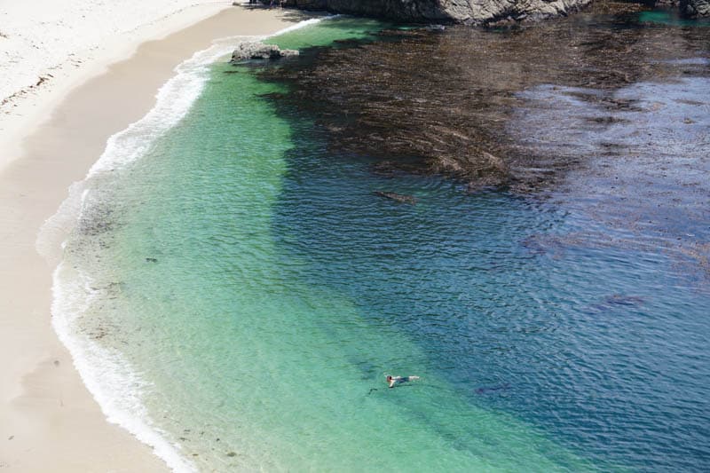
Along this trail, you will see China Cove, with its jade green waters and pristine strip of beach. In the spring, harbor seal moms nurse their newborn pups on this beach.
Further up, the beautiful blue waters at sandy Gibson Beach will lure you down the steps to linger for a bit before you continue on the trail. Be warned that the steps leading down to Gibson Beach are steep and narrow, so be sure to take your time. There are picnic tables and toilets by the beach, so this is a great spot to take a midday break between hikes!
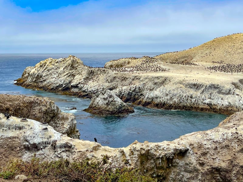
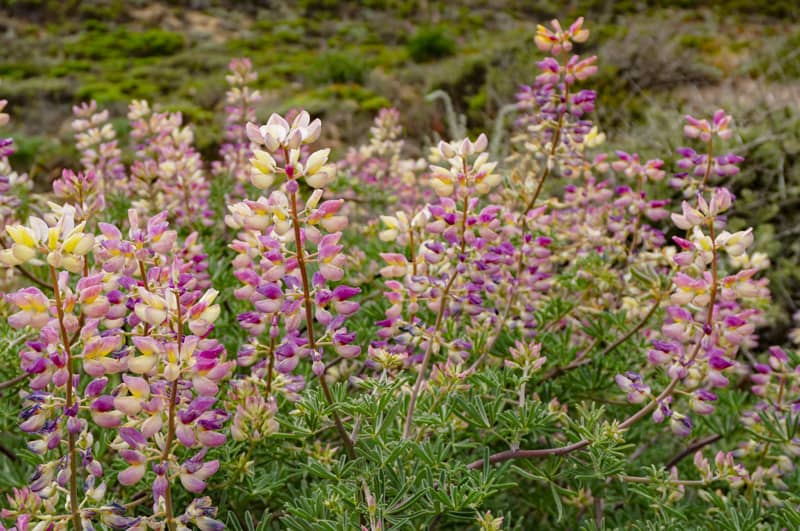
Continue walking to Pelican Point, where a riot of wildflowers well lasts into the summer. Here you will find the Bird Island overlook, one of the best places in Point Lobos to view birds.
Bird Island sits slightly offshore, possibly having broken off from the mainland due to the pounding of the waves against the cliffs.
Hundreds of seabirds are generally visible: Brandt’s cormorants, Western gulls, and an occasional black-crowned night heron.
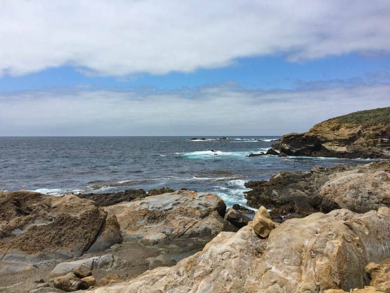
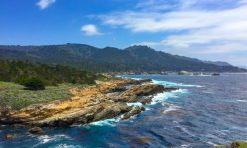
2. South Shore Trail
A very scenic trail that offers spectacular views of the water and the rocky cliffs that make up the shore, South Shore Trail at Point Lobos is a magnet for photographers, painters, and birdwatchers.
South Shore Trail Facts
Distance: 2 miles round trip
Elevation Gain: ~60 feet
Difficulty: Easy, suitable for most skill levels. This trail is not accessible, but it runs parallel to the park road. You can park at different points long the road and cut across to the trail to take in the views. Parts of the trail are rocky and uneven. You can leave the trail at some points to explore the shore.
Trailhead: Google Maps. The south end of the trail is at the Bird Island Trail parking lot, and the north end is accessed by a flight of steps that descend from the Sand Hill Trail.
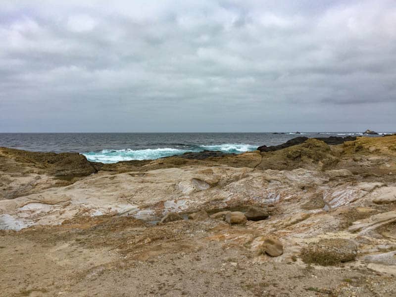
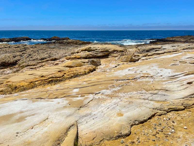
South Shore Trail is known for its expansive ocean vistas. The rocks along this stretch of coast are a gorgeous colorful mix of sandstone, mudstone, and the local conglomerate, and their shapes and patterns are fascinating to observe.
As you walk South Shore trail, look out into the ocean to see if you can spot whales or other sea mammals. If you enjoy birding, bring your binoculars and look for seabirds and shorebirds, and raptors in the skies above.
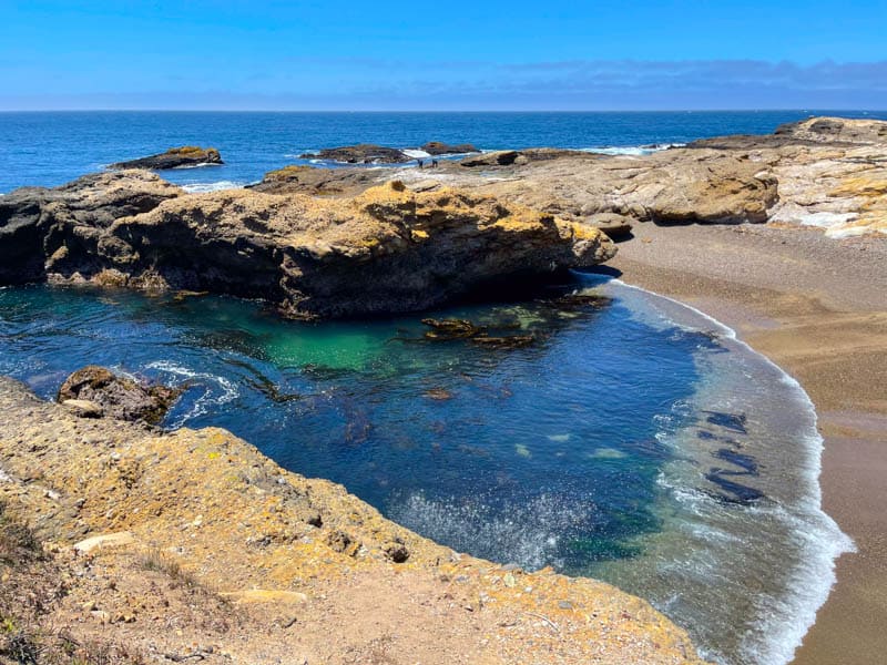
South Shore Trail is home to Weston Beach, the best tidepooling location in the park. Look for sea stars, anemone, crabs, and turban snails. Low tide is a great time to look for sea creatures and algae in the pools.
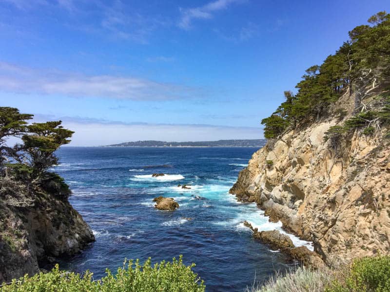
3. Sea Lion Point Trail
Sea Lion Point Trail is a superbly scenic short trail that affords magnificent water views, to Sea Lion Cove on one side and Headland Cove on the other. You will hike it in conjunction with the Sand Hill Trail, a loop that goes around Sand Hill.
Sea Lion Point Trail Facts
Distance: 0.6 mile round trip loop
Elevation Gain: ~20 feet
Difficulty: Easy, suitable for most skill levels, trail is accessible other than for lower viewpoints
Trailhead: Sea Lion Point Trail Parking Lot, Google Maps. From the parking area, take a right at the fork on Sand Hill Trail to the Sea Lion Point Trail loop.
Sea Lion Point Trail is famous not just for the ocean views it offers, but it is also the best trail in the park from which to spot sea lions. If you are in the park around sunset, head to Sea Lion Point for the best views!
Along the way, take note of all the beautiful coastal flora, from aromatic sages to mock heather. You may see land birds in the brush, or perhaps a squirrel or a rabbit.
As you walk to Sea Lion Point, admire beautiful Headland Cove to your right. You may see otters playing in the kelp and harbor seals lazing on the rocks at the shore. You may also see harbor seals at Sea Lion Cove, on the other side of the hill.
Walk down the steps on the right for more viewpoints over Headland Cove and Sea Lion Cove. This is one of the best photo spots in the park, so you’ll want to have your smartphone or camera with you.
You may be able to hear the barking of sea lions, and possibly see them lying on rocks further offshore. Bring your binoculars to see them better. You can also try to spot whales in season.
You can actually go down to the shore via the steep staircase, but we have never ventured down. Be sure to check with a docent if you choose to attempt to go down, because rogue waves are known to wash over the area.
We normally complete the walk around Sand Hill past Sand Hill Cove back to the parking area, but you can also retrace your steps along the part of Sand Hill Trail you walked to get to Sea Lion Point Trail.
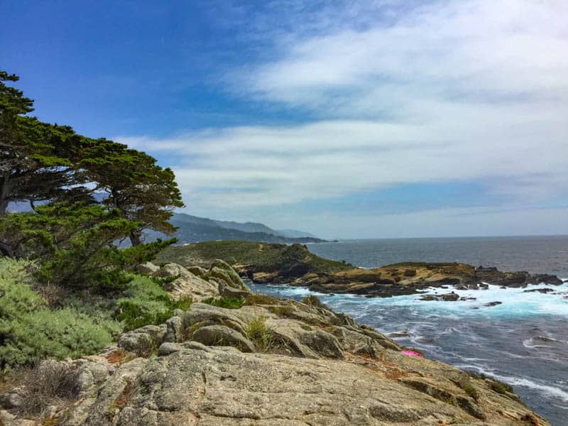
4. Cypress Grove Trail
You will not want to leave Point Lobos State Natural Reserve without walking through the grove of Monterey cypresses along the Cypress Grove Trail, because this is one of only two places on the planet where the native species can still be found (the other being Cypress Point in Pebble Beach).
Cypress Grove Trail Facts
Distance: 0.8 mile round trip loop
Elevation Gain: ~20 feet
Difficulty: Easy, suitable for most skill levels, trail is accessible for a short portion (0.25 mile)
Trailhead: Sea Lion Point Trail Parking Lot, Google Maps.
Walk through a forest of rare Monterey cypress trees on this scenic loop that also offers beautiful views of the Pacific Ocean. The trees reportedly grew over a much larger area in the past, but perished inland on account of climate change. They obviously love the fog on the fringes of the coast here!
Point Lobos State Reserve was established in part to protect what’s left of these ancient trees. This cypress grove is a memorial to Alexander Allan and his wife.
Mr. Allan purchased the land that became the Point Lobos Park when he discovered that it was going to become a subdivision. He wanted to preserve this beautiful part of the coast for future generations.
Along the trail, you’ll see the sculptured forms the trees acquire from battling the winds. Observe the lace lichen that grows on the lower trunks, enjoy wildflowers in the spring and early summer, and look for marine animals out in the water.
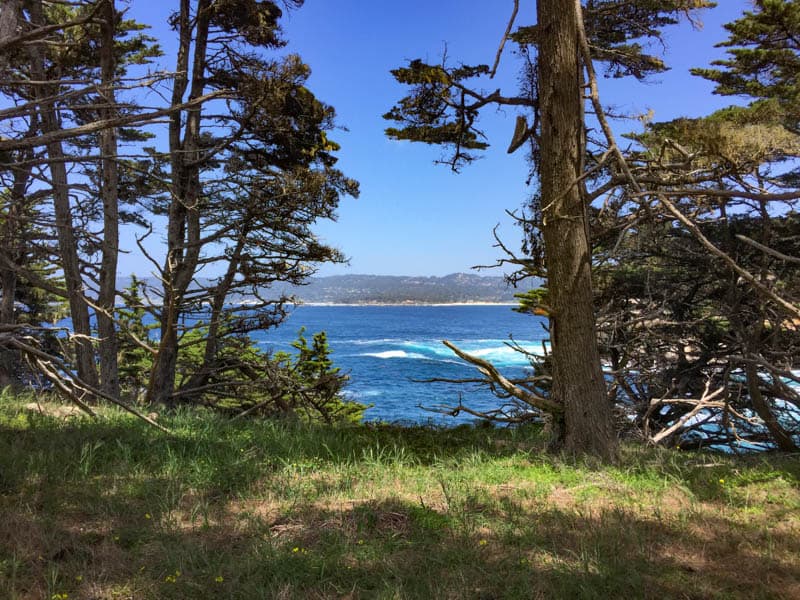
The Cypress Grove Trail at Point Lobos is one we love to walk in the afternoon. It is shaded for much of its length, and the tree limbs frame the bright blue of the ocean once the morning fog has dissipated.
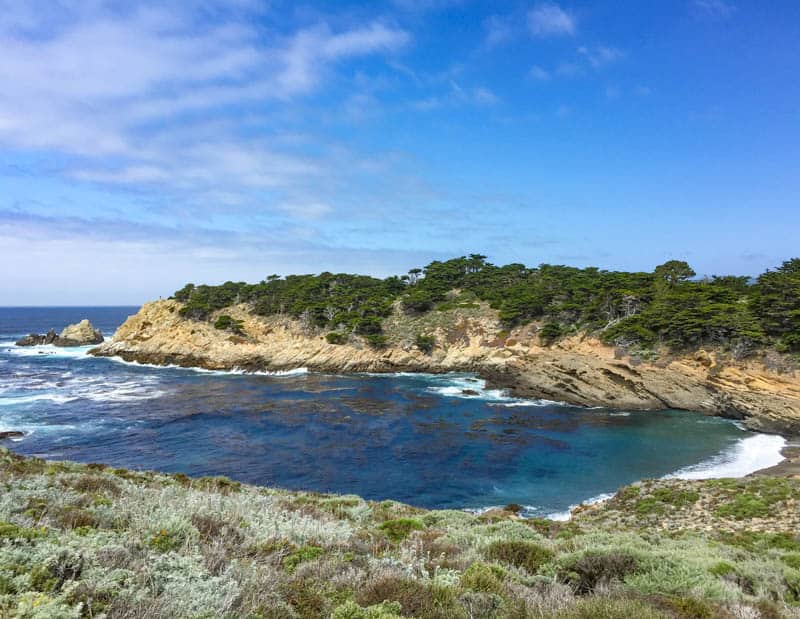
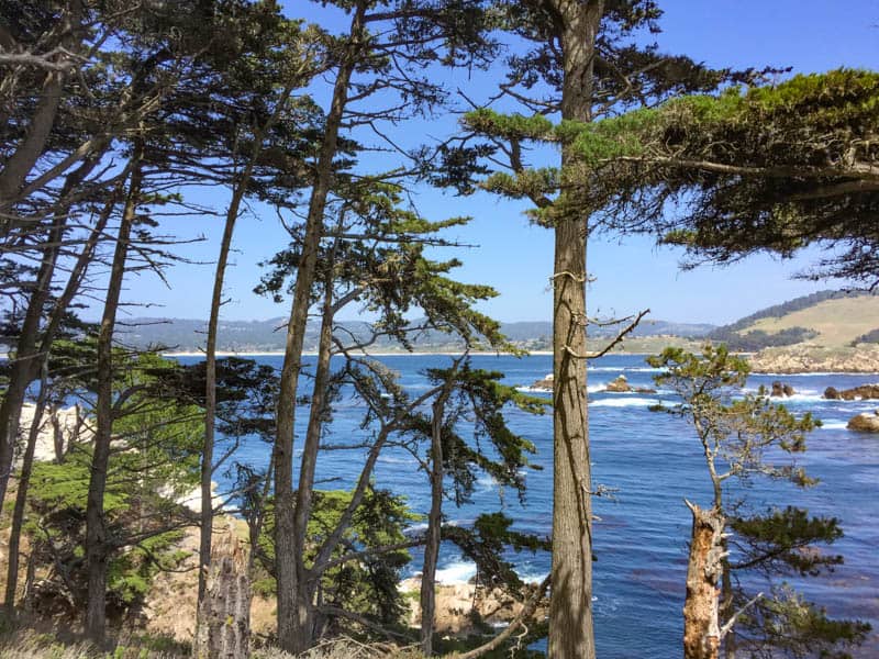
5. North Shore Trail
Offering beautiful ocean views framed by trees, and wildflowers in season, North Shore Trail is a somewhat more challenging trail than the others on this list.
North Shore Trail Facts
Distance: 2 miles round trip
Elevation Gain: ~70 feet
Difficulty: Moderate, requires maneuvering over rocks and rocky ground, tree roots, and steps
Trailhead: On the west end, access is from the Sea Lion Point Trail Parking Lot, Google Maps. On the eastern end, there are steep steps leading up to Cannery Point. We normally hike North Shore Trail from west to east, and back, to avoid the stairs: they can be real knee-busters.
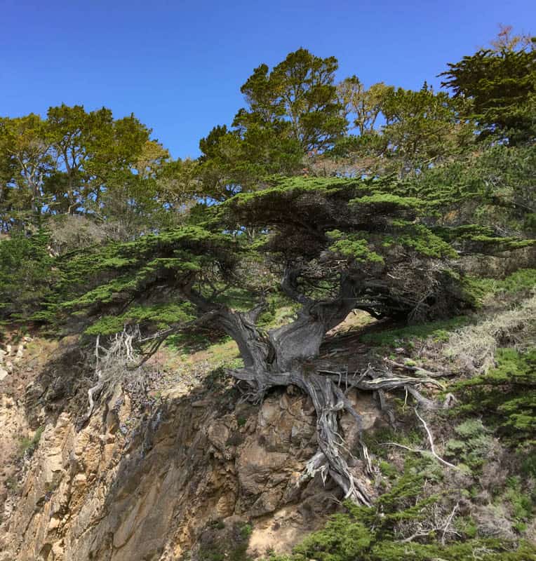
As you walk North Shore Trail, keep an eye out for the spur called the Old Veteran Trail. If you walk this short spur, you will get a great view of the Old Veteran Cypress, a remarkable tree clinging to the side of the cliff face against all odds. This amazing tree is over two hundred years old!
North Shore Trail offers endless beautiful photo opportunities of the water framed by the trees and cliffs along the shore. In season, you will see lots of wildflowers, although more as singles here and there than as a profuse group.
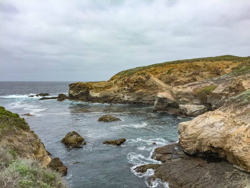
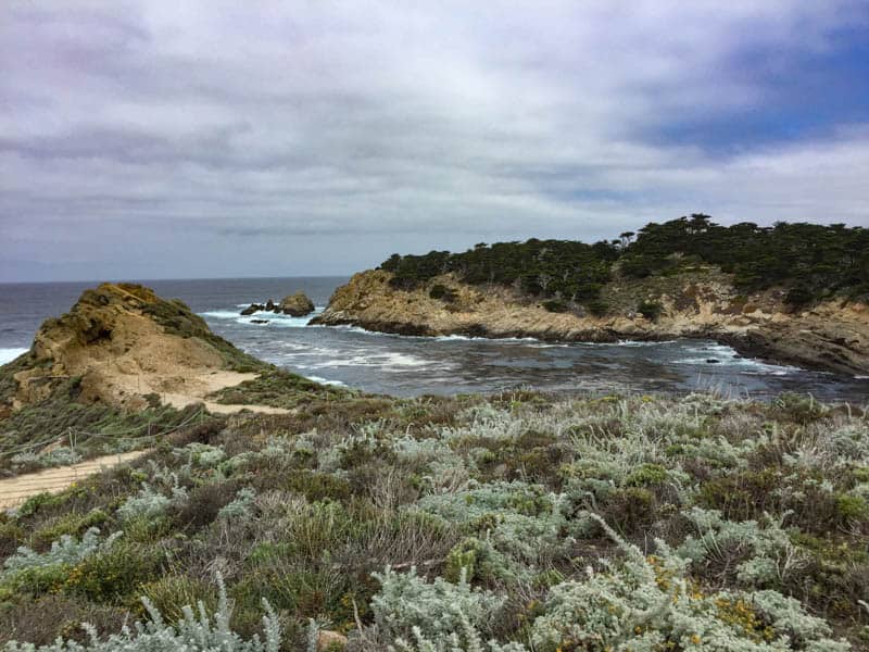
Bluefish Cove, one of the larger coves you will see along this trail, is gorgeous. The trail is bookended by Cypress Cove and Bog Dome Cove on the west and Whaler’s Cove on the east, so you will see many lovely coves on this trail.
Look out into the water as you walk: you may see otters or seals. Also look for seabirds: cormorants and Western gulls nest on Guillemot Island, which lies offshore along the trail.
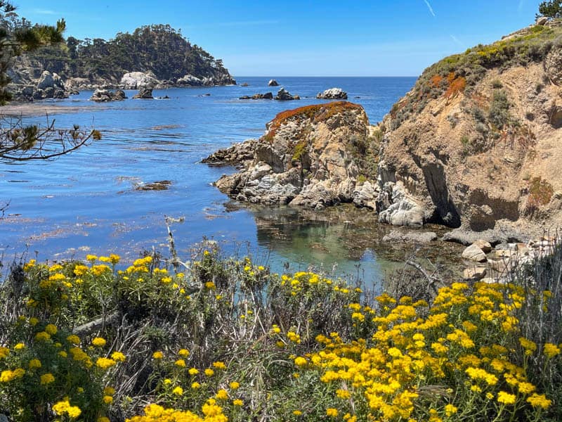
6. Granite Point Trail
Granite Point Trail offers a little bit of everything: a shaded walk through woods, views of the water and Carmelo Meadow, lots of wildflowers in the spring and summer, and opportunities to spot wildlife and birds.
Granite Point Trail Facts
Distance: 2.8 miles round trip
Elevation Gain: ~70 feet
Difficulty: Easy, suitable for most skill levels, trail is accessible for a portion of the trail, from Whaler’s Museum to a little ways beyond the Pit viewpoint.
Trailhead: From Whaler’s Museum, Google Maps.
From Whaler’s Museum, Granite Point Trail follows the bluff above beautiful Whaler’s Cove. Carmelo Meadow is on your right, and you will see lots of wildflowers if you visit in spring or summer.
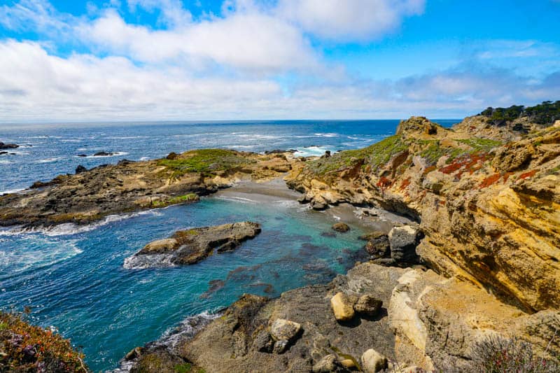
Follow the trail through a wooded portion that emerges at the viewpoint to the Pit, a pretty little cove you can see from above. Follow the loop to the left that leads to Coal Chute Point for gorgeous water views.
Continue down the steps and keep straight to begin the Granite Point loop. Along this loop, you get fabulous views of Moss Cove to the east, and Pebble Beach to the west. It’s a wilder part of the park, but the views are spectacular in every direction.
On your way back, if you have the time, take the little spur to the right through the ravine that goes to the Pit, a great spot for viewing seabirds, harbor seals, and otters.
Tips for Hiking Point Lobos
Structuring your hikes
The six trails we’ve described above cover the oceanfront part of Point Lobos State Natural Reserve from its southernmost end to almost the northernmost end: we’ve only left out the 0.6-mile Moss Cove Trail, which leads from the Granite Point Trail to Ichxenta Point at the north boundary.
If you plan to spend a few hours at the park, start at one end and work your way to the other end for the most efficient way to cover all the trails.
When we spend the day at Point Lobos, we generally hike the three southern trails in the morning, and then take a break for lunch.
In the afternoon, we cover the three northern trails. The coves in the northern part of the park look their bluest best when the sun is shining.
How much time will these trails take?
You could walk all six trails in about three to four hours, spending either the morning or the afternoon in the park. Allow for extra time if you want to go tidepooling or relax for a bit at Gibson Beach.
We love to dawdle over the views and the coastal flora and spend ages watching otters playing in the water, so we take the whole day to do the six trails!
If you have less than 3 hours, pick a couple of adjoining trails to hike: South Shore Trail in combination with Bird Island Trail, or Sea Lion Point Trail in combination with North Shore Trail, for example.
Learn with the Discover Point Lobos App
The Discover Point Lobos app can be downloaded for free either from the Google Play store or the Apple App store.
It’s a great way to learn about the park’s geology and its flora and fauna, especially if you are visiting for the first time.
Stay on the Trails
Poison oak grows rampantly in many California coastal state parks, including in Point Lobos. The trails at Point Lobos State Reserve have looked impeccably maintained every time we’ve visited, so as long as you stay on the trails, you should be fine.
As extra precaution, wear long sleeved shirts and full pants with socks and closed-toed shoes on your Point Lobos walks.
Good to know: You can tell poison oak by its three shiny leaves. They can be green or red. “Leaves of three, leave them be!”
Find Out and Follow Safety Guidelines
The brochure you will receive as you enter details safety guidelines and reserve rules. Researching and following safety guidelines will help you have a safe and enjoyable visit hiking Point Lobos.
Good to know: Dogs are not permitted in Point Lobos, even in your vehicle. The only exceptions are service animals.
What to Wear
Dress in layers. Even in the summer, mornings can be foggy and cool, and you will be glad you brought a windbreaker or a light jacket.
Wear sturdy, closed-toed walking or hiking shoes with good grip. Wear sunscreen, sunglasses, and a sun hat: portions of each of the trails above are in full sun, and some trails, like South Shore Trail, are fully exposed.
Food, Snacks, and Water
You cannot buy food, snacks, or bottled water inside Point Lobos State Reserve. There are drinking fountains at various points, so bring your refillable water bottle. Carry snacks, and bring a picnic meal if you want to eat in the park.
We generally leave the park to have lunch in nearby Carmel, and return to do our afternoon hikes. Your parking fee is valid for the entire day, but know that it will be much harder to find a parking spot inside the park during the day than in the early morning or late afternoon.
Bring binoculars and your camera
The super scenic Point Lobos hiking trails will have you reaching for your smartphone or camera every few minutes to snap yet another photo. So make sure you do not forget your usual photography gear!
We take our pocket Panasonic Lumix on hikes. It has a 30X zoom and takes great shots of birds and animals!
A pair of compact binoculars will come in handy to observe birds and animals up close. You can borrow a pair at the information station in the park if you don’t have yours.
*****
Enjoy hiking scenic trails? Check out these other articles on California hiking trails to walk:
Hike the Bluff Trail in Montana de Oro State Park
Hiking Hidden Valley Nature Trail in Joshua Tree National Park
Hike the Barker Dam Nature Trail in Joshua Tree
Mosaic Canyon Trail in Death Valley National Park
Moonstone Beach Boardwalk in Cambria, California
Bird Island Trail in Point Lobos State Park, Carmel
Did you enjoy this article? Pin it for later!
Thanks a lot for a very informative and detailed Web Site.
We covered the top 6 Point Lobos trails and few more(Carmelo Meadow Trail and Lace Lichen Trail) and also visited the Gibson Beach during our 4 visits to Point Lobos/Carmel in 2021 in addition to the Big Sur drive to Bixby Bridge and Hurricane Point and viewing of whales in December 2021 from Hyatt Carmel Highlands and seeing fall colors in Carmel Valley(Bernardus Lodge & Spa).
We also visited Almond Orchards in Los Banos in February 2021 and hiked trails in Las Trampas Regional Wilderness Park(Elderberry – Rocky Ridgeway loop and Las Trampas Peak) and visited Rock City and Mount Diablo.
Your information on Pinnacles National Park(visited multiple times), Sequoia National Park, Lassen Volcanic National Park and Burney Falls was also useful when we visited in 2021.
Your website has been quite helpful in planning of all the above trips.
Thanks again for a very informative and detailed website!
Hi Vijay, thank you so much for taking the time to read and comment and I am so glad you found the info helpful when you visited. All of these places are beautiful and I am happy you got to enjoy them.