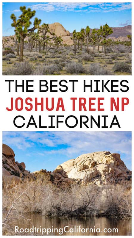
Looking for the best Joshua Tree hikes? Hiking is undoubtedly one of the most popular things to do in Joshua Tree National Park.
The Southern California desert park is home to a wide variety of hiking trails, and hiking is a great way to explore its unique landscapes up close.
Whether you are looking for a short and scenic family-friendly Joshua Tree trail, or you want a strenuous challenge, you will find a trail to suit!
Some links on this page may be affiliate links. If you click an affiliate link and make a purchase, we may receive a small commission, at no extra cost to you. For more details, refer to our disclosure.
Trails like the Cholla Cactus Trail and Arch Rock can be easily squeezed into a day of sightseeing in the park, while tough hikes like Warren Peak and Lost Palms Oasis require more time and planning.
The best Joshua Tree hikes are diverse in their beauty and the rewards they offer.
From summits with epic views to washes and canyons that lead down into otherworldly oases, you can really appreciate the uniqueness and diversity of Joshua Tree National Park on foot, hiking its many trails.
Enjoy local history? You can hike to the remnants of old mines from the Gold Rush era.
Love checking out local flora? Many Joshua Tree hiking trails let you get close to the plants and trees in the park, from California fan palms to cholla cacti and the Joshua trees for which the park is named.
Want the chance to see wildlife and birds? Hiking offers the best chances of spotting wildlife in the park, from rabbits to bighorn sheep and more.
If you are planning a hiking trip to the park, read on to learn about the top Joshua Tree hikes, plus our tips for hiking in Joshua Tree National Park!
The Best Joshua Tree Hikes
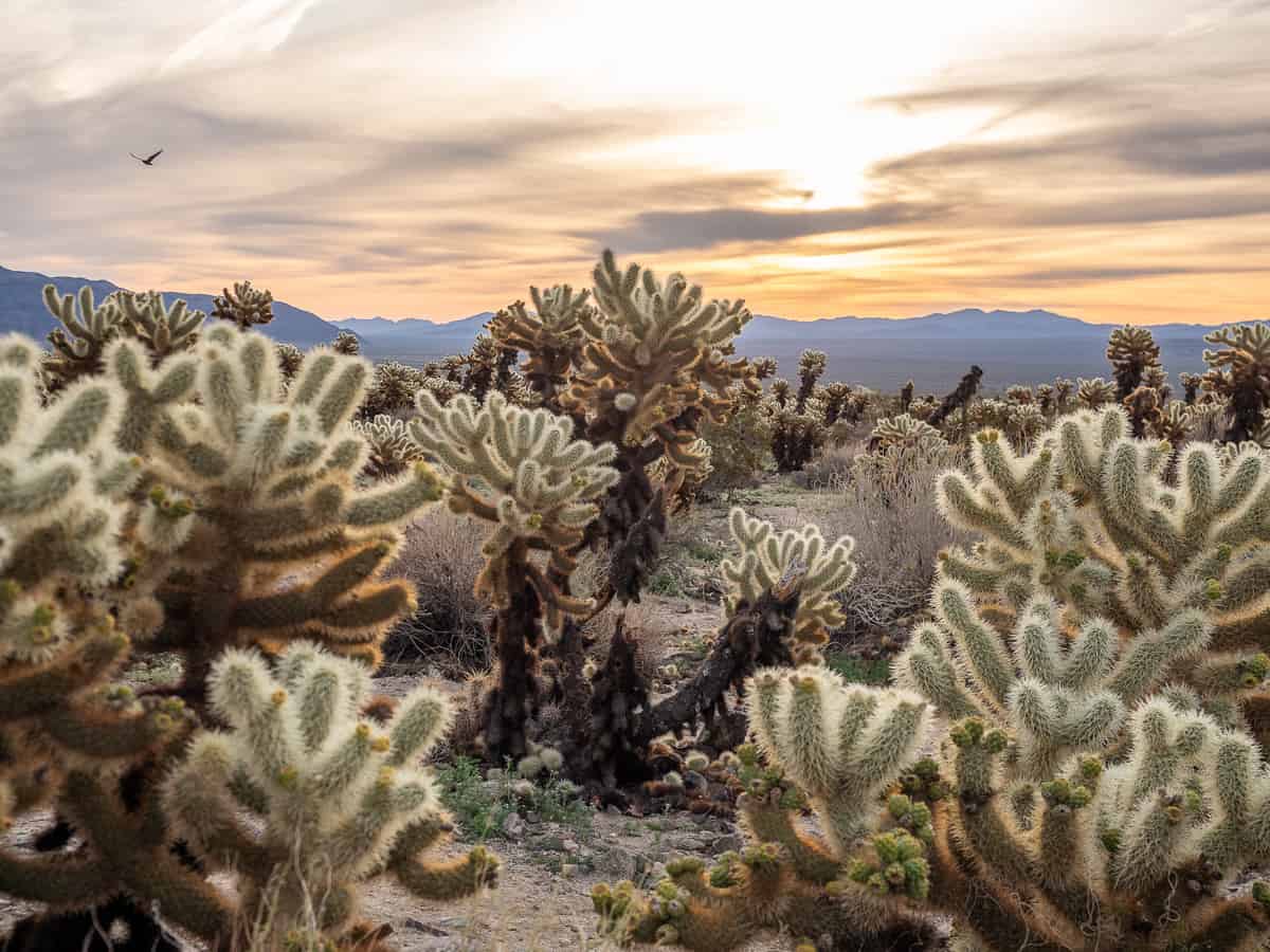
Cholla Cactus Loop Trail
Difficulty: Easy
Length: About 0.25 mile, loop
Elevation gain: Negligible
Time: 20-30 minutes
Trailhead: Along Pinto Basin Road, 20 miles north of the Cottonwood Visitor Center, or 14.4 miles south of the Twentynine Palms (north) entrance (see map)
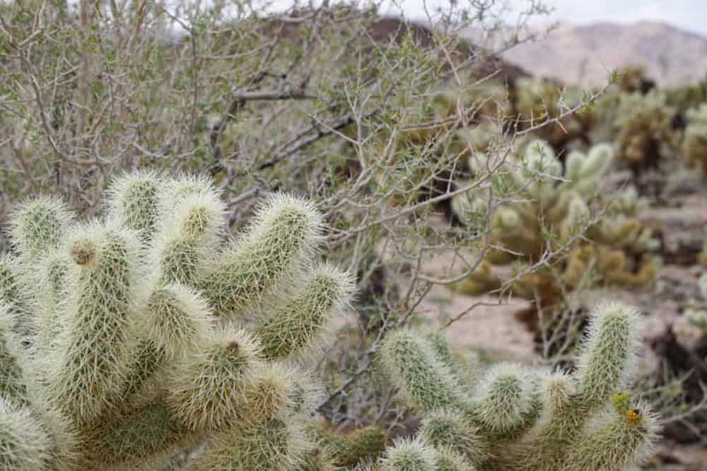
The Cholla Cactus Garden Nature Trail definitely deserves a spot on your itinerary for Joshua Tree National Park, especially if it’s your first visit. It’s suitable for most visitors to the park.
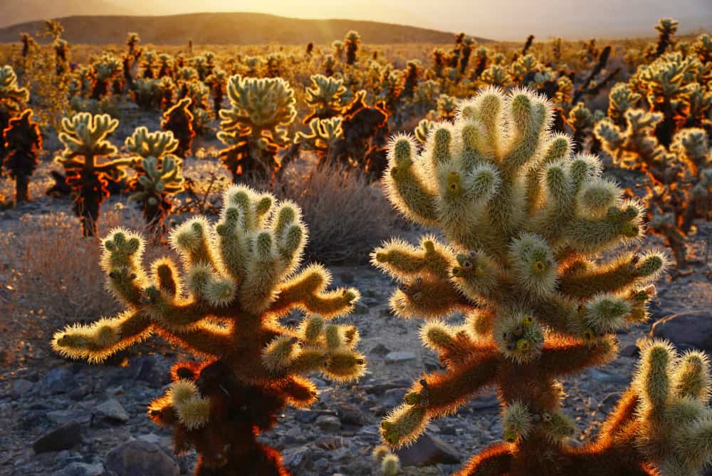
The flat boardwalk trail showcases thousands of cholla cactus plants that grow naturally in this part of the park, creating a spectacular visual display. Meander through the natural desert garden, taking in the views.
You’ll find interpretive brochures at the start of the trail, and sixteen markers along the route that describe the flora and fauna along the trail.
The teddybear cholla features dense yellow-green spines and it blooms between March and May. Its seeds are infertile, and the plant gets its spine joints dispersed by the winds or plants and animals, which then form new plants.
Be careful: the spines are sharp, and if you even lightly brush against a cholla cactus plant, you may get spines on your clothes or your skin. Removing them is not pleasant!
Other than spring bloom time, which is spectacular, golden hour is a great time to walk the Cholla Cactus Trail. The mellow golden light of the setting sun causes the cacti to glow, creating an otherworldly scene.
This part of Joshua Tree also has less traffic and some of the darkest skies in the park, so if you stay past sunset, it’s a great spot for stargazing as well.
Sunrise is another beautiful time to do this walk, with the golden glow of the rising run lighting up the cactus.
Many visitors on one-day visits start off their day in the park with this short and scenic hike before heading to Park Boulevard, the main sightseeing road through the park.
Arch Rock Trail
Difficulty: Easy
Length: About 1.4 mile, lollipop
Elevation gain: About 100 feet
Time: 45 minutes to 1.5 hours
Trailhead: Twin Tanks Parking Lot, see map (If you are staying in White Tanks Campground, Arch Rock is a 0.3 mile loop from the campground).
One of the popular photo spots in Joshua Tree National Park, Arch Rock is a natural arch formation that looks equally good by day or by night.
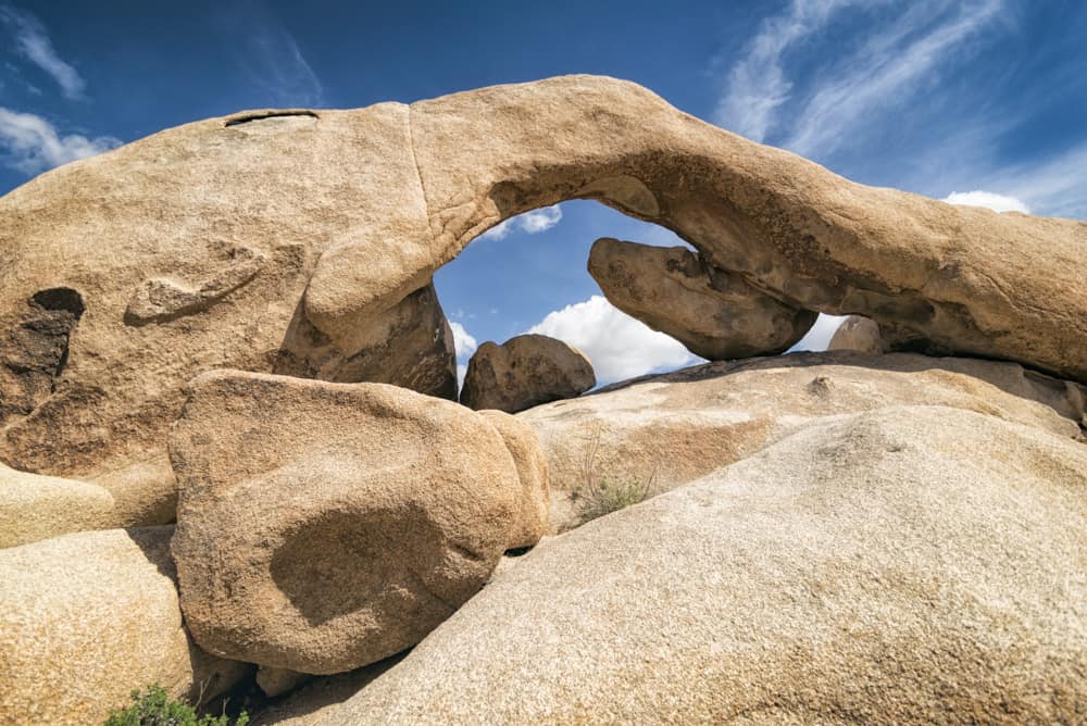
From the Twin Tanks parking lot, the trail heads straight east for about 0.6 mile, at which point it is a short loop. Go counter clockwise to be able to better spot Arch Rock, which comes up about 0.1 mile into the loop.
The trail is sandy in parts and rocky and somewhat uneven in the loop section. Interpretive signs along the route describe the geology and the flora and fauna in the area.
There are other rock formations you see on the route, and you can do a bit of rock scrambling along the route if you choose. Arch Rock is a few steps off the trail, and you can scramble up into the arch if you wish, although it takes some agility.
If you have the time, there are several little spur trails you can explore, including one to Heart Rock, which does look quite a bit like a heart! Go around the rock to view it from the back as well.
For more mellow light for photos, hike the Arch Rock Trail early in the day or around sunset.
Hidden Valley Trail
Difficulty: Easy to easy-moderate
Length: About 1 mile, loop
Elevation gain: About 100 feet
Time: 30 minutes to 2 hours
Trailhead: Hidden Valley Campground on Park Boulevard, see map
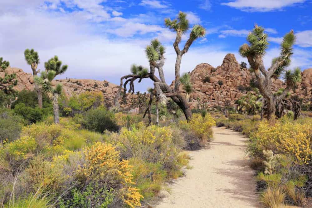
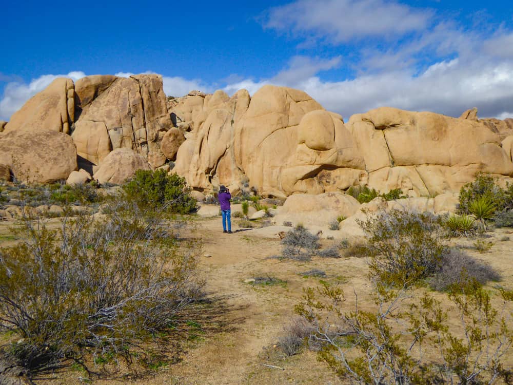
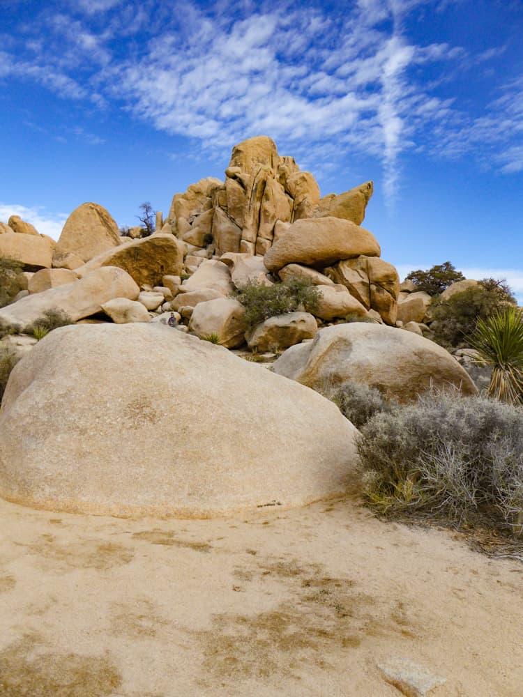
Arguably the most popular hiking trail in Joshua Tree National Park, Hidden Valley Trail is a beautiful nature walk through scenic masses of boulders and lots of local vegetation, from pinyon pines to Joshua trees.
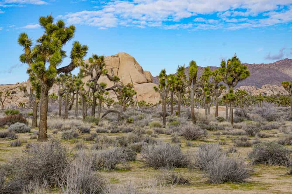
We’ve walked this trail every time we’ve visited Joshua Tree National Park, because in a short, easy trail, you get to see a great representation of the park’s signature features.
Hidden Valley Trail is a must-do on your first visit to the park. It’s short enough that you can even add it to a Joshua Tree day trip itinerary, and so scenic that you’ll get a great feel for the best elements of this unique national park.
Hidden Canyon was reportedly a hideout for cattle rustlers in days past. With its ring of tall boulder formations, it is easy to see why! Have fun scrambling up and down the boulders you see along the trail, and look for wildlife as you walk.
Even if you don’t do bouldering, this trail offers the opportunity to get close to rock formations to admire their subtle colors and textures.
There are interpretive markers along the trail, if you wish to learn more about the history and geology of Hidden Valley, and its flora and fauna.
Sunset is a great time to do the Hidden Valley Trail: the light is gorgeous. Or you can do it early in the day, when there are fewer other visitors and you can have a tranquil desert nature walk. In spring, you will see lots of wildflowers.
Parking is available at the trailhead, but may get full during the day in season, so arrive early.
Read Next
Hike the Hidden Valley Trail in Joshua Tree National Park
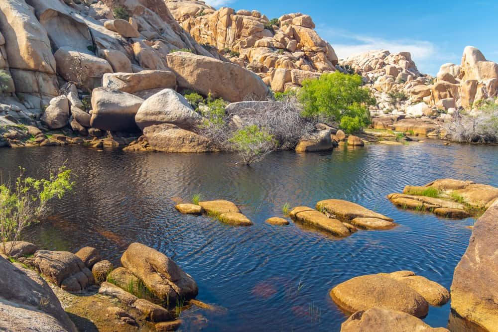
Barker Dam Nature Trail
Difficulty: Easy to easy-moderate
Length: About 1.1 miles, loop
Elevation gain: About 50 feet
Time: 30 minutes to 2 hours
Trailhead: Barker Dam Parking Area along Park Boulevard, see map.
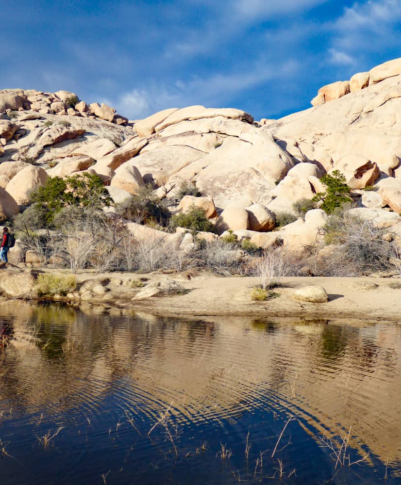
Barker Dam, in our opinion, is one of the best trails in Joshua Tree: it combines a bit of history and culture with the opportunity for bouldering and spotting birds and wildlife, and it is a short flat trail.
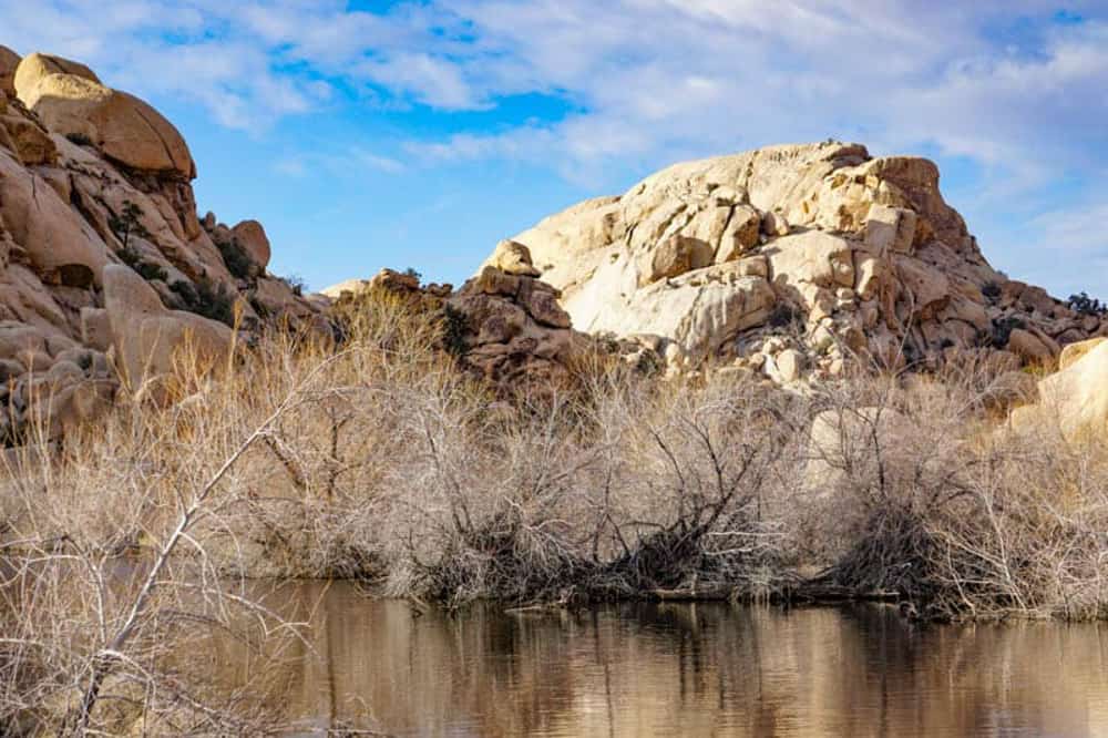
Barker Dam was built as a reservoir to hold drinking water for cattle during the early days of ranching in the area. It is listed on the National Register of Historic Places.
The dam is one of the places in the park where you are most likely to see birds and bighorn sheep, especially when there is water in the dam.
The Barker Dam Trail also has quite a bit of flora: creosote, cacti, pinyons, oaks, and Joshua trees. Along the route, you will also see a little cave with old petroglyphs!
Barker Dam is generally dry, other than during or just after a period of rain, so if you only want to hike the trail when there is water, check at the visitor center on the day of your visit, or call ahead.
The parking area is quite large, but it is shared with the Wall Street Mill Trail.
Read Next
Hike The Barker Dam Trail in Joshua Tree National ParK
Wall Street Mill Trail
Difficulty: Easy
Length: About 1.5 miles, out and back
Elevation gain: About 100 feet
Time: About 1 to 2 hours
Trailhead: Off Queen Valley Road. See map. You can also access this trail from the Wonderland of Rocks Trailhead, which offers access to Barker Dam (2.15 miles round trip).
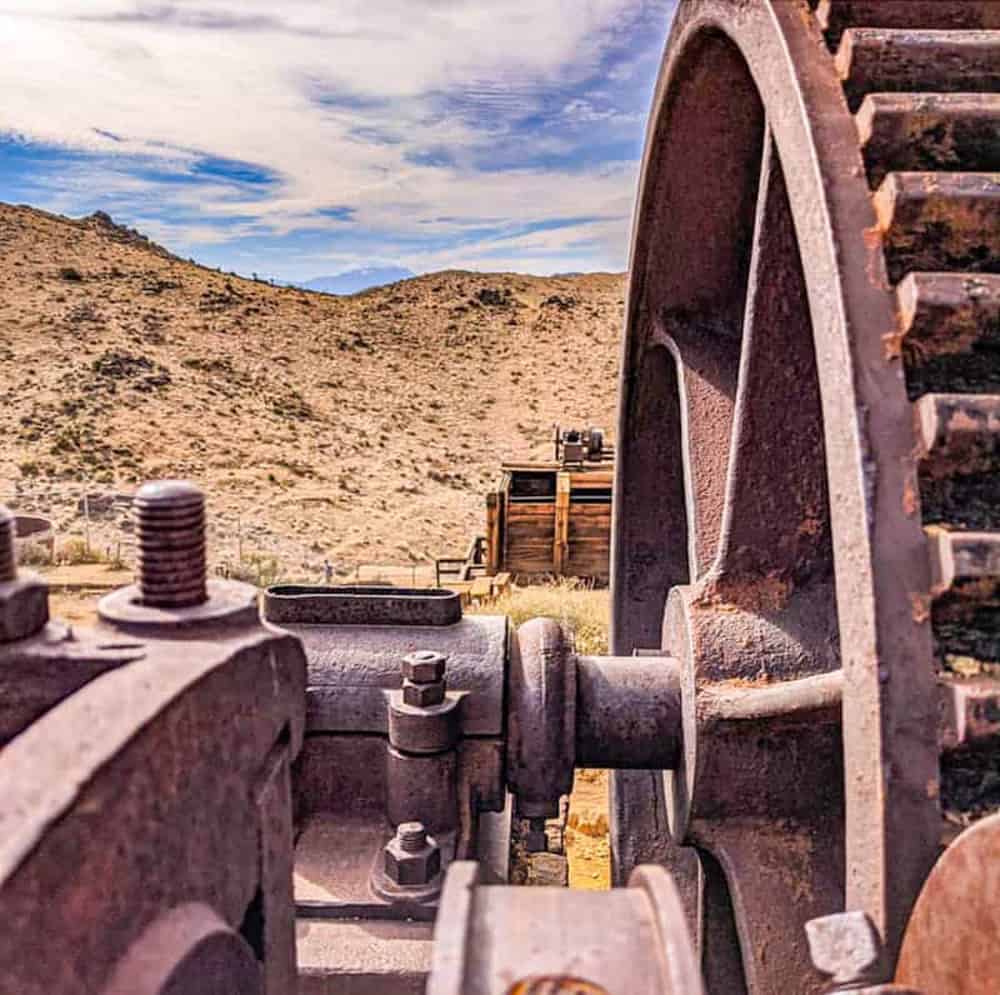
The Wall Street Mill hike in Joshua Tree is one of the best easy hikes you can do if you enjoy history and great views.
Wall Street Mill is a well-preserved gold mill listed on the National Register of Historic Places, and it is a cool place to visit if you enjoy local history.
But the trail is also known for another colorful incident: it was the scene of a Wild West duel, with a stone marking the demise of the unfortunate loser of the gunfight.
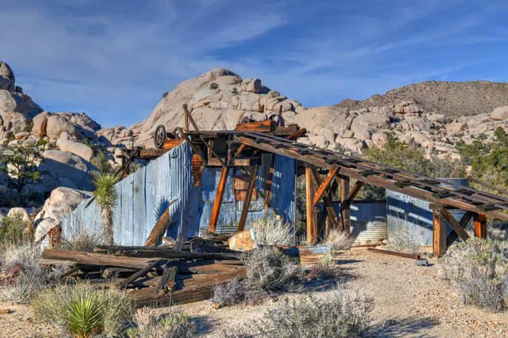
During the Depression, Bill Keys, prominent rancher in the region, bought the site and assembled the Wall Street Mill. He charged miners a fee to process their ore and remove the gold. He ran the mill off and on all the way until 1966!
Keys got into a dispute with his neighbor, Worth Bagley, over the road leading to the mill. A showdown led to a gun fight, and Bagley was killed.
Keys was put into prison, but released five years later. A monument marks the spot where Bagley was killed: look for it as you walk the trail.
The trail is flat and easy, and makes its way through sandy desert, dotted with desert plants. Along the way, you’ll see old relics like rusted cars and the ruins of Wonderland Ranch.
At the end of the trail, you can walk around and view the remains of the mill, which have stood the test of time remarkably well.
To return to the trailhead, simply retrace your steps.
Looking for accommodations in Joshua Tree? Check out our article on where to stay when you visit Joshua Tree National Park!
Skull Rock Trail
Difficulty: Easy
Length: About 1.7 miles, loop
Elevation gain: About 150 feet
Time: About 1 to 2 hours
Trailhead: Skull Rock parking area east of Jumbo Rocks Campground, see map. You can also access the trail from within the campground, if you are staying there!
Skull Rock can be easily viewed off Park Boulevard, but the 1.7-mile Skull Rock Nature Trail is a great opportunity to take in some of the other beautiful rock formations in the park up close.
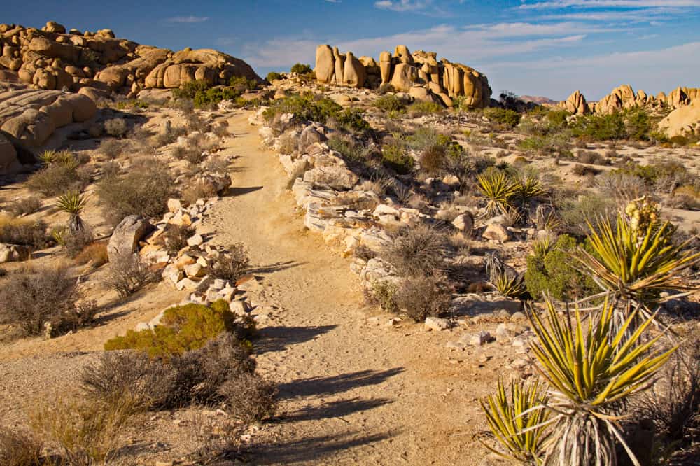
The trail begins just across from the entrance to Jumbo Rocks Campground and winds its way past massive boulder piles and through sandy washes. Interpretive markers along the route offer lots of information.
You’ll see a variety of Joshua Tree flora on the route, and perhaps some fauna as well! Cat’s claw acacia, desert almond, California buckwheat, and Mojave yucca are some of the plants you’ll see.
If you walk the trail in the spring, look for wildflowers such as bush penstemon, woody forget-me-not, and various cacti. Also keep your eyes open for rabbits, and perhaps even a coyote!
Rock formations along the route offer great scrambling for all skill levels. As a bonus, once you get away from Skull Rock and the boulders alongside Park Boulevard, the rest of the trail is generally not super busy.
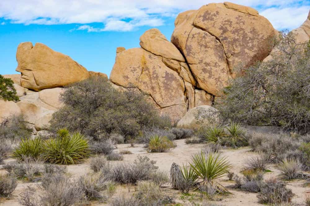
Split Rock Trail
Difficulty: Easy to low moderate
Length: About 2.5 miles, loop
Elevation gain: About 150 feet
Time: About 1.5 to 2.5 hours
Trailhead: Split Rock parking lot, at the end of a short dirt road off Park Boulevard. See map. The dirt road can be traversed by passenger sedans.
Split Rock is one of our favorite locations (and hikes) in Joshua Tree National Park. In season, it tends to be less crowded than trails like Barker Dam and Hidden Valley.
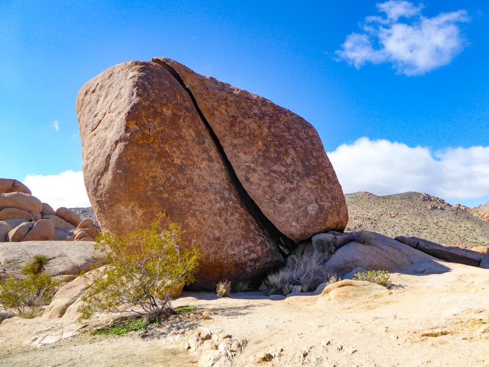
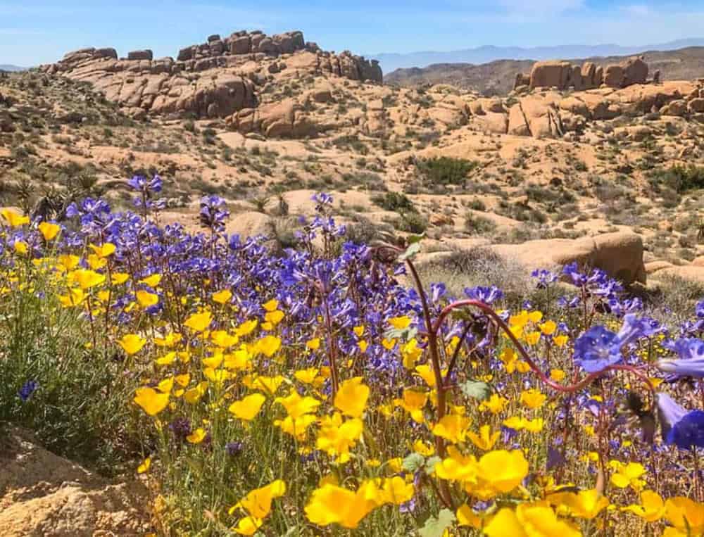
Split Rock Trail offers all of the signature elements of Joshua Tree, from masses of picturesque boulders to a few Joshua trees, other vegetation like the occasional pinyon pine, and wildflowers in season.
Along with the must-photograph Split Rock, you’ll also see Face Rock on this loop. The boulder masses are some of the most scenic in the park!
Also keep your eyes open for wildlife as you walk. We saw a rattlesnake on this trail, as well as some cottontails, chipmunks, and lizards.
Start the hike at the signposted start, which will take you counter-clockwise around the loop. There is a small climb to the top of a ridge, with some steps: this is the only real elevation change on this trail, which has sections of rock and sections of sand.
Face Rock is a short side out and back hike on the loop. It is signposted, and worth doing.
Along the way, look for climbers going up vertical rock faces. They are fun to watch!
Lost Horse Mine Trail
Difficulty: Moderate
Length: About 4 miles, out and back
Elevation gain: About 550 feet
Time: About 2 to 3 hours
Trailhead: Dirt road off Keys View Road, about 2.4 miles from Park Boulevard. See map.
Joshua Tree National Park has a rich history, with mining and ranching operations flourishing in the area in the days of the early settlers. On hikes, you can get close to the relics of the park’s past.
Lost Horse Mine was one of the richest producers in the region, yielding about 10,000 ounces of gold and more than that in silver over its run.
The millsite is quite well preserved, so it’s worth making the trek to view the mill and the mine. In the spring, the area is flush with wildflowers.
From the trailhead, the trail ambles its way gradually upward, with views of Joshua trees and yucca, and boulders.
Eventually the trail winds around a slope, at which point you can see the site of the mine. You can walk around to see the site and take photos, but stay outside the fenced area.
Before you turn back, you may want to climb up a little more beyond the mine, for a panoramic view from the ridge.
To make this a challenging hike, you can continue on and complete the Lost Horse Loop trail, about 6.5 miles total.
Parking can get full quickly, so arrive early in the day to snag a spot.
Mastodon Peak Hike
Difficulty: Moderate
Length: About 3 miles, loop
Elevation gain: About 375 feet
Time: About 1.5 to 3 hours
Trailhead: Cottonwood Spring parking area. See map.
Mastodon Peak Loop Trail is a beautiful hike in the Colorado Desert, in the southern part of the park. From the peak, you get panoramic views of Joshua Tree National Park.
On this loop, you will also see the remains of the Mastodon Mine. The trail is particularly beautiful in the spring, with lots of wildflowers.
At the start of the hike, you will pass through Cottonwood Springs Oasis, a lush landscape with tall California fan palms. The park is one of the few native habitats of this palm.
Beyond the oasis, the trail (which is also the trail to Lost Palms Oasis) starts a gradual ascent, with views of yucca and ocotillo.
Take the left for Mastodon Peak at the sign. After this the climb becomes somewhat steeper, with steps to help you in places, as you make you way towards the peak.
The final bit is the steepest, and there is some scrambling required if you want to actually stand atop the peak.
You don’t have to scramble to the top, you can just continue following the trail. The views from the highest point in the trail are superb.
From the peak, you can see all the way to Salton Sea in the south and Eagle Mountain in the east. In the west you may even be able to see Mount San Jacinto.
The trail then leads down to the remains of the Mastodon Mine, which you can view from outside the fenced area. Then follow the trail through several sandy washes back to the trailhead.
Signs with arrows and rock markers help you stay on the trail as you make your way back. The desert landscape is beautiful. Keep your eyes open for wildlife!
Parking can get full during the day, especially on weekends and in the spring. Arrive early or later in the day to secure a spot.
Ryan Mountain Trail
Difficulty: High moderate to challenging
Length: About 3 miles, out and back
Elevation gain: About 1,050 feet
Time: About 1.5 to 3 hours
Trailhead: Parking area off Park Boulevard between Sheep Pass and Ryan Campground. See map.
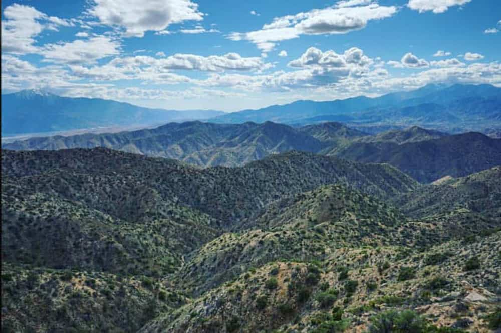
The Ryan Mountain hike leads to a high-up point that offers superb panoramic views of the landscapes of Joshua Tree National Park.
The trail to the top is mainly dirt, and there are stone steps to help you with the climb. If you are up for a challenge, the Ryan Mountain hike is super rewarding on a bright clear day.
You will start climbing almost immediately, and the ascent is fairly steep. Enjoy beautiful views all along the ascent, first of nearby masses of boulders and Joshua trees, and as you climb, a more expansive view of the surrounding landscape.
Keep climbing until you get to the sign that marks the top of the 5,457-foot Ryan Mountain.
From the summit, you will see Mount San Jacinto and Mount San Gorgonio towards the southwest, and Lost Horse Mountain to the south.
You can walk around the summit to take in the views from every angle. The mountain is in the middle of the park, so the views extend in every direction. They really are breathtaking!
Getting back down is simply a matter of retracing your steps. You can stop along the way to take photos you missed on your way up! Layers are a good idea, because it can be cooler (and windy) at the top in the colder months of the year.
Also, the Ryan Mountain Trail in Joshua Tree is one of the most popular trails in the park, so the parking lot gets full during the day and the trail gets crowded. Arrive early for a more enjoyable hike!
READ NEXT
Hike the Ryan Mountain Trail in Joshua Tree NP!
49 Palms Oasis Trail
Difficulty: Moderate
Length: About 3 miles, out and back
Elevation gain: About 300 feet each way
Time: About 2 to 3 hours
Trailhead: Fortynine Palms parking area, off Highway 62. Take Canyon Road to Fortynine Palms Canyon Road. See map.
An oasis, with its lush palms, is a magical sight in a desert. Joshua Tree National Park contains several California palm oases.
Cottonwood Spring Oasis is a super short walk by the south entrance to the park, and Oasis of Mara a short walk by the north entrance. You have to hike to the others.
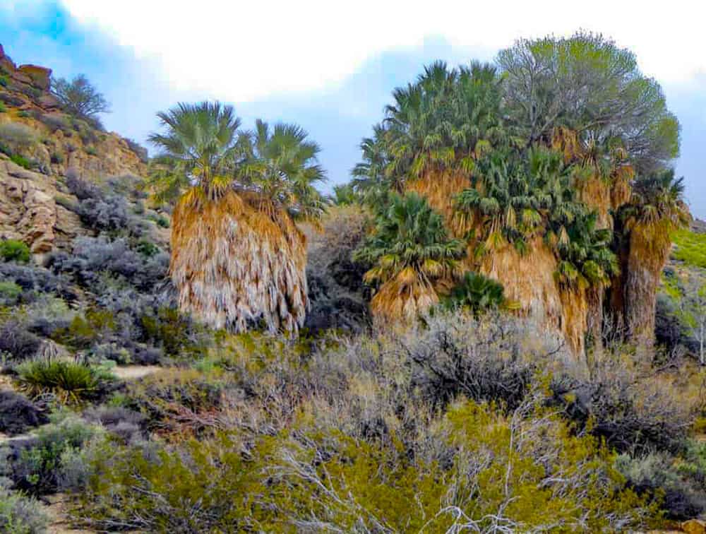
The 49 Palms Oasis Trail is the shorter of two epic fan palm oasis hikes in Joshua Tree. It leads to arguably the most beautiful oasis in the park, with lush palms fed by a natural spring. Keep your eyes peeled for bighorn sheep and birds.
From the start point, the 49 Palms Oasis trail leads up the hill, gradually at the beginning, and more sharply, via a few switchbacks towards the top. Once you crest the ridge, you will be able to see the tallest of the palms in the oasis!
The trail gradually slopes down the other side of the hill, and eventually arrives at the oasis. Walk past the first stand of palms to the heart of the oasis, where you can relax for a bit and admire the beautiful palms.
Stay on designated trails: there are signs asking you not to go into the area where the palms are, to protect the oasis.
To return, retrace your steps over the ridge. The ridge has lots of barrel cactus, which look pretty when in bloom, some time in April or May. You will also see other wildflowers here in the spring.
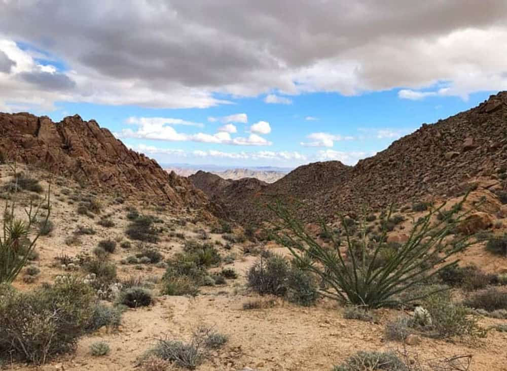
Warren Peak Trail
Difficulty: Challenging
Length: About 6.3 miles, out and back
Elevation gain: About 1,110 feet
Time: About 3 to 5 hours
Trailhead: Black Rock Campground. See map.
If you want a trail with great views but without the crowds, try the Warren Peak trail, which is tucked away in the quiet western part of the park. The elevation is somewhat less than Ryan Mountain, but the trail is still challenging.
The trail starts at Black Rock Campground and descends into a sandy wash. Once you are across the wash, you will walk through open desert for a bit before starting to climb via a number of switchbacks to the top of the 5,103-foot Warren Peak. The top stretch is pretty steep.
Warren Peak Trail is unique because it straddles the Colorado and Mojave desert environments. So while you will see lots of Joshua Trees towards the start of the trail, the later stretches are notable for pinyon pines, oak, and juniper.
You will also get beautiful panoramas of both the Mojave Desert and Coachella Valley from the summit. Look for Mount San Jacinto in the south, Mount San Gorgonio (the tallest peak in Southern California) in the west, and Eureka Peak in the east.
The summit is a quiet place to relax for a bit, take a few photos, and enjoy the beauty of the surrounding landscape.
To return, retrace your steps to Black Rock Campground. If you have the time, you can hike Panorama Loop as well, on your way up to the peak.
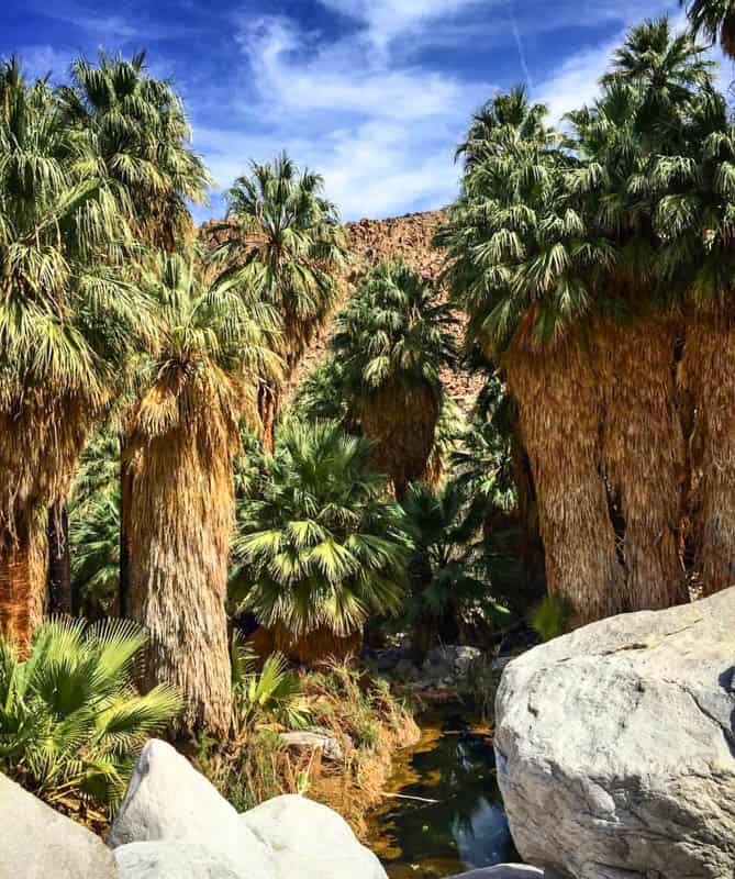
Lost Palms Oasis Hike
Difficulty: Moderate to challenging
Length: About 7.5 miles, out and back
Elevation gain: About 500 feet each way
Time: About 5 to 6 hours
Trailhead: Cottonwood Spring parking area. See map.
Located in the Colorado Desert in the southern part of Joshua Tree National Park, Lost Palms Oasis Trail is a long out and back trail to the largest concentration of fan palms in the park.
There aren’t any super steep climbs, but the trail is long and exposed.
The trail makes its way to the oasis through a series of undulating sandy washes dotted with desert flora. There are signs along the trail to keep you on the correct path. Plus, rocks and stones mark off spurs. Be watchful and stay on the main trail.
Start at Cottonwood Spring and walk through the oasis into the desert beyond. Later in the route you will hike through a cool mini slot before weaving up and down through sandy washes. Stone steps have been placed to help you over climbs.
There are beautiful views of the landscape to admire as you walk. Soon you will descend into the final canyon to reach the overlook for the oasis.
Getting down to the oasis requires a difficult scramble down rocks and gravel (and a difficult climb back up), but the oasis looks just as beautiful from the overlook.
Scan the rocks for bighorn sheep, especially early or late in the day. You may also spot birds, so bring your binoculars! To return, retrace your steps, being watchful about staying on the main trail.
The parking lot can get full so arrive early to get a spot. Plus, this hike is best started early in the day, even in the cooler months, since it takes several hours.
Planning a trip to Joshua Tree and wondering where to stay? Read our detailed article on the best places to stay in and around Joshua Tree National Park.
Tips for Hiking in Joshua Tree National Park
Get a National Parks Pass!
If you plan to visit 3 or 4 national parks (or other federally managed recreation areas) during the course of the year, get the America the Beautiful National Parks Pass: it will save you money. You can buy the annual pass online at REI.
Follow Park Safety Guidelines and Advice
The Joshua Tree National Park website has a page on safety. Read and follow the guidelines for a safe visit, because your safety is your responsibility!
Best Time of Year to Hike in Joshua Tree
Visit in the cooler months of the year, from October to April, if you want to do day hikes of reasonable length or difficulty. The heat of the desert can be unforgiving and dangerous. Heed park guidelines on when to avoid specific trails.
Summer daytime temperatures in the park get over 100 degrees on a routine basis. Definitely not a time to be hiking in Joshua Tree National Park, or anywhere in the desert.
Check the weather forecast
Sudden thunderstorms can cause flash floods. A cold snap in winter can bring the occasional snowfall. Always check the forecast before you head out on a hike, no matter what the time of year.
Best Time of Day to Hike in Joshua Tree National Park
If you visit in the spring or fall, it may be more comfortable to start your hike earlier in the day. Shorter trails can also be done in the late afternoon.
Not only is the sun less intense early or late, you will also have better light for photos, and a better shot at seeing birds or animals. Plus, a parking spot at the more popular trailheads is much easier to find early or late in the day.
During shorter winter months, return to your vehicle by 4 p.m., and hike during the day, when it is brighter and warmer. The winter months are the perfect time to be out and about in the desert park during the day.
Although the park is open 24 hours a day, some trails can only be walked between sunrise and sunset. Call the park to find about about any time restrictions on the trails you plan to hike.
Carry plenty of water
Even if you aren’t hiking, you need to drink lots of water when visiting a desert park like Joshua Tree. You need even more water if you hike. There is no food or water available for purchase inside Joshua Tree.
Carry lots of drinking water in a cooler in your vehicle, and carry a filled hydration pack or filled water bottles with you on your hikes. You can also fill up at campgrounds within the park.
Carry food and snacks
Pack your cooler with plenty of food and carry non-perishable snacks on your hikes, along with a meal, if you plan to do a longer trail.
Food and other supplies can be bought in the towns of Joshua Tree or Twentynine Palms north of the park before you enter. Invest in a light and easy-to-carry daypack to stow food and other supplies.
Download maps before you arrive
There is no cell reception in most parts of the park. Download any maps or directions you need to your phone before you arrive. Keep a printed map as backup: National Geographic has a handy trail guide for Joshua Tree National Park.
Get a GPS smartwatch, if you do not have one already: it will come in handy not just at Joshua Tree National Park but in other parks and wilderness areas as well.
Check out this premium Garmin Fenix 6 (you can buy it on Amazon or you can buy it on REI), or the more affordable Garmin Instinct (buy on REI or Amazon).
Also consider the InReach Mini as a backup resource for navigation. With a satellite subscription, it enables you to send and receive texts when there is no cell phone reception. It weighs only 3.5oz, and has tracking and SOS capabilities as well.
Buy it on REI | Buy it on Amazon
Dress in Layers
Always dress in layers to account for temperature differences during the course of the day, and at different elevations in the park.
Wear loose, light colored clothing for sun protection. We generally wear clothing with SPF protection if we are going to be in the sun for several hours. Check REI for women’s SPF shirts here and men’s SPF shirts here.
Wear Appropriate Footwear
Sturdy, closed-toed footwear is a must. Sneakers or sturdy walking shoes with good grip are fine for short nature trails.
Lightweight hiking shoes or boots are best for longer trails. We wear the La Sportiva brand cuffed hiking boots: they are not heavy, they are waterproof, and they are super comfy. Check women’s here and men’s here.
Use Sun Protection
Use a wide-brimmed hat with SPF protection, sunscreen, and sunglasses, when hiking in the desert. Most trails in the park are exposed.
Bring Essential Supplies
Pack these essentials in your daypack: a first-aid kit (add a pair of tweezers to pull out cholla cactus needles if you happen to be unlucky!), disinfecting wipes or hand sanitizer, headlamp or flashlight, and a pocket knife.
Bring your trekking poles if you anticipate needing them, your camera, and binoculars to view birds or wildlife.
Did you find this article informative? Pin it for later reference!