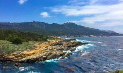
Big Sur, on California’s Central Coast, is famous for its spectacular scenery, but it is also renowned for its hiking. Big Sur hiking trails are a great draw for outdoor enthusiasts, nature lovers, and landscape photographers alike.
The best hikes in Big Sur range from accessible or easy to super strenuous, so there’s a trail (or three!) for every visitor that wants to hike in this beautiful region.
Whether you wish to chase waterfalls, walk sandy beaches, climb for panoramic views of the Pacific Ocean, or stroll among the redwoods, Big Sur hiking trails deliver.
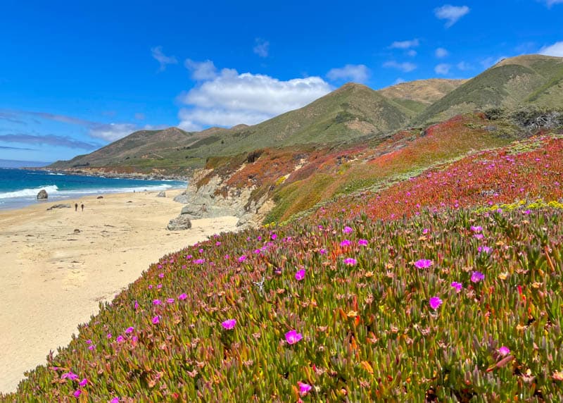
Plus, you will see lots of wildflowers in the spring, and, if you are lucky, wildlife and birds year round.
Some links on this page may be affiliate links. If you click an affiliate link and make a purchase, we may receive a small commission, at no extra cost to you. For more details, refer to our disclosure.
In this article, we’ve rounded up the best Big Sur hikes, from north to south. We’ve included some short and scenic trails, so you can do a couple of quick hikes even if you are just driving through Big Sur on a road trip.
Let’s get started discovering the best trails to hike in Big Sur!
1. Sea Lion Point Trail, Point Lobos State Natural Reserve
Difficulty: Easy (accessible except for optional stairs and lower trail to beach)
Length: About 0.6 mile, loop
Elevation gain: About 15 feet
Time: 20-30 minutes
Trailhead: At Sea Lion Point/Cypress Grove parking lot, see map
If you want a short scenic hike that showcases some of the best of Point Lobos State Natural Reserve, then Sea Lion Point Trail is the hike for you!
It can be done on its own or in conjunction with the short Sand Hill Trail as a wider loop around Sand Hill.
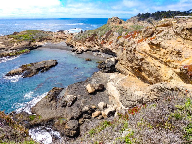
The payoff on this trail are the sea lions on the rocks offshore. Their barking is clearly audible, but you need binoculars or a zoom lens to see them clearly.
Other than sea lions, look for otters in the kelp, harbor seals hauled out on rocks or the edge of the water in the coves, and sea birds.
Even if you do not see birds or wildlife, expect fabulous water views in every direction when you do this hike at a bright, fog free time.
In spring, wildflowers add to the beauty of the trail.
2. South Shore Trail, Point Lobos State Natural Reserve
Difficulty: Easy
Length: 2 miles round trip, out and back
Elevation gain: About 120 feet
Time: About 1-1.5 hours
Trailhead: At South Shore Trail parking lot, see map
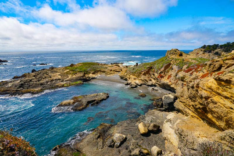
South Shore Trail hugs the coastline in the southern part of Point Lobos State Reserve, offering unobstructed views of the Pacific Ocean on a clear day.
The trail actually starts with some steps down from Sand Hill Trail, but you can pick it up at the parking area and head south.
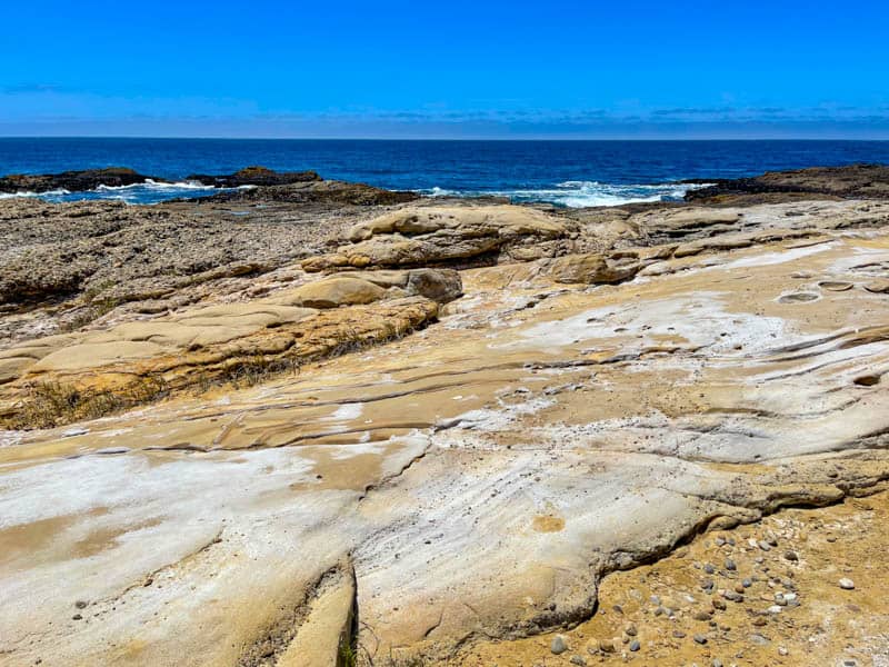
You will see gorgeous rock formations along this trail: the sedimentary rocks, in shades of light and dark brown, are part of the Carmelo Foundation.
Look for otters in the water, and raptors and sea birds flying over the water.
Inland views from the trail, of the hills, are also photogenic.
If you choose, you can take side trails down to tide pools and the water. Weston Beach, along this trail, is the best tidepooling area in the park.
Make it longer: Combine with Bird Island Trail at the south end, or with Cypress Grove Trail, Sea Lion Point Trail, and Sand Hill Trail at the north end!
Or do the long stretch of ocean view Point Lobos hiking trails from Cypress Grove to Bird Island!
3. Bird Island Trail, Point Lobos State Natural Reserve
Difficulty: Easy (accessible except for optional stairs to beach)
Length: About 0.8 mile, loop
Elevation gain: About 75 feet
Time: 30-45 minutes
Trailhead: At Bird Island parking lot, see map
Other than birds, Bird Island Trail in Point Lobos State Park includes some of the prettiest sights in the park.
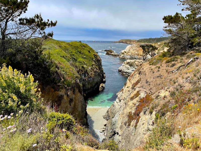
On this trail, you will see jade green China Cove, and navy blue Gibson Beach, along with rocky outcrops and beautiful flora.
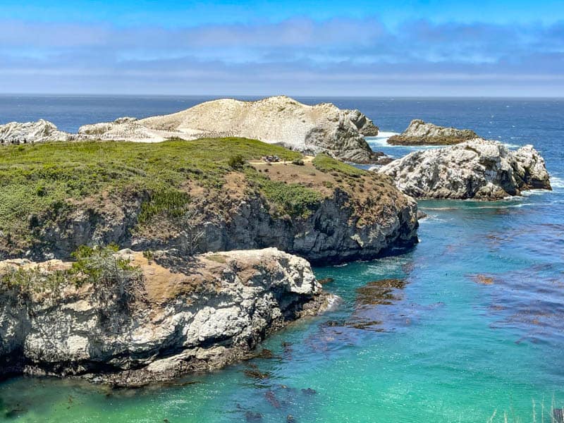
In season, you can watch harbor seals and their pups at China Cove. The pristine strip of sand is out of bounds for human visitors to the park.
You can, however, take the steep stairs down to the bigger Gibson Beach, where you can dip your feet in the ice cold water.
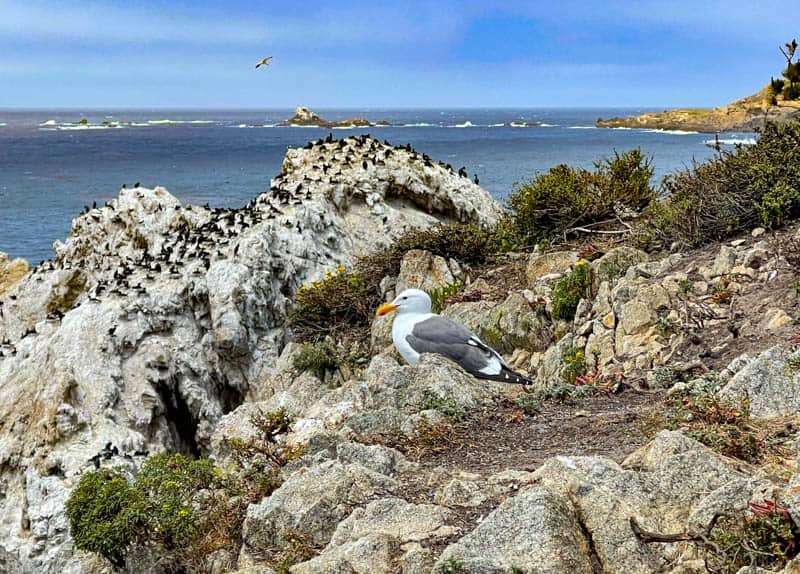
In April and May, hundreds of birds nest on Bird Island. With binoculars, you can get a great view of Western gull chicks hopping about on the islet.
Brandt’s cormorants can be seen by the hundreds, as well as the occasional brown pelican or black-crowned night heron.
Sometimes docents are here, with scopes, and will point out nests for you to see!
4. Soberanes Canyon and Rocky Ridge Loop Trail, Garrapata State Park
Difficulty: Strenuous
Length: 4.4 miles, loop
Elevation gain: About 1,750 feet
Time: About 2.5-3.5 hours
Trailhead: Along Highway 1 at Soberanes Point, see map
The Soberanes Canyon part of this hike (about 1.25 miles each way) goes through beautiful redwoods and is relatively flat, easy, and shaded.
You will cross gurgling Soberanes Creek, and see tons of wildflowers in season. At the time of writing, only this part of the trail is officially open.
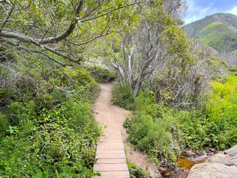
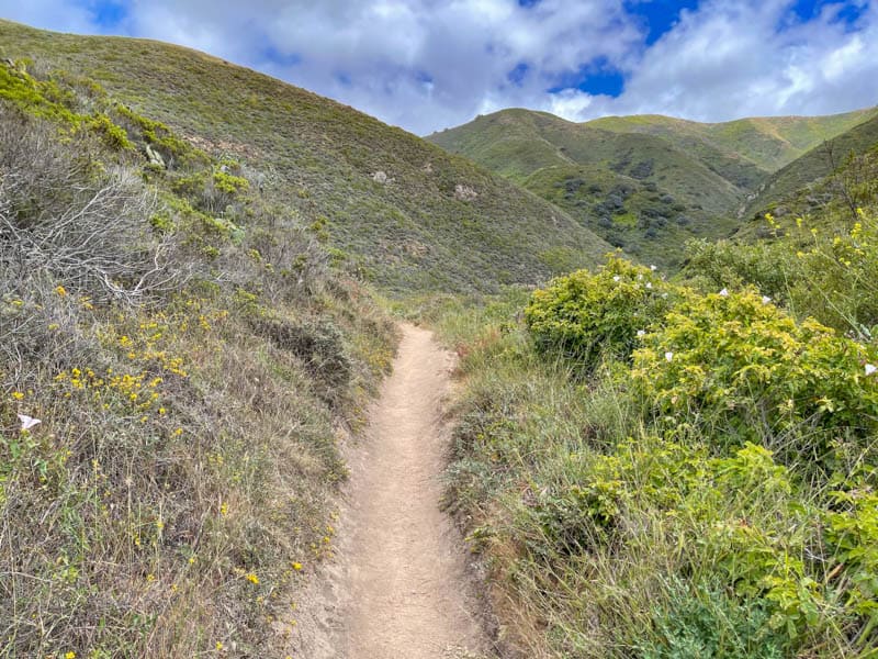
Rocky Ridge Trail is exposed, and offers panoramic views of the Pacific Ocean on one side, and hills and valleys on the other. In the spring, the entire trail is flush with wildflowers, and the hills are green: it’s undoubtedly the best time of year for this hike.
The climb to the top is strenuous though, with slippery sandy portions, so shoes with excellent grip and trekking poles are advised.
Also, going counter clockwise is a little easier, and on a clear day, you get excellent ocean views all the way down.
Pro Tip: The only parking is by the side of Highway 1, and this Big Sur hike is extremely popular. Arrive early to be assured of a parking spot, or visit during the week!
Note: The Rocky Ridge portion of this trail is still closed as of the end of 2023.
5. Soberanes Point and Whale Peak Trail, Garrapata State Park
Difficulty: Easy to low moderate
Length: 1.8 miles, loop
Elevation gain: About 300 feet
Time: About 1-1.5 hours
Trailhead: Along Highway 1 at Soberanes Point, see map
On the coast side of Garrapata State Park, the Soberanes Point and Whale Peak Trail winds through coastal scrub to a promontory above the Pacific Ocean.
Expect spectacular views on clear days. Soberanes Point is considered one of the best photo spots in Big Sur.
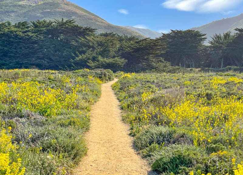
Look for sea otters and seals in the water, and migrating whales in season. You may also see sea and land birds, and lots of wildflowers in season.
Garrapata State Park trails tend to be less manicured than trails in some of the other Big Sur parks, so you may find some areas where the trail is overgrown.
As you return from the land side of the loop, be sure to climb the spur trail to the top of Whale Peak for a breathtaking view up and down the rugged Big Sur coast. This is a great trail to do at sunset!
We’ve also done the ocean facing portion of this trail as an out and back many times. The views are too incredible to give up just to complete the loop.
6. Bluff Trail, Garrapata State Park
Difficulty: Easy
Length: About 1.2 miles round trip, out and back
Elevation gain: About 50 feet
Time: About 30-45 minutes
Trailhead: Along Highway 1 at Garrapata Mile Marker 8, see map
Also at Soberanes Point, the short Garrapata State Park Bluff Trail is super scenic and can be comfortably fit into a brief visit to the region.
The views of the cliffs and the ocean are spectacular every step of the way. Sea birds and raptors are often sighted, and you may see whales during their migration.
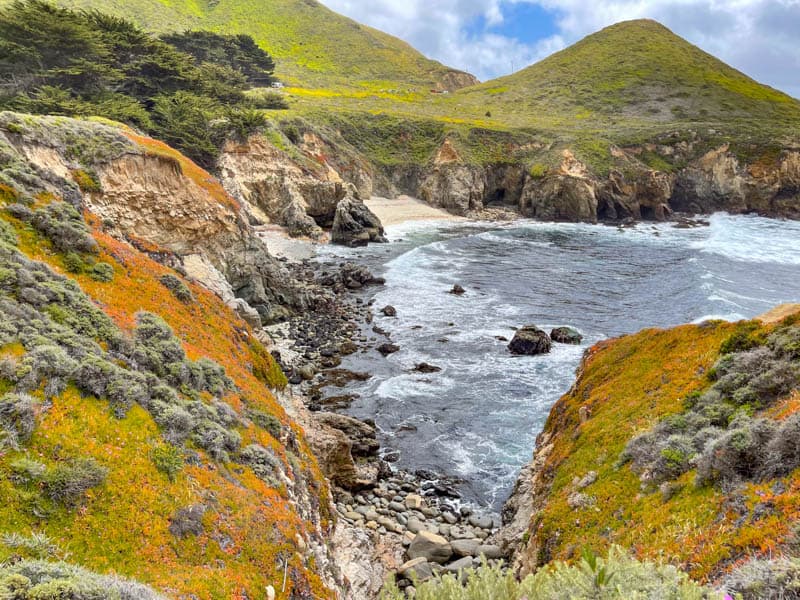
As you walk, do not forget to look down into the little pebbly coves fringed with pristine strips of sand, and toward the hills on the opposite side of the road.
The colorful rock faces just offshore are gorgeous, and you will see tons of wildflowers in season.
This short hike features a bridge and a series of small waterfalls, where Soberanes Creek runs into the Pacific Ocean, and a number of overlooks perfect for photos.
We entered at gate 8 and walked right along the bluffs, all the way over the bridge and up the steps at gate 7. We then retraced our steps to gate 8 along the water.
Entering at gate 7 makes for an even shorter hike, although you will miss some of the fabulous views near gate 8.
7. Garrapata Beach Trail, Garrapata State Park
Difficulty: Easy
Length: About 2 miles, out and back
Elevation gain: None
Time: About 60-90 minutes
Trailhead: Along Highway 1 at Garrapata Mile Marker 19, see map
The surf at Garrapata Beach does not allow for wading or swimming, but the beach makes for a scenic walk, with the mighty Pacific Ocean on one side, and the rugged Big Sur cliffs on the other.
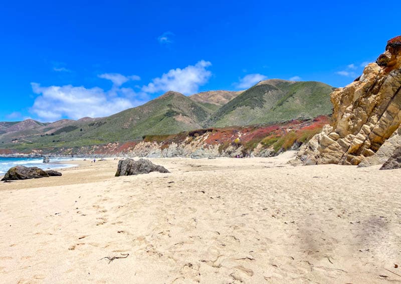
As you walk, look out to the water to see if you can spot migrating gray whales in season. Sea birds and raptors fly about overhead and you can hear their calls, along with the sound of the surf.
At the southern end of the beach, Garrapata Creek flows into the ocean, and somewhere around the mid point, you will see Doud Creek cut a course through the sand on its way to the ocean.
If you do not walking on sand, you may want to walk the bluff trail at the top of the beach instead. It roughly follows the beach, but meanders through coastal scrub and wildflowers (in season). The views of the water from the bluffs are beautiful.
8. Headlands Trail, Andrew Molera State Park
Difficulty: Easy to low moderate
Length: About 2 miles round trip, out and back
Elevation gain: About 50 feet
Time: About 1 hour
Trailhead: At Surfer’s Pullout, about 0.25 mile north of park entrance, or north end of parking area, see map
The Headlands Trail follows the Big Sur River and leads to Molera Point, a promontory with panoramic views up and down the coast. It is a good shorter hike to do in Andrew Molera, with a variety of landscapes.
If you start at the parking area, follow Trail Camp Trail by the river, as it cuts through live oaks and sycamores to an open spot, where the path from Surfer’s Pullout meets it.
You will then pass Cooper’s Grove, a grove of eucalyptus that provides overwintering for monarch butterflies. Continue along the wooded trail by the river until you climb to the viewpoint at the end of the trail.
From the viewpoint, you can see the mouth of the Big Sur River pooling on the beach, along with the coastline and the beach. Look for sea birds, migrating gray whales in season, and sea otters and sea lions.
9. Bluffs Trail via Creamery Meadow Trail, Andrew Molera State Park
Difficulty: Easy to low moderate
Length: About 5.4 miles round trip, out and back
Elevation gain:
Time: About 2-2.5 hours
Trailhead: Look for the trail sign near the Molera Ranch House Museum, see map
This is a fun combination of trails that allows you to experience some of the best of Andrew Molera State Park.
Start by fording the Big Sur River (or cross over the seasonal footbridge) and walk Creamery Meadow Trail through the pretty meadow to the bluffs above the Pacific Ocean. You will see lots of wildflowers in season.
The bluffs trail parallels the beach, so you have gorgeous views of the water and sand on the west and the hills and valleys on the east as you hike. Toward the end of Bluffs Trail, an optional small spur (Spring Trail) leads down to the beach.
Make it longer: Continue onto Panorama Trail from Bluffs Trail for superb views, and then take the Ridge Trail back to Creamery Meadow Trail to complete the loop. This loop is strenuous, at 8.8 miles and 1,100 feet of elevation gain.
10. Nature Trail and River Path, Pfeiffer Big Sur State Park
Difficulty: Easy (Nature Trail is accessible)
Length: About 0.6 mile, loop
Elevation gain: None
Time: About 30-45 minutes
Trailhead: Look for the signs near the day use parking lot by the entrance, see map
The River Path, in conjunction with the Nature Trail (and/or the Warden’s Path), is an easy loop that allows you to experience the Big Sur River and the different flora in the park, including coastal redwoods. It’s a great loop to do with young kids, and one of the signature Big Sur trails.
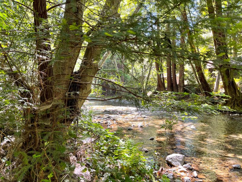
The Nature Trail starts at Day Use Lot Two. Pick up a pamphlet at the trailhead, so you can read about the flora you see along the trail, including bays, sycamores, and redwoods. There are twelve markers along the trail. You will likely see squirrels and birds.
Cross the park road to the River Path, the highlight of which is the impressive Proboscis Grove of coastal redwoods. The Proboscis Tree appears to have a nose sticking out of the trunk. The redwoods in the grove are several hundred years old and super tall.
The River Path then runs along the bank of the Big Sur River to the park amphitheater and the parking lot. You can hear the river gurgle as it flows over rocks and pebbles. The walk is serene and shaded.
11. Buzzard’s Roost, Pfeiffer Big Sur State Park
Difficulty: Moderate to strenuous
Length: About 3 miles round trip, out and back
Elevation gain: About 800 feet
Time: About 1.5-2 hours
Trailhead: Off Warden’s Path near the first day use parking area, look for trail signs
If you do the Buzzard’s Roost hike only for the view from the top, you may be disappointed. While the view is good, it is not as spectacular a payoff as some of the other high elevation viewpoint in the Big Sur region. It is an ocean view though!
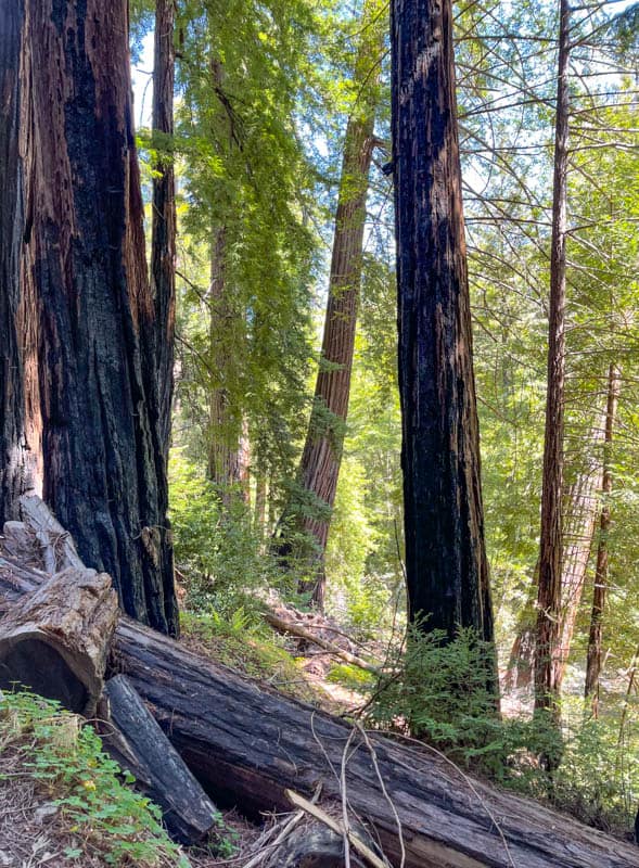
We enjoyed the Buzzard’s Roost Trail for the views of the river and the path through impressive redwoods and other park flora. Pfeiffer Big Sur State Park is known for its redwoods and is on the land side of Highway 1, so if you love trees and plants, you will love this trail.
The trail is shaded for the most part, with wildflowers in season, yellow banana slugs, and bright blue Steller’s jays flying about. At the loop, go counter clockwise for an easier climb to the top. At the top, enjoy the nice view (and try to ignore the tower!).
12. Valley View and Pfeiffer Falls Trail, Pfeiffer Big Sur State Park
Difficulty: Moderate to strenuous
Length: About 2 miles round trip, out and back
Elevation gain: About 550 feet
Time: About 1-1.5 hours
Trailhead: Off Nature Trail or River Path near the day use parking areas, look for trail signs, see map
The hiking trails in Pfeiffer Big Sur State Park are mainly about the redwoods, and Valley View Overlook Trail is no exception. The bottom part of the trail traverses a lovely redwood grove by Pfeiffer Redwood Creek. The understory of ferns and redwood sorrel is beautiful.
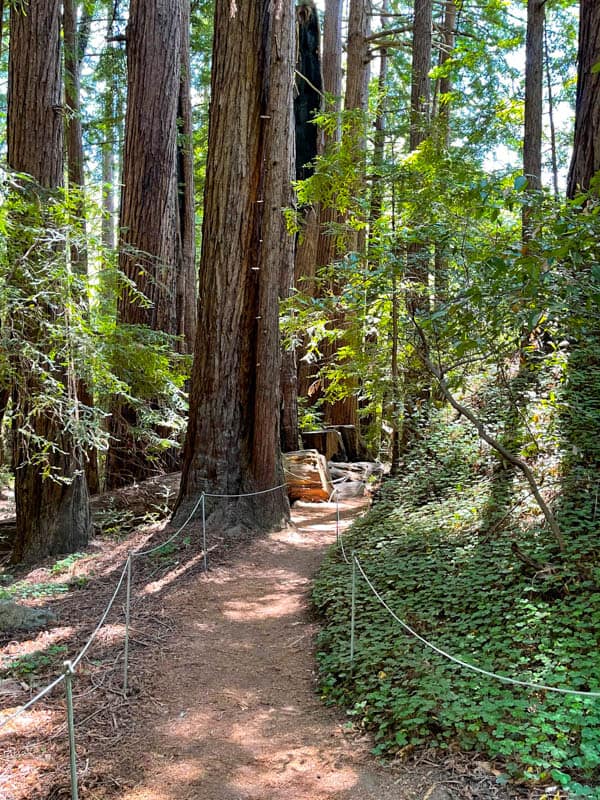
Once the trail starts climbing, you will leave the redwoods behind for pines and other trees. Wildflowers line the trail in the spring. Continue climbing until you reach a fork, where one trail leads to Pfeiffer Falls, and the other to Valley View Overlook.
The Pfeiffer Falls fork leads through redwoods in the gorge to the beautiful waterfall, where ribbons of water tumble about 60 feet down into a tranquil plunge pool below. It is the quintessential Big Sur waterfall hike.
Keep climbing until you come to a bench at the very top of the trail, from where you will get a fabulous view of the Big Sur River Valley. The view is beautiful in the spring, when the hills and valleys are green.
13. Pfeiffer Beach Walk
Difficulty: Easy
Length: About 2 miles round trip, out and back
Elevation gain: None
Time: About 1-1.5 hours
Trailhead: Off the parking lot at Pfeiffer Beach, see map
Pfeiffer Beach, with its famous purple sand, is one of the prettiest beaches you will find anywhere. It’s not a swimming beach, and walking it from end to end and back is the best way to appreciate its rugged beauty.
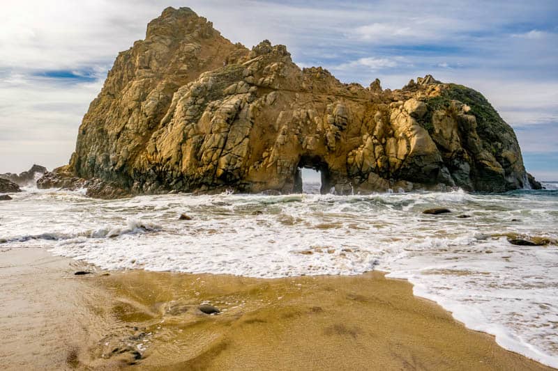
The beach comes up just steps from the little parking area.
As you walk, admire gorgeous Keyhole Rock, lying just off the beach, and other rock formations.
In the spring, you will find wildflowers on the rocks. Look down to note the purple crystals in the sand.
The views out to the ocean are spectacular on fog free days. You may see migrating whales spout or fluke if you visit in winter or spring.
You will find yourself stopping often to snap photos, and this is a wonderful sunset hike, especially if you visit in February, when the sun’s rays stream through the keyhole in Keyhole Rock.
14. McWay Falls Overlook Trail, Julia Pfeiffer Burns State Park
Difficulty: Easy
Length: About 0.5 mile round trip, out and back
Elevation gain: About 15 feet
Time: About 20-30 minutes
Trailhead: Near entrance to park at McWay Canyon, see map
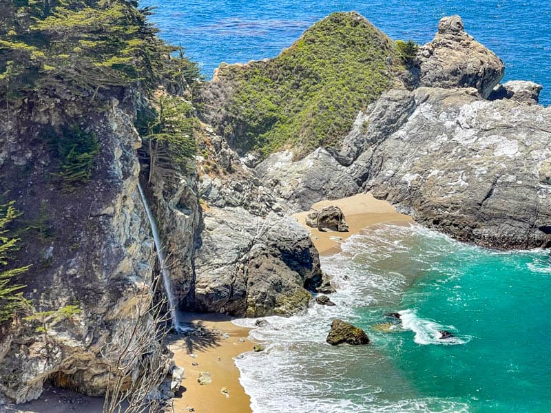
McWay Falls is one of Big Sur’s most photographed spots and the McWay Falls Overlook Trail is short and easy.
At the time of writing, the trail is open only to the first overlook, but you still get a good unobstructed view of the waterfall plunging into the pretty cove.
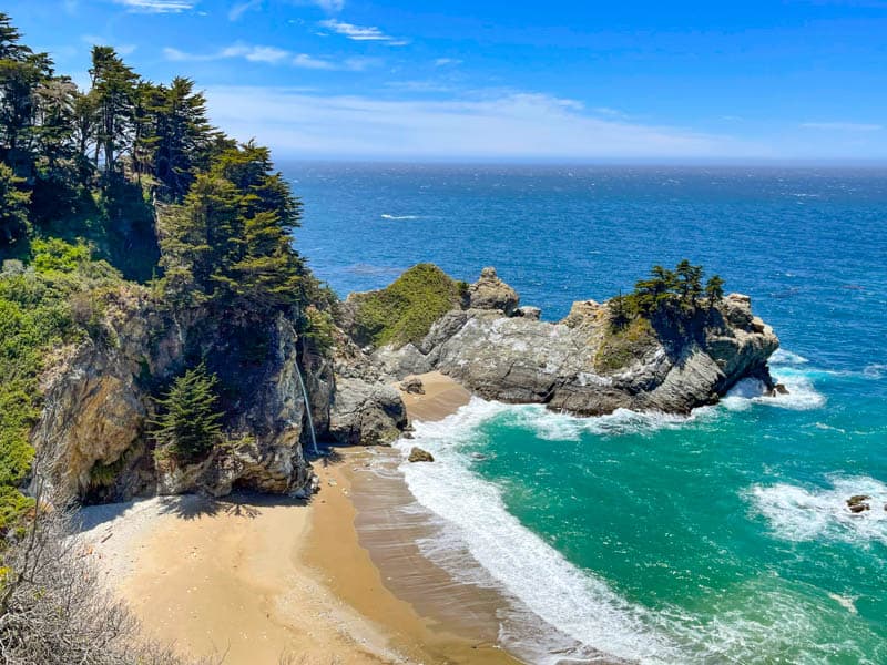
There are a few steps to descend at the start of the trail, but the rest of the trail is flat and wide. You go through a tunnel underneath California Highway 1 to get to the opposite side. There is no access to to the cove on account of the fragility of the landscape.
Look for birds: California condors can sometimes be seen roosting in the Eucalyptus trees by the trail. Enjoy wildflowers in season. The falls photograph better in the afternoon, and golden hour is a beautiful time to visit.
15. Partington Cove Trail, Julia Pfeiffer Burns State Park
Difficulty: Moderate
Length: About 2 miles round trip, out and back
Elevation gain: About 350 feet
Time: About 60-90 minutes
Trailhead: At Partington Cove turnout, about 2 miles north of McWay Falls, see map
One of the relatively lesser known Big Sur hikes, Partington Cove Trail features stunning ocean views, a little waterfall where Partington Creek drops to meet the ocean, a beautiful cove, and some historic sights.
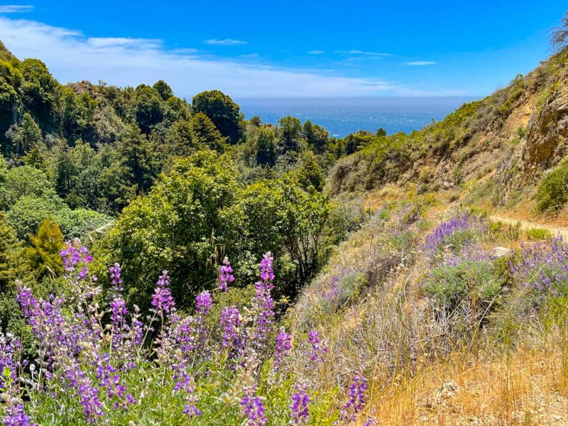
The trail is an old fire road, so it’s wide. We found it lined with pink mallow and purple bush lupine when we hiked it in mid May. From Highway 1, the trail leads steeply down to the water.
Along the way, a short spur allows you to walk beside Partington Creek for a bit.
The main trail leads across a bridge and a historic tunnel, before emerging at the beautiful cove. A spur leads to a beach where Partington Creek tumbles over rocks on its way to the ocean.
16. Tan Bark Trail, Julia Pfeiffer Burns State Park
Difficulty: Strenuous
Length: About 6.4 miles round trip, out and back
Elevation gain: About 2,000 feet
Time: About 3-4 hours
Trailhead: East side of Hwy 1 at Partington Cove turnout, about 2 miles north of McWay Falls, see map
One of the more strenuous Big Sur hiking trails, Tan Bark Trail (aka Tanbark Trail) starts with a walk through redwoods, along the side of Partington Creek. Soon you will begin to climb through a landscape of meadows and redwood groves, steeply at first, and then more gradually.
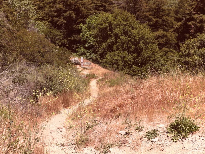
You will have occasional glimpses of the ocean en route, but the trail is mainly about the creek and the flora until you reach the top, where it ends at the Fire Road.
A short distance down on the Fire Road are the remnants of Tin House, which was built in 1944 and gutted in a 2008 wildfire. Here you have a spectacular view of the ocean and Partington Canyon.
Enjoy a break and the view, and then retrace your steps to the bottom. You can also follow the Fire Road down to California Highway 1. The road offers stunning water views.
A word of warning if you do the Fire Road loop: it will bring you down a short distance south of the starting point, and you will have to walk along the side of the highway to reach your car, with cars whizzing by too close for comfort.
17. Limekiln Falls Trail, Limekiln State Park
Difficulty: Easy to low moderate
Length: About 2.6 miles round trip, out and back
Elevation gain: About 250 feet
Time: About 1.25-1.5 hours
Trailhead: Just inside Limekiln State Park entrance, see map
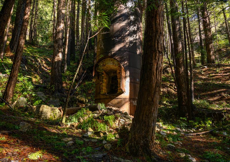
A trio of easy trails emanate from this trailhead: Hare Creek, Limekiln Falls, and Limekiln. It’s worthwhile doing all of them if you have the time. Limekiln Falls, with its 100 foot drop, is one of the more impressive waterfalls in Big Sur.
The out-and-back Hare Creek spur comes up just a short distance from the trailhead.
Walk along the side of the bubbling creek through redwoods and the understory of redwood sorrel, ferns, and pine needles. Very relaxing!
Return to the main trail and continue further up the canyon. The gurgling Limekiln Creek and redwoods keep you company. the next spur to come up leads to Limekiln Falls.
This spur is a little more uneven and requires some maneuvering among boulders, but your reward is the picturesque waterfall, which flows the best in winter and spring.
Back on the main Limekiln Trail, continue to the end, where you can see the historic lime kilns, built to extract lime from the rocks in the region.
Note: This trail is closed as of the end of 2023.
18. Salmon Creek Falls Trail
Difficulty: Moderate (some bouldering involved)
Length: About 0.3 mile round trip, out and back
Elevation gain: About 25 feet
Time: About 30 minutes
Trailhead: On the east side of California Highway 1, south of Salmon Creek Ranger Station, see map
This short out-and-back hike brings you close to Salmon Creek Falls, a powerful cascade of water in winter and spring.
The 120-foot waterfall tumbles down the rockface, creating an awesome sight. You will hear the falls almost as soon as you start hiking the trail.
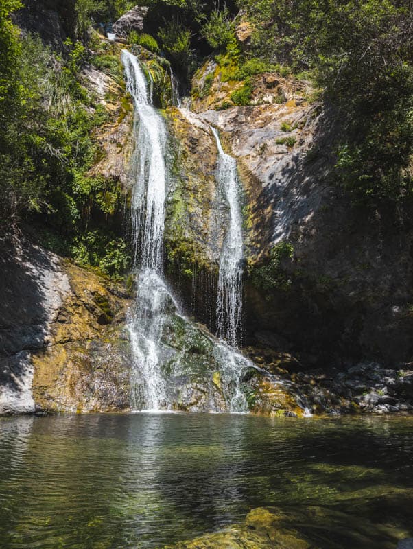
At the junction, take the left fork to proceed to the falls. Boulders are strewn about the landscape, and you may find more than one path to get near the falls. The landscape is beautiful with many mature bay trees, and light filtering down into the canyon.
A large boulder lies at the base of the falls. You can scale this boulder, if you are agile, to get to the base, but the view from the end of the trail is not bad at all.
Tips for Hiking Big Sur
Check for Trail Closures Before You Go
Winter storms, mudslides, wildfires, and landscape erosion can cause Big Sur hiking trails to be closed, partially or fully, sometimes for long periods of time.
Entire parks can be closed at times, and occasionally California Highway 1 may be closed.
To avoid disappointment, make sure to check which hiking trails in Big Sur are open before you visit.
If the trail you wish to hike is within a state park (Big Sur is home to six state parks + the Point Sur Lighthouse State Historic Park), check the park website for current trail information.
If the trail is outside of a state park but in Big Sur, call the Big Sur Station ((831) 667-2315) for up-to-date information.
Download Maps and Directions Prior to Your Visit
There is pretty much no cell reception along almost the entire length of Big Sur. While some parks offer hard copy brochures and trail maps, others do not.
There may be park maps on poster boards by the entrance kiosks or parking areas in some cases.
To save time and hassle, it’s best to come prepared with downloaded or printed trail maps and trailhead directions for the Big Sur hikes you plan to do on your visit.
If you like to travel with a hard copy map, consider this National Geographic trails map.
Helpful Navigation Devices
If you hike a lot, a GPS smartwatch can be a handy device to have. Check out this premium Garmin Fenix 6 (you can buy it on Amazon or you can buy it on REI), or the more affordable Garmin Instinct (on REI or Amazon).
Also consider the InReach Mini as a backup resource for navigation. With a satellite subscription, it enables you to send and receive texts when there is no cell phone reception. It is lightweight, and has tracking and SOS capabilities as well. Super helpful if you have a breakdown or are lost without cell reception!
Buy it on REI | Buy it on Amazon
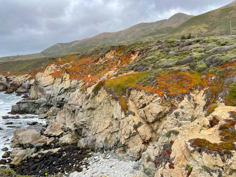
Fill Up Your Gas Tank Before You Enter Big Sur
Depending on how much of Big Sur you will cover, make sure to top up your gas tank before you drive into Big Sur. Gas is available at Big Sur Village, but it is usually very expensive.
Follow Trail and Park Safety Guidelines
Big Sur is wilderness. The region is home to myriad wildlife, and is also a place where you will find ticks and poison oak. Surf here is dangerous, tides can cut you off on beaches, and rocks by the ocean can be slippery.
The California State Parks site has hiking safety tips here and ocean safety tips here. Do your research prior to your visit and follow all safety guidelines and all park rules an d recommendations.
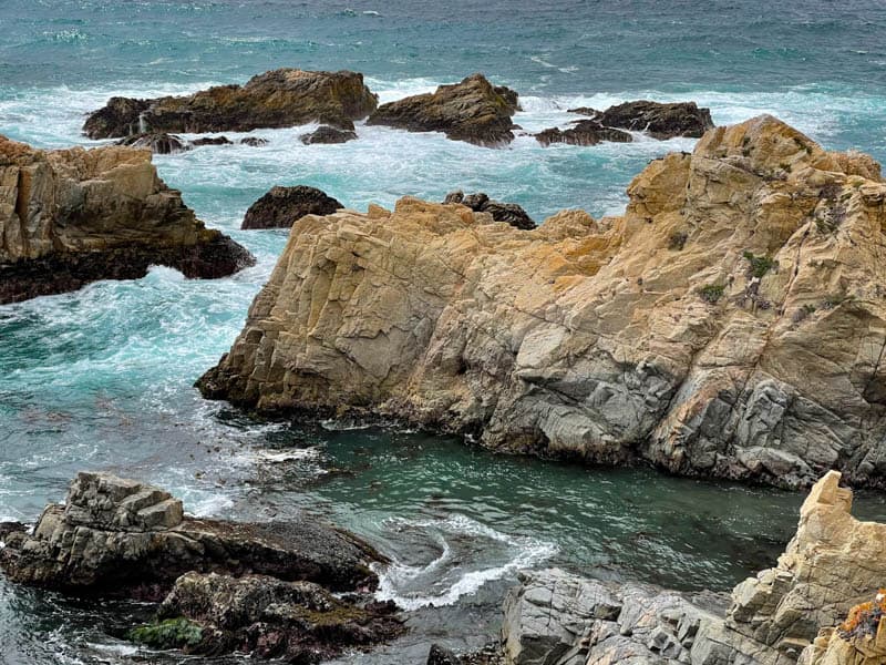
Note that dogs are not allowed on hiking trails in Big Sur. Leashed dogs may be allowed on some beaches and the trails leading directly to those beaches.
During a recent visit to Big Sur parks we saw visitors squeeze past barriers into closed off sections of trails, bring dogs on trails where signs clearly stated no dogs, and climb onto offshore rocks despite signs saying such climbing could be unsafe. Please do not be those visitors.
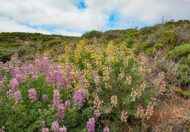
Wear Appropriate Hiking Attire
Some Big Sur trails are wide and well-maintained but others can be narrow and overgrown, especially the longer trails that go up into the mountains and ridges, or forested parts of trails.
To protect your skin, wear reasonably thick long pants and long-sleeved tops. Wear thick hiking socks and closed-toed sturdy shoes with good grip.
Dress in layers: it can be cool and breezy in Big Sur any time of the year, and a light warm jacket or windcheater will help you stay snug as you hike, especially early or late in the day.
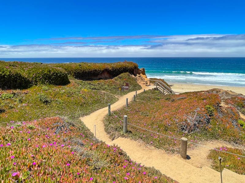
Bring Trekking Poles for Difficult Hikes
If you plan to do some of the more strenuous climbs and descents in Big Sur, you may wish to bring trekking poles to help with balance on uneven terrain and to take some of the strain off your joints as you hike.
We use the LEKI Micro Vario Carbon Trekking Poles, available on Amazon. They are light, durable, have comfortable grips, and they collapse for portability.
Use Sun Protection
Many Big Sur trails are fully or partially exposed. Use a wide-brimmed hat with SPF protection, sunscreen (we love this sunscreen), lip balm with SPF (love this 3-pack!), and sunglasses.
Wear Bug Spray
Bring and use bug spray to help repel ticks. You may also run into mosquitoes along some of the forested trails, especially by water. We sometimes use a natural bug spray, but we use a spray with DEET if necessary.
Bring Your Camera and Binoculars
Your smartphone will likely take good photos of the scenery if the day is clear and bright, but if you enjoy photographing birds, wildlife, or wildflowers, you may want to bring a camera with a good zoom lens.
We don’t usually carry our large camera and lens on hikes, unless the trip is a dedicated photo trip. Instead, we bring our little Panasonic Lumix DC-ZS70. It has a 30X zoom and Leica lens, and it fits into a pocket when we aren’t using it.

We also bring our Celestron Trailseeker compact binoculars: they are not too heavy, and they perform well in low light, when you can typically expect to see birds and animals.
Hike in the Spring for Wildflowers
Although Big Sur hiking trails can be hiked year round, spring is our favorite time of year to hike Big Sur. The mountains and hillsides are lush and green, waterfalls are in powerful flow, and there are numerous wildflowers along the trails.
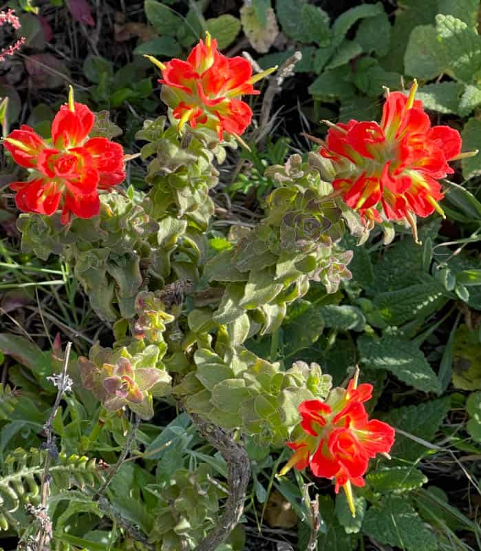
Even in a not-so-good wildflower bloom year, we found lots of color from wildflowers and flowering bushes when we hiked a few trails in mid May. Poppies, Indian paintbrush, wild mustard, and bush lupine were in peak bloom.
Although summer brings more daylight hours for longer day hikes, the marine layer tends to obscure views most mornings. It usually dissipates by mid day.
Fall and winter days are generally free of fog. Fall, however, is wildfire season. If there is a fire in the area, trails may be closed and air quality poor. Winter sunsets in Big Sur tend to be colorful, but winter is also the time when it rains in Big Sur.
Hike on a Clear Bright Day
One of the big enticements for hiking in Big Sur is the view of the Pacific Ocean, whether up close on a beach walk, or from above on a bluff or ridge trail.
For fabulous water views and the best photos, plan your Big Sur hiking for a bright clear day. Parks and other day use areas are generally open between sunrise and sunset.
Carry Plenty of Drinking Water
Bring adequate supplies of drinking water on your hikes, especially if you plan on doing some of the longer Big Sur trails.
Carry a filled hydration pack or filled water bottles with you, or bring along a water purification system if you will hike along creeks or rivers. We use this straw, available on Amazon.
Bring Food and Snacks
If you plan to do one or more of the longer hikes in Big Sur, pack food and snacks. There are restaurants along the Big Sur Coast, especially at Big Sur Village.
Bring Hiking Essentials
Pack these essentials in your daypack for hiking Big Sur: a first-aid kit, disinfecting wipes or hand sanitizer, headlamp (with spare batteries), and a pocket knife. Invest in a light and easy-to-carry daypack to stow food and other supplies so you can hike hands-free.
*****
Did you find this article informative? Pin it for later reference!
