Looking for the best scenic drives in California? You will be spoiled for choice, because there are so many spectacular drives all over the Golden State: in national parks, along the coast, and in the desert and mountains.
Whether you are looking for a short drive to enjoy the beautiful weather and the bounties of nature near your base in California, or you are considering a multi-day California road trip to discover some of its numerous natural wonders, California’s scenic drives deliver in spades.
Some links on this page may be affiliate links. If you click an affiliate link and make a purchase, we may receive a small commission, at no extra cost to you. For more details, refer to our disclosure.
In this article, we’ve rounded up some of the most scenic drives in California.
We’ve done many of the drives over and over, because we just can’t get enough of the magical vistas. We still have many more new routes to discover, though, so we will continue to add to the list!
TABLE OF CONTENTS
Short Scenic Drives in California
Multi-Day Scenic Driving Routes in California
Short but Stunning Scenic Drives in California
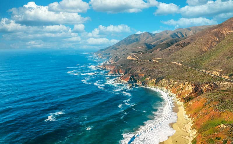
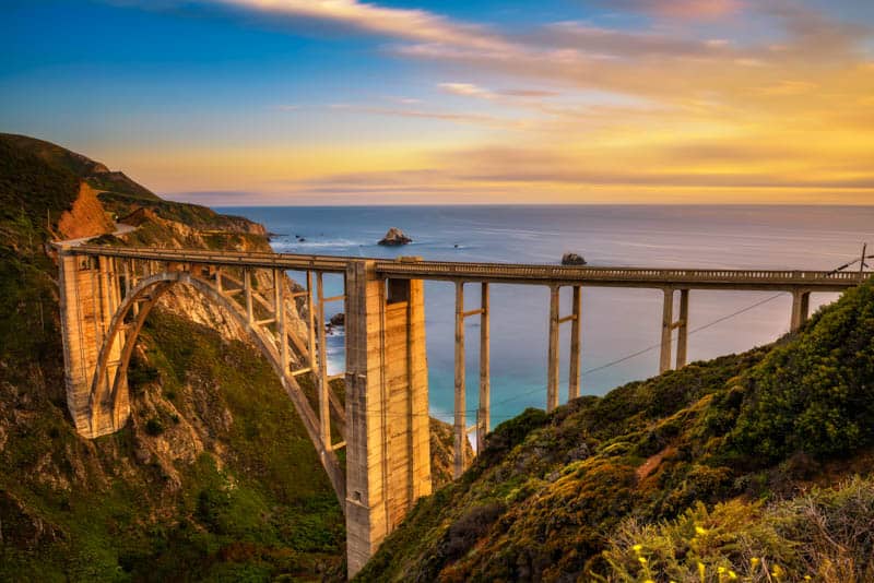
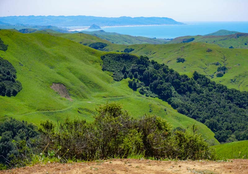
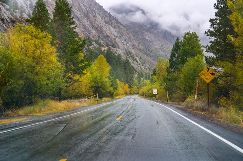
Big Sur Coast between Carmel and San Simeon
Driving Distance: 90 miles
Driving Time: About 2 hours
Don’t have the time for the entire PCH? Drive the 90 miles of highway along the Big Sur Coast, between Carmel-by-the-Sea and San Simeon, to enjoy some of the most spectacular coastal scenery on the planet.
While you can drive the Big Sur Coast in a day (or even a few hours if that’s all you have), you can also do a two-day Big Sur road trip and soak in the beauty of the region at leisure.
You certainly won’t tire of the views, and there are lots of things to do in Big Sur.
Big Sur offers several state parks for hiking, a historic light station you can tour, many beautiful waterfalls, and Pfeiffer Beach, with its beautiful purple sand. McWay Falls, Bixby Creek Bridge, and Ragged Point are must-stop photo stops.
While Big Sur is beautiful year-round, know that summer brings coastal fog in the mornings, fall is wildfire season in California, and winter sometimes sees rain storms and mud slides that can close Highway One in the region.
Check to make sure there are no closures before you head out.
Silverado Trail through Napa Valley
Driving Distance: 29.8 miles
Driving Time: About 45 minutes
We’ve never visited Napa Valley without driving Silverado Trail up and down at least once. The “old” two-lane road through the valley, Silverado Trail runs parallel to Highway 29, the main Napa Valley artery.
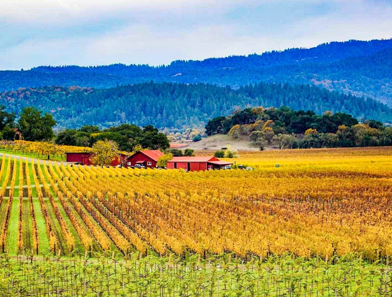
The picturesque wine country drive is about 29 miles in length, and connects Napa in the south of the valley to Calistoga in the north.
Along the way, there are cross roads that connect to Highway 29 if you want to stop and explore Saint Helena or Yountville.
Silverado Trail features endless views of vineyards, picturesque red-roofed barns, the hills on the east, and the countryside.
You will find several beautiful Napa Valley wineries along the route, if you want to plan tastings. Some wineries allow you to picnic on their grounds, so plan ahead if you want to enjoy a meal on your drive!
If you are looking to splurge on a stay, short detours take you to some of the most exclusive resorts in Napa Valley: Auberge du Soleil in Rutherford, Solage in Calistoga, and Meadowood in Saint Helena.
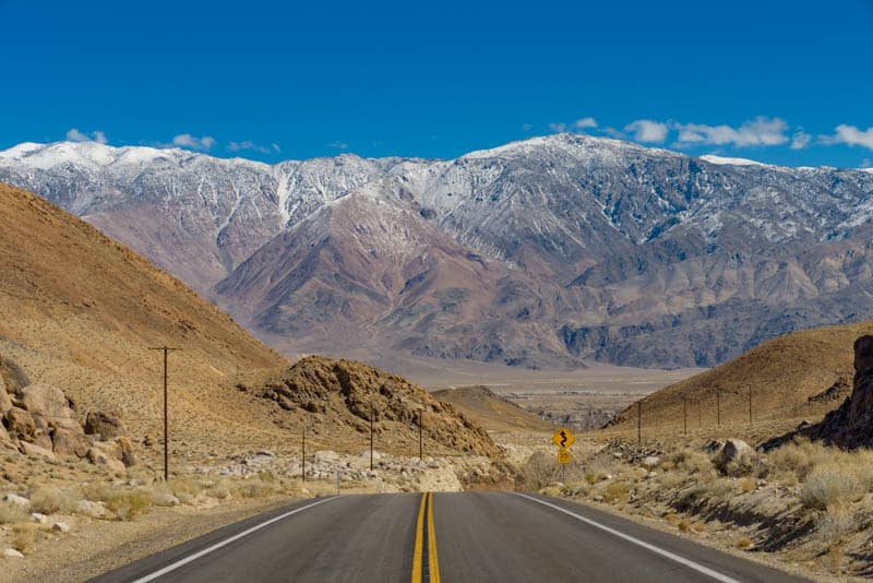
Movie Road in the Alabama Hills
Driving Distance: 7.8 miles
Driving Time: About 25 minutes
At under 8 miles one way, Movie Flat Road / Movie Road in the Alabama Hills is one of the shorter drives in our round-up.
But does this drive pack a punch when it comes to stunning scenery! The drive is a definite must-do if you plan to visit the laid-back Eastern Sierra town of Lone Pine, California.
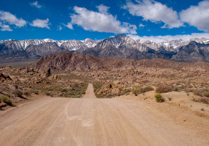
Featuring up close views of the beautiful rock formations of the Alabama Hills and the craggy peaks of the Sierra Nevada in the distance, Movie Road is a favorite photo spot for Instagrammers and landscape photographers.
Along the route, you can stop to explore the many natural arches in the Alabama Hills.
Mobius Arch, accessed via a short trail, is the most famous, but you will find many other arches to photograph as well. The area served as the location for dozens of Westerns.
Connecting Whitney Portal Road to Moffat Ranch Road, Movie Road is a graded dirt road that is generally maintained for sedans.
Other dirt roads leading off the road may be sand, so plan ahead and bring a 4X4 if you want to explore the back roads of the Alabama Hills.
Palms to Pines Scenic Byway Near Palm Springs
Driving Distance: 42 miles
Driving Time: About 60 minutes
The Palms to Pines Scenic Byway is a cool drive that takes you from the palm trees of the Sonoran Desert to the pine forests of Mount San Jacinto in about an hour.
It is one of our favorite scenic drives in Southern California.
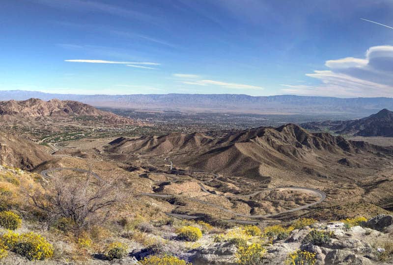
Officially California Highway 74, the scenic drive connects the desert city of Palm Desert near Palm Springs with the mountain community of Idyllwild.
Scenic overlooks along the route offer panoramas of the desert floor, and there are tiny communities to explore along the way.
At Idyllwild, you can turn and retrace your route back down, or continue on to California Highway 243 to Banning, where you can catch the Interstate back to your start point.
The route from Palm Desert to Banning is about 67 miles, and makes for one of the easiest day trips from Palm Springs you can do.
You will want to do this drive when the weather is good: heavy snow accumulations during winter snow storms can cause closures and delays and may require snow chains at the higher elevations.
17-Mile Drive in Monterey
Driving Distance: 17 miles
Driving Time: About 60 minutes
If you are planning a trip to Monterey or Carmel-by-the-Sea, make sure you put the 17-mile drive through Pebble Beach on your itinerary!
The drive connects Pacific Grove and Carmel, and features beautiful ocean views if you pick a bright fog-free day.
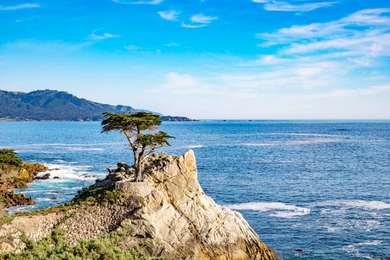
There are 17 stops along the scenic drive, but if you are pressed for time, just the drive is beautiful. There is a fee to drive the road, but it is reimbursed if you spend a certain amount at one of the restaurants along the drive.
The Lone Cypress is the most popular stop on the 17-Mile Drive: the brave little tree stands on a rock just above the ocean and is a favorite subject of landscape photographers and plein air painters, as are the ghost trees at Pescadero Point.
Spanish Bay Beach makes for a lovely stroll. Crocker Grove is home to native Monterey Cypresses, one of only two locations where you can find them. The other is Point Lobos State Natural Reserve, near Carmel-by-the-Sea.
Pebble Beach Golf Links is world-famous.
California SR190 through Death Valley National Park
Driving Distance: 131 miles
Driving Time: About 2 hours and 15 minutes
California Highway 190 is the main road through Death Valley National Park, and features some of the park’s signature sights.
It connects Olancha, at the western end of the park in California, with Nevada SR 160 in the east, a little north of the town of Pahrump.
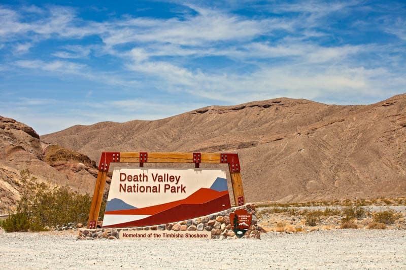
Along the route, you will be awe-struck by the majestic desert landscapes for which Death Valley is famous, from sand dunes to badlands and canyons.
Mesquite Flat Sand Dunes and the scenic overlook at Zabriskie Point are Death Valley must-not-miss sights.
Stop for a little bit of Death Valley history at the Harmony Borax Works, where you can see a double wagon from the 20-mule days.
If you have the time, do the detour up to Dante’s View, the highest point in the park that you can access in a vehicle. There are vehicle size limits, though, so check before you visit.
There is an entrance fee for Death Valley National Park.
The National Parks pass is accepted, so bring yours if you have one. If you do not, but plan to visit three or four parks this year, save some money by picking up an annual pass online at REI!
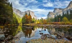
Tioga Road through Yosemite National Park
Driving Distance: 72.2 miles
Driving Time: About 2 hours and 45 minutes
Officially California State Route 120, Tioga Road traverses Yosemite National Park in an east-west direction. It goes over Tioga Pass, the highest automobile pass in California, and offers stunning sights en route, from redwood groves to granite cliffs.
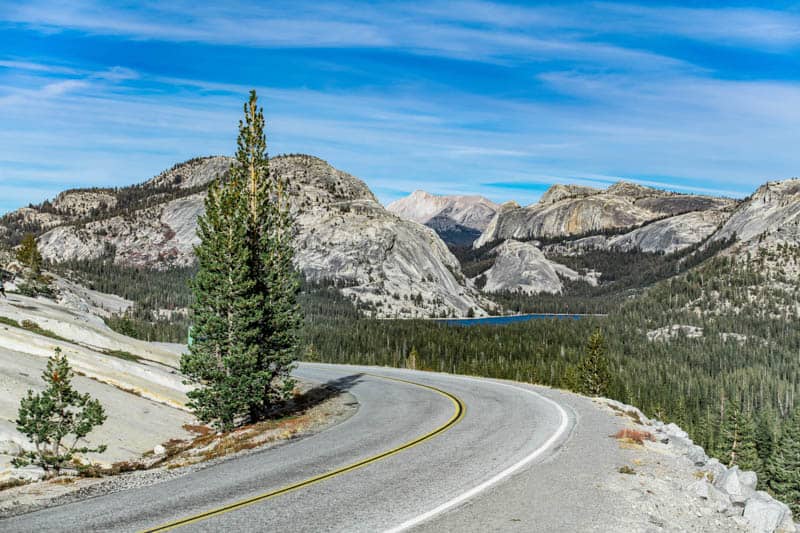
Although Highway 120 extends further in both directions, if you are pressed for time, the stretch through Yosemite National Park, along with the descent from Tioga Pass to Lee Vining, is the most scenic section of the road.
Olmsted Point is one of Yosemite’s iconic viewpoints, and offers panoramas of the park’s granite cliffs right from the parking lot.
Tenaya Lake is a serene alpine lake with a beach and lake shore hiking. Ellery Lake and Tioga Lake are other sparkling alpine lakes en route.
Tioga Pass road is only open from the end of May or early June until late October or early November. Exact dates in any year are dependent on snow accumulations.
In the summer, you will see tons of wildflowers along the road and at Tuolumne Meadows.
Park Boulevard in Joshua Tree National Park
Driving Distance: 23.5 miles
Driving Time: About 40 minutes
Park Boulevard runs east-west along the northern section of Joshua Tree National Park, where you will find the Mojave Desert part of the two-desert park.
The drive is very scenic, with large boulder formations and different types of desert flora.
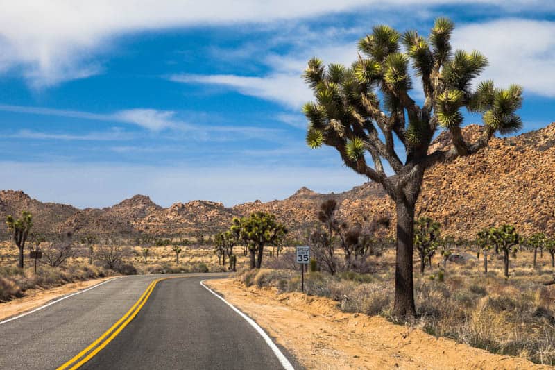
Although the drive is short, you will want to allow plenty of time, because a number of Joshua Tree National Park’s signature hikes and attractions are found along Park Boulevard.
There are plenty of opportunities for rock scrambling, for kids and adults alike.
Hidden Valley Nature Trail and Barker Dam Nature Trail, in our opinion two of the best hikes in Joshua Tree National Park, are relatively short and easy trails. The more challenging Ryan Mountain Trail is also accessed from Park Boulevard.
Even if you choose not to hike, you will see lots of great scenery along Park Boulevard, including Skull Rock, one of Joshua Tree’s most famous photo spots.
A detour from Park Boulevard will bring you to Keys View, which offers spectacular panoramas over the Coachella Valley and the Salton Sea, along with views of surrounding mountain peaks.
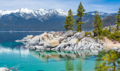
Lake Tahoe Scenic Drive
Driving Distance: 72 miles
Driving Time: About 3 hours
Lake Tahoe is not only one of the most beautiful lakes in California, it is also one of the largest.
The lake actually straddles the California-Nevada border, and you can drive all around the lake, along US Route 50 and state highways 89 and 28.
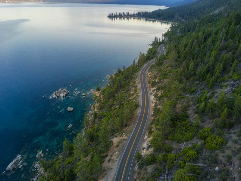
Many sections of the road hug the water, offering beautiful views. Emerald Bay State Park, on the west shore, has a scenic overlook right off the road that offers stunning views of the bay and Fannette Island, Lake Tahoe’s only island.
On the Nevada side, Sand Harbor State Park has a lovely interpretive boardwalk trail and a picture postcard beach.
There are beaches all around the lake, and boat rentals are available as well, so there is plenty to do along the drive.
Numerous hiking trails lead from the road into the surrounding mountains.
Lake Tahoe doesn’t freeze in the winter, so the water views stay the same sensational deep blue all through the year.
For easier driving, however, pick any time from late spring until the fall, when you are less apt to run into snowstorms. Fall also brings beautiful leaf color.
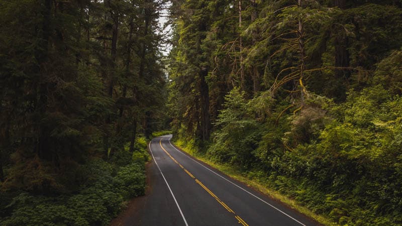
Howland Hill Road in Jedediah Smith Redwoods State Park
Driving Distance: 10 miles
Driving Time: About 40 minutes
At just ten miles, Howland Hill Road is one of the shorter drives in our round-up, but it features some of the best old-growth redwoods in the Golden State.
So if you are planning a trip to the Redwood National and State Parks, add this drive to your itinerary for Jedediah Smith Redwoods State Park!
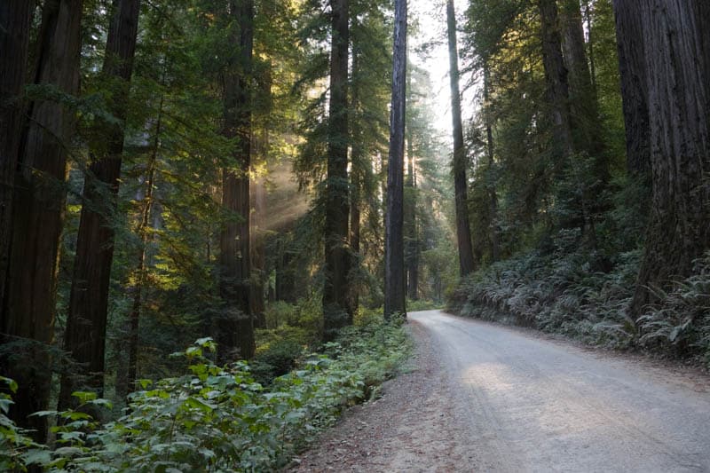
Howland Hill Road offers access to Stout Grove, where you can stroll among enormous coastal redwoods. The grove’s colors shine in the late afternoon.
Also along the drive you will find the trailhead for the more challenging Boy Scout Trail, which features a waterfall and the Boy Scout Tree, which is over 300 feet tall.
The scenic drive connects Crescent City along the coast to the little town of Hiouchi by the Smith River.
It is a narrow unpaved road, not suitable for trailers. Be sure to check road conditions before you head out, especially during and after rains.
California State Route 46 between Paso Robles and CA Hwy 1
Driving Distance: 21.5 miles
Driving Time: About 25 minutes
One of our favorite drives on the California Central Coast, State Route 46 west of Paso Robles is lined with vineyards and rolling hills dotted with oaks.
It is scenic is any season, but especially so in the spring, when the hills are green, vines are budding, and there are colorful wildflowers everywhere.
Make sure to pull over and park at the three overlooks near the western end of the drive by CA Highway 1 for fabulous views over the hills and valleys to the Pacific Ocean beyond.
On clear days, you can see Morro Rock rising up from the water in the distance.
If you enjoy wine, many of the wineries located along California SR 46 West offer tastings, and some offer food as well.
At Niner Wine Estates, snap a photo of the famous heart-shaped copse of trees on the hillside.
Newton B. Drury Scenic Byway in Prairie Creek Redwoods State Park
Driving Distance: 10 miles
Driving Time: About 25 minutes
A paved two-lane scenic road that runs through the heart of Prairie Creek Redwoods State Park in Northern California, the Newton B. Drury Scenic Parkway is a must-do when you are in redwoods country.
The 10-mile drive through old-growth redwoods is a scenic alternative to Highway 101, and offers you the opportunity to see Roosevelt elk.
Unlike other scenic drives in Redwood National and State Parks, this drive is suitable for RVs and trailers, and gives all visitors the chance to experience driving through a tunnel of tall coastal redwoods.
Along the drive, you will find several trailheads. The Big Tree is a 200 yard walk from the parking area, and the area features other big trees as well. The Ah-Pah Interpretive Trail is another really short walk to a nice redwood grove.
California County Route 22 through Anza-Borrego Desert State Park
Driving Distance: 21 miles within the park
Driving Time: About 60 minutes
Anza-Borrego Desert State Park is the largest of California’s state parks, and features beautiful badlands and desert landscapes.
In a good bloom year, the park puts on one of the most colorful spring wildflower shows in the Golden State.
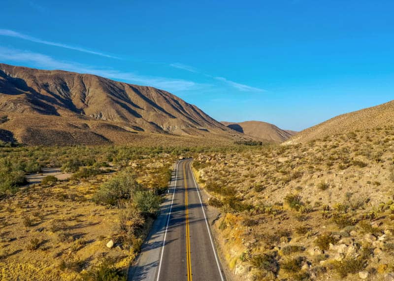
County Route S-22, also called Borrego-Salton Sea Way, is fully paved, one lane on each side, and can be driven in a passenger sedan.
But it is worthwhile arriving in a 4X4 so you can explore some of the dirt roads that lead off S-22 to epic hikes and fabulous overlooks.
Font’s Point offers spectacular views of the Anza-Borrego badlands and is simply otherworldly at sunrise.
Santa Rosa Overlook features views of the Santa Rosa Mountains and Clark Valley.
Calcite Canyon Overlook, at the eastern end, offers panoramas of the canyon and majestic rock formations.
Like other desert drives, County Route S-22 is best driven between late fall and mid spring, for the best weather to explore.
You can drive it from Ranchita in the west, or the Visitor Center at Anza-Borrego, to the park border, or even all the way to Salton City in the east.
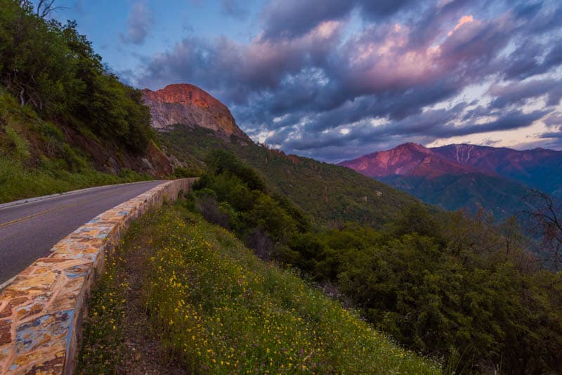
Generals Highway through Sequoia and Kings Canyon National Parks
Driving Distance: 50 miles
Driving Time: About 2 hours
The scenic Generals Highway connects Sequoia and Kings Canyon National Parks and the Giant Sequia National Monument.
Drive from Three Rivers, near the southern entrance to Sequoia National Park, to the junction with California State Route 180, just south of Grant Grove Village in Kings Canyon National Park, or vice versa.
Along the route, you can stop and explore groves of giant sequoia trees, hike, or admire waterfalls.
There are numerous scenic overlooks where you can park for photos. The views of the Sierra Nevada peaks are magnificent. Keep your eyes peeled for birds and wildlife.
The high-elevation road is winding and narrow with lots of switchbacks, and is considered difficult to drive. There is a restriction on vehicle length on some sections.
Part of all of the road may be closed in winter on account of snow accumulations, so this drive is best done between late spring and early fall. That’s when the road is most crowded, though, so allow plenty of time.
June Lake Loop (California State Route 158)
Driving Distance: 16 miles
Driving Time: About 30 minutes
The Eastern Sierra of California has so many scenic drives that you could pretty much point your vehicle in any direction and you will find stunning scenery to admire.
But even in such a scenic region, the June Lake Loop is a must-not-miss drive.
The horseshoe-shaped paved loop road starts and ends at Highway 395, and is just about 16 miles in length.
Along this short length are crammed four beautiful lakes, along with a wealth of spectacular views of the surrounding Sierra Nevada Mountains.
If you have the time, there are lots of things to do in June Lake, all along the drive: hiking, boating, fishing, beach activities, and horse back riding.
If you do not, the drive itself is beautiful, especially in the fall, when the striking yellows and oranges of aspen and willow light up the roadsides.
June Lake Road is partly closed in the winter due to snow accumulations. While the scenery is breathtaking in the winter, the loop drive is best done from late spring through the fall.
Artist’s Drive in Death Valley National Park
Driving Distance: 9 miles
Driving Time: About 22 minutes
Artist’s Drive is a 9-mile scenic loop in Death Valley National Park. The drive is famous for the Artist’s Palette viewpoint, where you can see a particularly colorful mass of mineral deposits on the hillside, but the drive as a whole is very scenic as well.
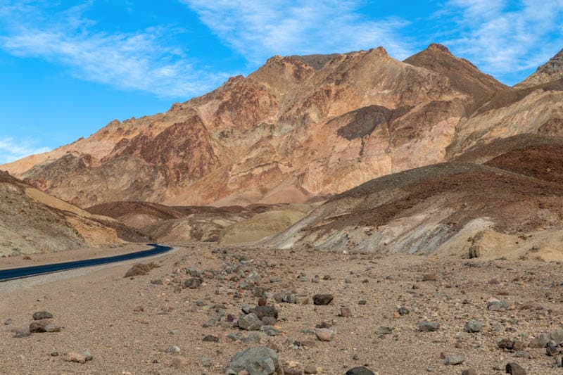
The paved road is one narrow lane each way, and the drive is winding, with lots of dips and climbs. There is a vehicle length restriction. Artist’s Palette comes up about five miles into the drive. Scenes from Star Wars: A New Hope were filmed here.
At the official parking lot for Artist’s Palette, you can step down into the wash and walk over the mineral deposits to admire the colors from up close.
From lavender and green to yellow, orange, and rust, the colors will wow you with their stark beauty.
Late afternoon is considered the ideal time to do this drive, to see the colors at their best. But if you are looking for great photos, a cloudy time might produce richer colors without harsh shadows.
Bald Hills Road in Redwood National Park
Driving Distance: 17 miles
Driving Time: About 30 minutes
Bald Hills Road in Redwood National Park, just a little north of Orick in Northern California, makes for a wonderful drive, especially in the late spring, when carpets of wildflowers create color along the route.
Part of the road is paved and part is gravel.
While the beginning of the western end of the drive does feature some old-growth redwoods, later in the drive you will be treated to a variety of landscapes, from hills and valleys to open prairies.
Highway 101 offers the most convenient access to Bald Hills Road.
Look for wildlife along the drive: aside from Roosevelt elk, you may see bear, and raptors in the sky. Lady Bird Johnson Grove, one of the best easy hikes in the park, lies along Bald Hills Road.
Redwood Creek Overlook offers dramatic vistas of forest and ocean.
If you enjoy local history, the Lyons Ranch Historical District, listed on the National Register of Historic Places, is a must-explore, with its picturesque barns and sheds.
Lyons Ranch is a good place to turn back if you wish to return to Highway 101.
Lassen Peak Highway Through Lassen Volcanic National Park
Driving Distance: 29 miles
Driving Time: About 40 minutes
The beautiful Lassen Peak Highway, officially California State Route 89, runs through Lassen Volcanic National Park, featuring spectacular scenery and allowing access to the geologic and hydrothermal wonders in the park.
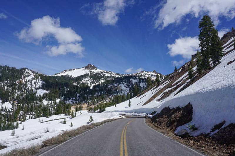
Connecting the Kohm Yah-mah-nee Visitor Center in the southwest part of the park to the Manzanita Lake entrance in the northwest, the drive winds its way past several beautiful alpine lakes as well as Sulphur Works and Bumpass Hell, the two major hydrothermal areas in the park.
The road climbs to an elevation over 8,500 feet at its highest point, where an overlook allows you to savor the sight of majestic Lassen Peak. The trailhead for the summit starts here.
The route is part of the Volcanic Legacy Scenic Byway, a 500-mile All American Road that also traverses Lava Beds National Monument, Tule Lake National Monument, and Crater Lake National Park in neighboring Oregon.
Drive Lassen Peak Highway in the summer and fall, when it is fully open to vehicular traffic.
Whitney Portal Road in Lone Pine, CA
Driving Distance: 13 miles
Driving Time: About 30 minutes
Whitney Portal Road is about 13 miles one way. It connects the town of Lone Pine with Whitney Portal, more than half way up the tallest mountain in the contiguous United States.
It offers stunning views along its entire length.
The two-lane road is fully paved, and is generally open between May and November, when snow shuts it down for the winter.
At Whitney Portal, you will find campgrounds, a cafe and store, and trailheads for hikes leading to the John Muir Wilderness and Sequoia National Park.
The road leads from Lone Pine into the Alabama Hills, where you can admire the gorgeous rounded rock formations and numerous natural arches.
Then it heads straight for the Sierra Nevada mountains, and finally up the mountain via a series of switchbacks, with panoramas at every turn.
Whitney Portal Road is narrow, curvy, and steep. As you climb, it gets steeper and steeper. Some parts are very narrow, with blind corners. It is definitely not a drive for the faint of heart!
Avenue of the Giants (California State Route 254)
Driving Distance: 31 miles
Driving Time: About 25 minutes
An easily accessed, yet dramatically beautiful drive through some of the most majestic redwoods in Northern California, the Avenue of the Giants in Humboldt County is a little over 30 miles long.
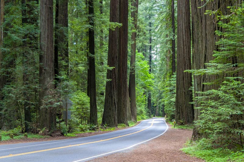
The stretch of scenic road is a part of the old Highway 101, and cuts through Humboldt Redwoods State Park, which contains the largest surviving stand of old-growth redwoods on the planet.
Along the scenic route you will find trailheads for hikes through the redwood groves. You can also access scenic Eel River for swimming and fishing. But just the drive is enough reason to take this scenic route.
Also along the avenue you will find a number of small charming communities, where you can browse souvenir shops or get supplies for a picnic meal.
The Shrine Drive-Thru Tree is located at Myers Flat.
Pepperwood, Redcrest, Weott, Miranda, and Phillipsville are other towns on the route.
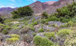
Soda Lake Road through Carrizo Plain National Monument
Driving Distance: 37 miles
Driving Time: About 60 minutes
Soda Lake Road is a two-lane road that runs through the Carrizo Plain National Monument in southeastern San Luis Obispo County.
It runs past Soda Lake, a saline lake that is dry most of the year but attracts lots of birds when it has water in it, generally in the winter and early spring.
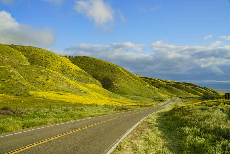
The road is super scenic in the spring of good bloom years, when gigantic carpets of wildflowers line both sides of the road. Hills in the distance are covered with carpets of yellow, orange, and purple as well, making for spectacular views all along the drive.
While the drive is not to be missed in the spring of a superbloom year, it is also worth doing when wildflowers are not in bloom, to see the vast plain, a relic of California as it was before agriculture and urbanization changed the landscape forever. Keep an eye out for pronghorns!
The northern section of the road is paved, but the southern section is gravel.
Although deemed passable to regular sedans in dry conditions, the unpaved section is quite rough, so be prepared to drive slow and expect a bumpy ride, or come in a 4WD high-clearance vehicle, which will also allow you to explore side dirt roads.
Rim of the World Scenic Byway
Driving Distance: 110 miles
Driving Time: About 2 hours and 20 minutes
One of the most beautiful scenic drives in Southern California, the Rim of the World Scenic Byway traverses the mountains and lakes of the Inland Empire. It is easily accessed from LA or San Diego.
The drive features stunning views of the San Bernadino Mountains. Stop at the Silverwood Lake overlook for a fabulous view of the lake.
Do the short detour to beautiful Arrowhead Lake before moving on to Big Bear Lake, where lots of fun activities await in every season.
Running along the crest of the San Bernadino Mountains, the Rim of the World Scenic Byway is a combination of California Highways 138, 18, and 38.
Along the route, services are available at the towns of Phelan, Crestline, Running Springs, and Mentone.
While you can do the drive year round, you will require snow chains in the winter. For easier driving conditions, do the drive from late spring through fall. Spring brings colorful wildflowers, and fall brings rich leaf color.
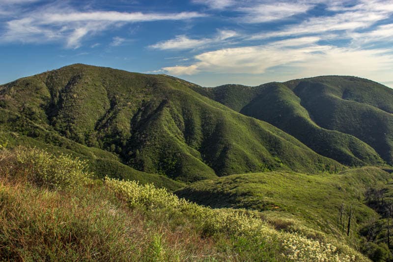
Angeles Crest Highway
Driving Distance: 66 miles
Driving Time: About 2 hours
The Angeles Crest Highway runs east-west from La Cañada Flintridge, in Los Angeles County, to the junction with California State Route 138.
Officially California State Route 2, it is one of the most scenic driving routes in Southern California.
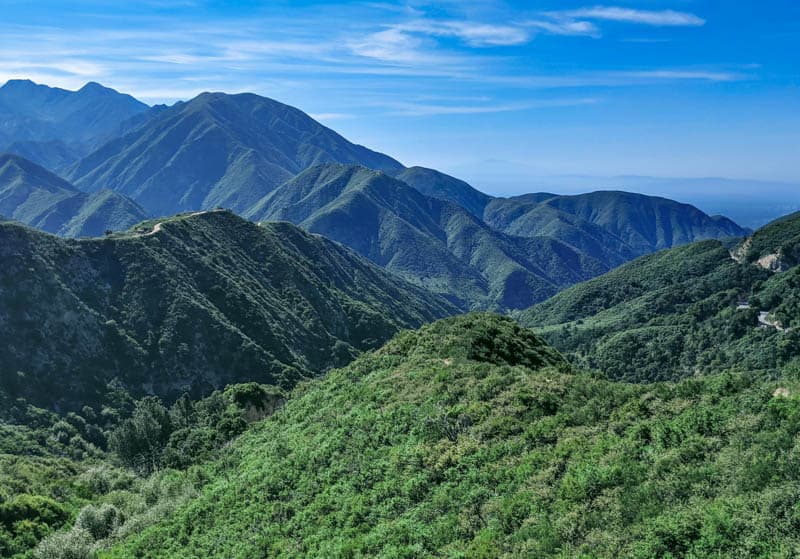
The scenic byway makes its way through the chaparral and montane of Angeles National Forest, before ascending to the ridges of the San Gabriel Mountains. The views of the mountains from the road are spectacular.
If you plan to do a day trip, pack a picnic lunch that you can enjoy en route, and find a hiking trail or two to stretch your legs. There are overlooks where you can park and snap photos of the scenery.
If you wish to make a weekend of it, you will find camping at Chilao or at Buckhorn Campground. Cooper Canyon Falls nearby is worth the hike, especially in the spring when the flow is at its best.
Multi-Day Scenic Drives in California
PCH Between San Francisco and Santa Monica
Driving Distance: 440 miles
Driving Time: About 9 hours
The most iconic scenic drive in California is the coastal drive along Highway 1 between San Francisco and Santa Monica.
While the Pacific Coast Highway actually runs between Leggett in Mendocino County and Dana Point in Orange County, it’s usually more convenient to bookend the drive with the two larger cities.
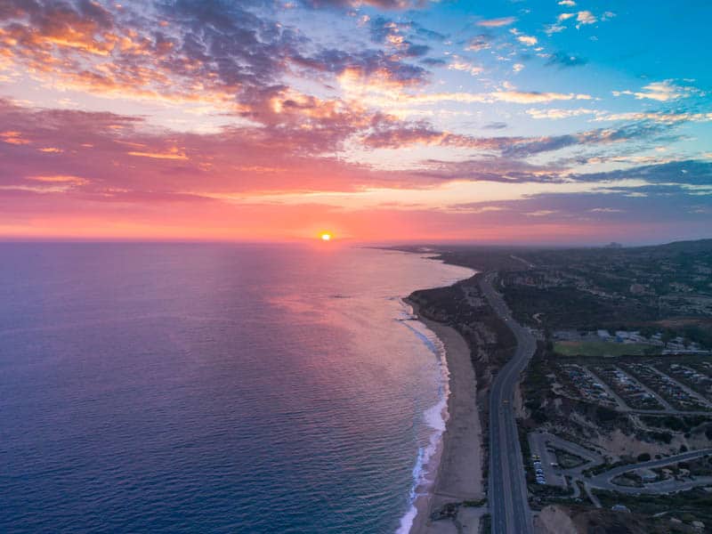
Generally driven on a road trip spanning several days, the PCH features spectacular coastal scenery that ranges from rugged cliffs and windswept beaches in the north to super tall palms and wide sandy beaches in the south.
Along the route, stop to explore any number of charming California coastal towns, from Monterey and Carmel-by-the-Sea to tiny Cambria and Cayucos and laid back San Luis Obispo and Morro Bay.
Further south, the beach towns of Southern California beckon, from Malibu to Laguna Beach and Huntington Beach.
Historic lighthouses, wildlife and marine life, and even a castle on a hill make this drive fascinating. Allow plenty of time: you will want to stop often and linger longer than you thought you would!
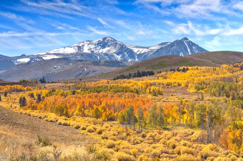
Highway 395 between Lake Tahoe and Lone Pine
Driving Distance: 232 miles
Driving Time: About 4 hours
Running north-south along the eastern part of California, Highway 395 is just as spectacular a drive as the PCH.
The section between South Lake Tahoe and Lone Pine runs alongside the Sierra Nevada, and features magnificent mountain vistas and alpine lakes.
Along this route, you can admire the unique Mono Lake tufa towers, take in the views from Conway Summit, soak in a natural hot spring, and go hiking, mountain climbing, rock climbing, or boating or fishing at one of many lakes.
There’s so much to do that you will want to allow a few days for the drive if you can.
Small detours bring you to Bodie State Historic Park, where you can see the remnants of a Gold Rush boom-and-bust town, to Devils Postpile National Monument, which preserves the stunning natural formation of basalt columns and the majestic Rainbow Falls, and to the Alabama Hills, the location for many Western movies.
While this drive is super scenic any time of the year, it is especially spectacular in the fall, when aspens, cottonwoods, and willows don their autumnal colors of yellow, orange, and red.
Summer, with wildflowers blooming everywhere, is another great time to drive this route.
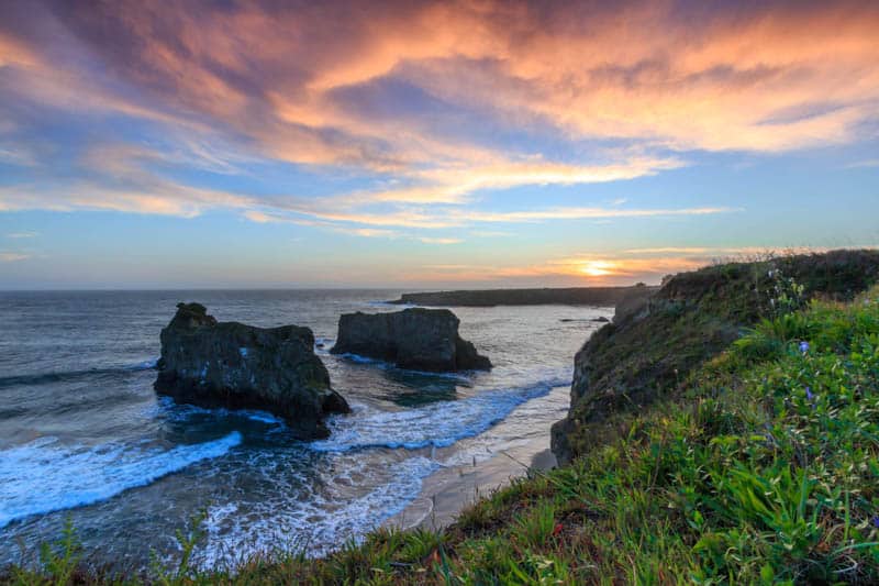
California Highway 1 Between San Francisco and Fort Bragg
Driving Distance: 174 miles
Driving Time: About 4 hours and 45 minutes
California Highway 1 is spectacular north of San Francisco as well. While the scenery is reminiscent of Big Sur, you will find several small towns to explore en route.
While you can do the drive in a day, make it a multi-day road trip to explore the coast in greater depth.
Plus, you will experience one of California’s most famous landmarks: the Golden Gate Bridge. Driving the iconic bridge, with views of sparkling San Francisco Bay, is definitely a California bucket list experience.
If you have the time, you can also drive up Conzelman Road for views of the bridge.
Point Reyes National Seashore is a must-explore en route, with beautiful views of the Pacific Ocean, the opportunity to eat fresh oysters, and perhaps a tule elk sighting.
Explore the tiny coastal communities of Jenner, Bodega Bay, and Sea Ranch, and take in the wild beauty of the Sonoma Coast.
Mendocino and Fort Bragg are two northern California coast gems. Not only are the communities charming, they are also gateways to area redwood forests, wine tasting, and beaches.
Be sure to stop to tour the gorgeous Mendocino Coast Botanic Gardens!
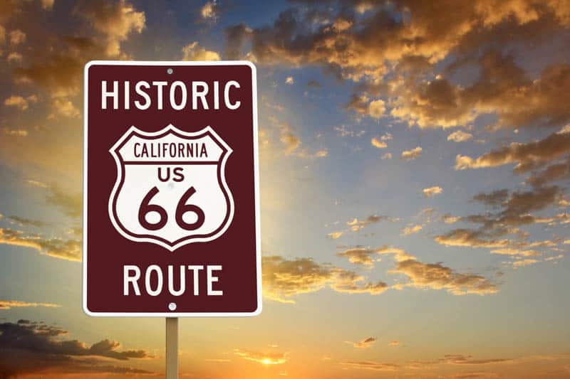
Route 66 between Santa Monica and Needles
Driving Distance: 315 miles
Driving Time: About 5 hours and 15 minutes
Route 66 in California showcases the desert landscapes of Southern California, along with lots of classic Americana and photo-worthy roadside attractions.
Closer to the coast, you will drive through a number of small Southern California towns before hitting LA.
If you love photographing vintage signs, old motels, and gas stations, and ghost towns, this scenic route is a must-do!
Roy’s Cafe at Amboy, and the remnants of old towns between Amboy and Barstow, are favorite Route 66 photo spots.
Further west, Elmer’s Bottle Tree Ranch, the first McDonald’s (now a museum), and the Fontana Orange are fun stops.
If you enjoy hiking, be sure to make the small detour to Amboy Crater, where you can hike to the top of the crater and around the rim of the young volcano. In the spring, you will see the desert floor flush with wildflowers.
The Route 66 drive between Needles and Santa Monica is best done in the cooler months of the year, since quite a bit of the route is through the desert, where triple digit daytime temperatures are common in the warmer months.
*****
Planning to explore more of California’s natural beauty? Check out some of our other articles for inspiration!
- The Most Beautiful Lakes in California
- The Best State Parks in California
- California’s Most Beautiful Waterfalls
- An Overview of California’s National Parks
- The Best Things to Do in California
Did you find this article informative? Pin it for later reference!
I grew up in CA and left for over 25 years to various places. I now live in Hawaii. I love Hawaii and CA. They are the best of both worlds! We go on road trips to CA a lot!
Road trips are absolutely the best way to explore California! I agree, California and Hawaii are both gorgeous. Happy (and safe) travels!